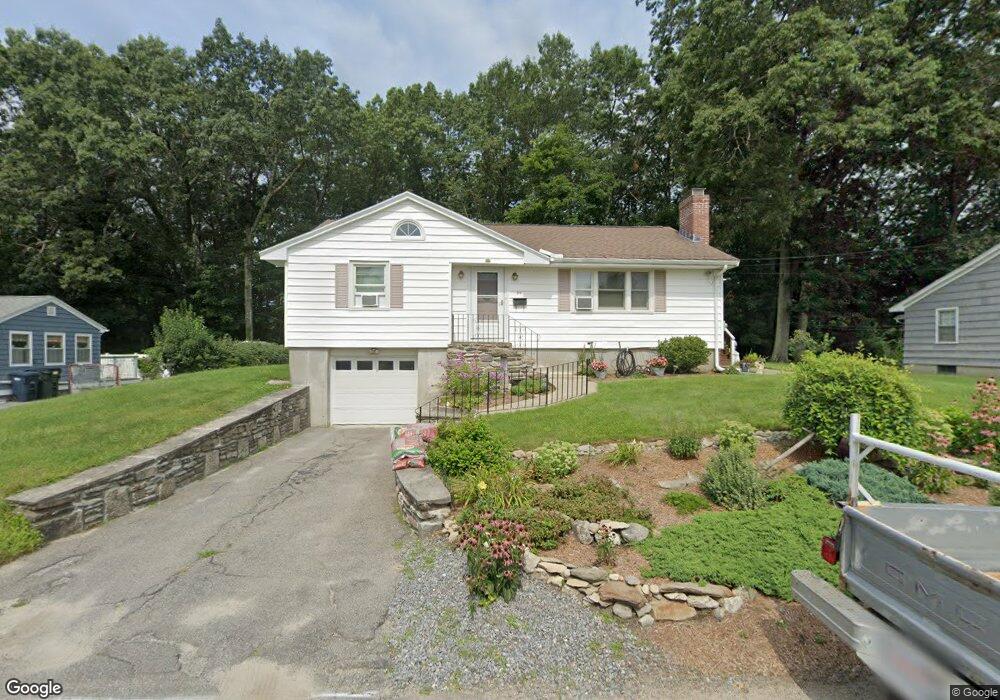
20 Frederickson Ave Holden, MA 01520
Estimated Value: $372,000 - $412,000
2
Beds
1
Bath
1,174
Sq Ft
$333/Sq Ft
Est. Value
About This Home
This home is located at 20 Frederickson Ave, Holden, MA 01520 and is currently estimated at $390,734, approximately $332 per square foot. 20 Frederickson Ave is a home located in Worcester County with nearby schools including Wachusett Regional High School, Abby Kelley Foster Charter Public School, and Bancroft School.
Ownership History
Date
Name
Owned For
Owner Type
Purchase Details
Closed on
Aug 15, 2003
Sold by
Stoddard Pauline M
Bought by
Bouthiller Judyann
Current Estimated Value
Home Financials for this Owner
Home Financials are based on the most recent Mortgage that was taken out on this home.
Original Mortgage
$140,000
Outstanding Balance
$60,932
Interest Rate
5.46%
Mortgage Type
Purchase Money Mortgage
Estimated Equity
$329,802
Create a Home Valuation Report for This Property
The Home Valuation Report is an in-depth analysis detailing your home's value as well as a comparison with similar homes in the area
Home Values in the Area
Average Home Value in this Area
Purchase History
| Date | Buyer | Sale Price | Title Company |
|---|---|---|---|
| Bouthiller Judyann | $182,000 | -- |
Source: Public Records
Mortgage History
| Date | Status | Borrower | Loan Amount |
|---|---|---|---|
| Open | Bouthiller Judyann | $140,000 |
Source: Public Records
Tax History
| Year | Tax Paid | Tax Assessment Tax Assessment Total Assessment is a certain percentage of the fair market value that is determined by local assessors to be the total taxable value of land and additions on the property. | Land | Improvement |
|---|---|---|---|---|
| 2025 | $4,725 | $340,900 | $109,700 | $231,200 |
| 2024 | $4,331 | $306,100 | $106,500 | $199,600 |
| 2023 | $4,197 | $280,000 | $92,600 | $187,400 |
| 2022 | $4,100 | $247,600 | $72,300 | $175,300 |
| 2021 | $3,953 | $227,200 | $68,900 | $158,300 |
| 2020 | $3,633 | $213,700 | $65,600 | $148,100 |
| 2019 | $3,560 | $204,000 | $65,600 | $138,400 |
| 2018 | $3,283 | $186,400 | $62,500 | $123,900 |
| 2017 | $3,196 | $181,700 | $62,500 | $119,200 |
| 2016 | $3,000 | $173,900 | $59,500 | $114,400 |
| 2015 | $2,979 | $164,400 | $59,500 | $104,900 |
| 2014 | $2,796 | $157,500 | $59,500 | $98,000 |
Source: Public Records
Map
Nearby Homes
- 42 N Worcester Ave
- 120 Brattle St
- 270 Brattle St
- 90 Bjorklund Ave
- 158 Chester St
- 41 Mohave Rd
- 37 Mohave Rd
- 23 Gail Dr
- 12 Tattan Farm Rd
- 250 Shrewsbury St
- 82 Holden St
- 97 Parkton Ave
- 47 Harvest Cir
- 4004 Brompton Cir
- 61 Barry Rd
- 25 Chester St
- 667 Grove St
- 46 Barry Rd
- 39 Mountainshire Dr
- 527 Salisbury St
- 22 Frederickson Ave
- 18 Frederickson Ave
- 25 Frederickson Ave
- 24 Frederickson Ave
- 16 Frederickson Ave
- 29 Frederickson Ave
- 7 Abby St
- 23 Frederickson Ave
- 33 Frederickson Ave
- 28 Frederickson Ave
- 141 Paugus Rd
- 14 Frederickson Ave
- 5 Abby St
- 35 Frederickson Ave
- 129 Paugus Rd
- 8 Abby St
- 15 Frederickson Ave
- 135 Paugus Rd
- 6 Abby St
- 30 Frederickson Ave
Your Personal Tour Guide
Ask me questions while you tour the home.