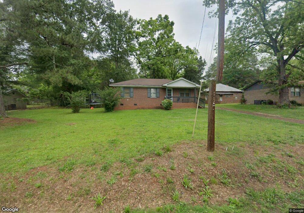
20 Freeman Ave Forsyth, GA 31029
Estimated Value: $67,000 - $163,000
--
Bed
1
Bath
1,025
Sq Ft
$101/Sq Ft
Est. Value
About This Home
This home is located at 20 Freeman Ave, Forsyth, GA 31029 and is currently estimated at $103,739, approximately $101 per square foot. 20 Freeman Ave is a home located in Monroe County with nearby schools including Samuel E. Hubbard Elementary School, Mary Persons High School, and Lighthouse Academy.
Ownership History
Date
Name
Owned For
Owner Type
Purchase Details
Closed on
Oct 3, 2024
Sold by
Pennington Jane
Bought by
Pine Haven Holdings Llc
Current Estimated Value
Purchase Details
Closed on
Apr 29, 2019
Sold by
Scandrett Ruby Jane Evans
Bought by
Pennington Jane
Purchase Details
Closed on
Nov 1, 1996
Sold by
Harden Tressa
Bought by
Sullivan Jerelynn and Sullivan Randy
Purchase Details
Closed on
Aug 1, 1995
Sold by
Mccowen Thresa
Bought by
Harden Tressa
Purchase Details
Closed on
Apr 20, 1995
Sold by
Mccowen Nathaniel and Mccowen Thresa
Bought by
Mccowen Thresa
Purchase Details
Closed on
May 11, 1971
Sold by
Edalgo-Persons Inc
Bought by
Mccowen Nathaniel and Mccowen Thresa
Create a Home Valuation Report for This Property
The Home Valuation Report is an in-depth analysis detailing your home's value as well as a comparison with similar homes in the area
Home Values in the Area
Average Home Value in this Area
Purchase History
| Date | Buyer | Sale Price | Title Company |
|---|---|---|---|
| Pine Haven Holdings Llc | -- | -- | |
| Pennington Jane | -- | -- | |
| Sullivan Jerelynn | $2,000 | -- | |
| Harden Tressa | -- | -- | |
| Mccowen Thresa | -- | -- | |
| Mccowen Nathaniel | -- | -- |
Source: Public Records
Tax History Compared to Growth
Tax History
| Year | Tax Paid | Tax Assessment Tax Assessment Total Assessment is a certain percentage of the fair market value that is determined by local assessors to be the total taxable value of land and additions on the property. | Land | Improvement |
|---|---|---|---|---|
| 2024 | $462 | $15,920 | $2,360 | $13,560 |
| 2023 | $417 | $13,680 | $2,360 | $11,320 |
| 2022 | $405 | $13,680 | $2,360 | $11,320 |
| 2021 | $418 | $13,680 | $2,360 | $11,320 |
| 2020 | $434 | $13,680 | $2,360 | $11,320 |
| 2019 | $437 | $13,680 | $2,360 | $11,320 |
| 2018 | $438 | $13,680 | $2,360 | $11,320 |
| 2017 | $439 | $13,680 | $2,360 | $11,320 |
| 2016 | $419 | $13,680 | $2,360 | $11,320 |
| 2015 | $399 | $13,680 | $2,360 | $11,320 |
| 2014 | $394 | $13,680 | $2,360 | $11,320 |
Source: Public Records
Map
Nearby Homes
- 60 Dew Place
- 120 Willis Wilder Dr
- 292 Martin Luther King Junior Dr
- 62 Washington Dr
- 11 Dew Place
- 451 Georgia 83
- 319 Willis Wilder Dr
- 309 Willis Wilder Dr
- 289 Willis Wilder Dr
- 95 Mitchell Rd
- 71 S Lee St
- 71 S South Lee St
- 333 W Main St
- 507 W Main St
- 556 Constitution Dr
- 101 E Chambers St
- 119 Country Club Dr
- 285 E Main St
- 0 College St Unit 10599940
- 0 James St Unit 10395342
- 28 Freeman Ave
- 377 Phillip Ln
- 142 Blount St
- 27 Phillip Ln
- 461 Freeman Rd
- 156 Blount St
- 25 Freeman Rd
- 31 Phillip Ln
- 20 Phillip Ln
- 17 Freeman Ave
- 0 Freeman Rd Unit 8360026
- 0 Freeman Rd Unit 8302591
- 0 Freeman Rd Unit LOT 3 3113717
- 0 Freeman Rd Unit 2 & 3 3191050
- 0 Freeman Rd Unit 7607119
- 0 Freeman Rd Unit 3B
- 0 Freeman Rd Unit 142120
- 0 Freeman Rd Unit M144031
- 0 Freeman Rd Unit 3B 8124894
- 0 Freeman Rd Unit 8272373