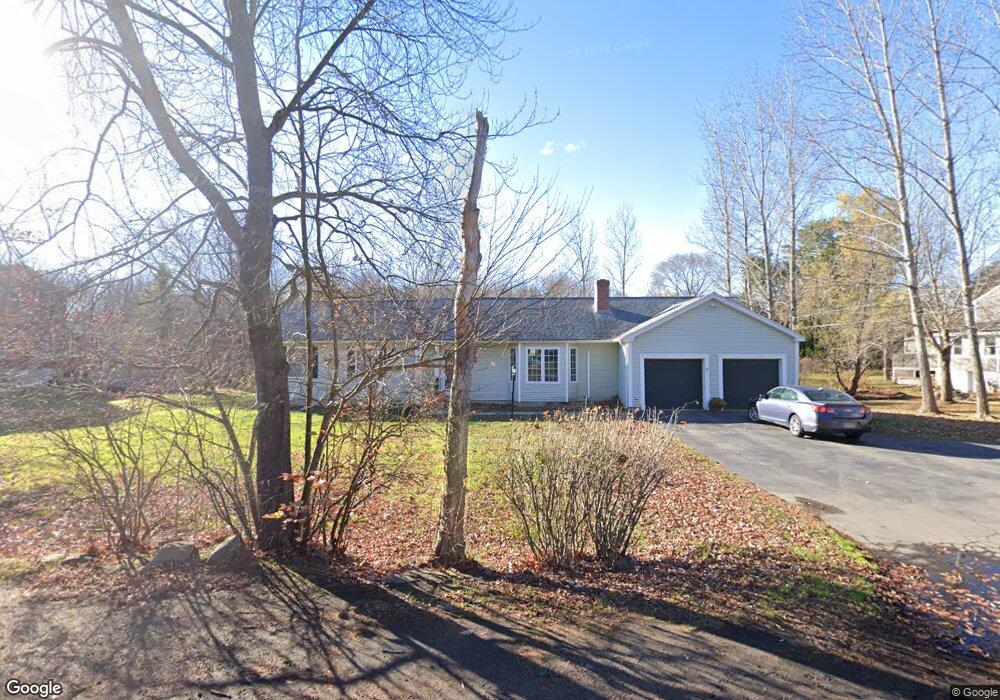
20 Gerrish Rd Salisbury, MA 01952
Estimated Value: $675,533 - $1,354,000
3
Beds
3
Baths
1,877
Sq Ft
$541/Sq Ft
Est. Value
About This Home
This home is located at 20 Gerrish Rd, Salisbury, MA 01952 and is currently estimated at $1,014,767, approximately $540 per square foot. 20 Gerrish Rd is a home located in Essex County with nearby schools including Triton Regional High School and Immaculate Conception School.
Ownership History
Date
Name
Owned For
Owner Type
Purchase Details
Closed on
Aug 15, 2019
Sold by
Deruosi David J and Deruosi Kim A
Bought by
Haugh Robert J and Paulson Sarah M
Current Estimated Value
Home Financials for this Owner
Home Financials are based on the most recent Mortgage that was taken out on this home.
Original Mortgage
$584,000
Outstanding Balance
$507,011
Interest Rate
3.7%
Mortgage Type
New Conventional
Estimated Equity
$507,756
Purchase Details
Closed on
Dec 5, 2017
Sold by
Dickie Celia E
Bought by
Gerrish 20 Rt
Purchase Details
Closed on
Apr 13, 2011
Sold by
Dicarlo Alfred
Bought by
Deruosi David J and Deruosi Kim A
Home Financials for this Owner
Home Financials are based on the most recent Mortgage that was taken out on this home.
Original Mortgage
$520,000
Interest Rate
4.89%
Mortgage Type
Purchase Money Mortgage
Purchase Details
Closed on
Jul 27, 2000
Sold by
Costa Barbara W
Bought by
Dicarlo Alfred
Purchase Details
Closed on
Oct 28, 1998
Sold by
Harris Rt
Bought by
Costa Barbara W
Purchase Details
Closed on
Aug 15, 1997
Sold by
Bradley Stephen E
Bought by
Dickie William R and Dickie Celia E
Purchase Details
Closed on
May 20, 1997
Sold by
Gerrish Two Rt and Grasso Gretchen E
Bought by
Bradley Stephen E
Create a Home Valuation Report for This Property
The Home Valuation Report is an in-depth analysis detailing your home's value as well as a comparison with similar homes in the area
Home Values in the Area
Average Home Value in this Area
Purchase History
| Date | Buyer | Sale Price | Title Company |
|---|---|---|---|
| Haugh Robert J | $735,000 | -- | |
| Gerrish 20 Rt | -- | -- | |
| Deruosi David J | $650,000 | -- | |
| Dicarlo Alfred | $165,000 | -- | |
| Costa Barbara W | $100,000 | -- | |
| Dickie William R | $217,600 | -- | |
| Bradley Stephen E | $48,500 | -- |
Source: Public Records
Mortgage History
| Date | Status | Borrower | Loan Amount |
|---|---|---|---|
| Open | Haugh Robert J | $584,000 | |
| Previous Owner | Bradley Stephen E | $520,000 | |
| Previous Owner | Bradley Stephen E | $600,000 |
Source: Public Records
Tax History
| Year | Tax Paid | Tax Assessment Tax Assessment Total Assessment is a certain percentage of the fair market value that is determined by local assessors to be the total taxable value of land and additions on the property. | Land | Improvement |
|---|---|---|---|---|
| 2025 | $15,783 | $1,052,900 | $350,100 | $702,800 |
| 2023 | $13,887 | $913,600 | $338,400 | $575,200 |
| 2021 | $12,802 | $714,400 | $280,100 | $434,300 |
| 2020 | $11,875 | $714,400 | $280,100 | $434,300 |
| 2019 | $11,886 | $699,200 | $280,100 | $419,100 |
| 2018 | $11,909 | $686,000 | $280,100 | $405,900 |
| 2017 | $11,152 | $658,700 | $252,800 | $405,900 |
| 2016 | $10,442 | $632,100 | $237,300 | $394,800 |
| 2015 | $10,230 | $621,900 | $226,300 | $395,600 |
Source: Public Records
Map
Nearby Homes
- 14 Seabrook Rd
- 55 Lafayette Rd
- 9 Meadowview Ln Unit A
- 14 Meadowview Ln Unit B
- 16 Meadowview Ln Unit B
- 6 Mason Ln
- 42 Kendell Ln
- 44 Seabrook Rd
- 2 True Rd
- 154 Lafayette Rd
- 64 Seabrook Rd
- 84 Forest Rd
- 48 Beach Rd Unit C
- 25 Bayberry Ln
- 100 Forest Rd
- 3 Lighthouse Cir Unit A
- 188 Lafayette Rd
- 7 Toll Rd
- 135 Beach Rd Unit B114
- 57 Baker Rd
Your Personal Tour Guide
Ask me questions while you tour the home.