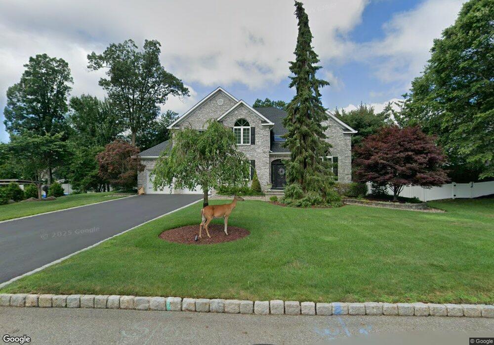
20 Haring Ln Mahwah, NJ 07430
Estimated Value: $886,000 - $1,453,000
--
Bed
--
Bath
3,474
Sq Ft
$340/Sq Ft
Est. Value
About This Home
This home is located at 20 Haring Ln, Mahwah, NJ 07430 and is currently estimated at $1,179,650, approximately $339 per square foot. 20 Haring Ln is a home located in Bergen County with nearby schools including Mahwah High School.
Ownership History
Date
Name
Owned For
Owner Type
Purchase Details
Closed on
Oct 26, 1995
Sold by
Penchina Jeffrey and Penchina Sharon
Bought by
Spera Charles and Spera Camille
Current Estimated Value
Home Financials for this Owner
Home Financials are based on the most recent Mortgage that was taken out on this home.
Original Mortgage
$347,000
Outstanding Balance
$4,845
Interest Rate
7.58%
Estimated Equity
$1,174,805
Purchase Details
Closed on
Jun 7, 1994
Sold by
Applewood Developers Inc
Bought by
Penchina Jeffrey and Penchina Sharon
Home Financials for this Owner
Home Financials are based on the most recent Mortgage that was taken out on this home.
Original Mortgage
$250,000
Interest Rate
8.51%
Create a Home Valuation Report for This Property
The Home Valuation Report is an in-depth analysis detailing your home's value as well as a comparison with similar homes in the area
Home Values in the Area
Average Home Value in this Area
Purchase History
| Date | Buyer | Sale Price | Title Company |
|---|---|---|---|
| Spera Charles | $495,000 | -- | |
| Penchina Jeffrey | $429,730 | -- |
Source: Public Records
Mortgage History
| Date | Status | Borrower | Loan Amount |
|---|---|---|---|
| Open | Spera Charles | $347,000 | |
| Previous Owner | Penchina Jeffrey | $250,000 |
Source: Public Records
Tax History Compared to Growth
Tax History
| Year | Tax Paid | Tax Assessment Tax Assessment Total Assessment is a certain percentage of the fair market value that is determined by local assessors to be the total taxable value of land and additions on the property. | Land | Improvement |
|---|---|---|---|---|
| 2025 | $16,774 | $812,700 | $387,700 | $425,000 |
| 2024 | $16,555 | $812,700 | $387,700 | $425,000 |
| 2023 | $16,026 | $812,700 | $387,700 | $425,000 |
| 2022 | $16,026 | $812,700 | $387,700 | $425,000 |
| 2021 | $14,962 | $812,700 | $387,700 | $425,000 |
| 2020 | $15,474 | $812,700 | $387,700 | $425,000 |
| 2019 | $14,962 | $812,700 | $387,700 | $425,000 |
| 2018 | $14,751 | $812,700 | $387,700 | $425,000 |
| 2017 | $14,515 | $812,700 | $387,700 | $425,000 |
| 2016 | $14,198 | $812,700 | $387,700 | $425,000 |
| 2015 | $14,003 | $812,700 | $387,700 | $425,000 |
| 2014 | $13,767 | $812,700 | $387,700 | $425,000 |
Source: Public Records
Map
Nearby Homes
- 163 Rutherford Rd
- 1194 Richmond Rd Unit A2
- 1248 Garrison Ct Unit E1
- 1114 Hyde Park Ct Unit 1114
- 5 S Bayard Ln
- 17 Grist Mill Run
- 1003 Crown Ct
- 1415 York St
- 18 Boulder Trail
- 4232 Hilltop Rd
- 2214 Hilltop Rd
- 1103 Hilltop Rd
- 324 Franklin Turnpike
- 16 Gardner St
- 172 Redwood Ct Unit 10
- 135 Mulberry Rd Unit 6
- 112 Magnolia Rd Unit 4
- 312 Cypress Ct Unit 2
- 12 Alcott Rd
- 37 Hillside Ave
- 162 Rutherford Rd
- 26 Haring Ln
- 30 Kiersted Place
- 158 Rutherford Rd
- 19 Haring Ln
- 23 Haring Ln
- 154 Rutherford Rd
- 34 Kiersted Place
- 166 Rutherford Rd
- 27 Haring Ln
- 141 Kilmer Rd
- 10 Haring Ln
- 150 Rutherford Rd
- 1217 Richmond Rd
- 46 Kiersted Place
- 1223 Richmond Rd
- 1216 Richmond Rd Unit D1
- 1214 Richmond Rd
- 1215 Richmond Rd
- 50 Kiersted Place