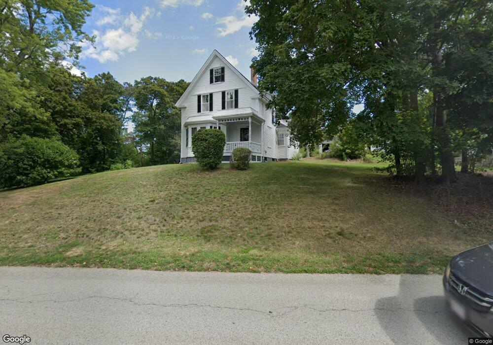
20 Hersey St Hingham, MA 02043
Estimated Value: $1,061,000 - $1,279,000
4
Beds
2
Baths
1,828
Sq Ft
$621/Sq Ft
Est. Value
About This Home
This home is located at 20 Hersey St, Hingham, MA 02043 and is currently estimated at $1,135,785, approximately $621 per square foot. 20 Hersey St is a home located in Plymouth County with nearby schools including William L. Foster Elementary School, St. Paul Elementary School, and Derby Academy.
Create a Home Valuation Report for This Property
The Home Valuation Report is an in-depth analysis detailing your home's value as well as a comparison with similar homes in the area
Home Values in the Area
Average Home Value in this Area
Tax History Compared to Growth
Tax History
| Year | Tax Paid | Tax Assessment Tax Assessment Total Assessment is a certain percentage of the fair market value that is determined by local assessors to be the total taxable value of land and additions on the property. | Land | Improvement |
|---|---|---|---|---|
| 2025 | $9,321 | $871,900 | $495,600 | $376,300 |
| 2024 | $8,569 | $789,800 | $495,600 | $294,200 |
| 2023 | $7,755 | $775,500 | $495,600 | $279,900 |
| 2022 | $8,009 | $692,800 | $412,900 | $279,900 |
| 2021 | $7,776 | $659,000 | $412,900 | $246,100 |
| 2020 | $7,598 | $659,000 | $412,900 | $246,100 |
| 2019 | $7,594 | $643,000 | $412,900 | $230,100 |
| 2018 | $9,717 | $634,100 | $412,900 | $221,200 |
| 2017 | $7,482 | $610,800 | $412,900 | $197,900 |
| 2016 | $7,340 | $587,700 | $393,200 | $194,500 |
| 2015 | $7,021 | $560,300 | $374,300 | $186,000 |
Source: Public Records
Map
Nearby Homes