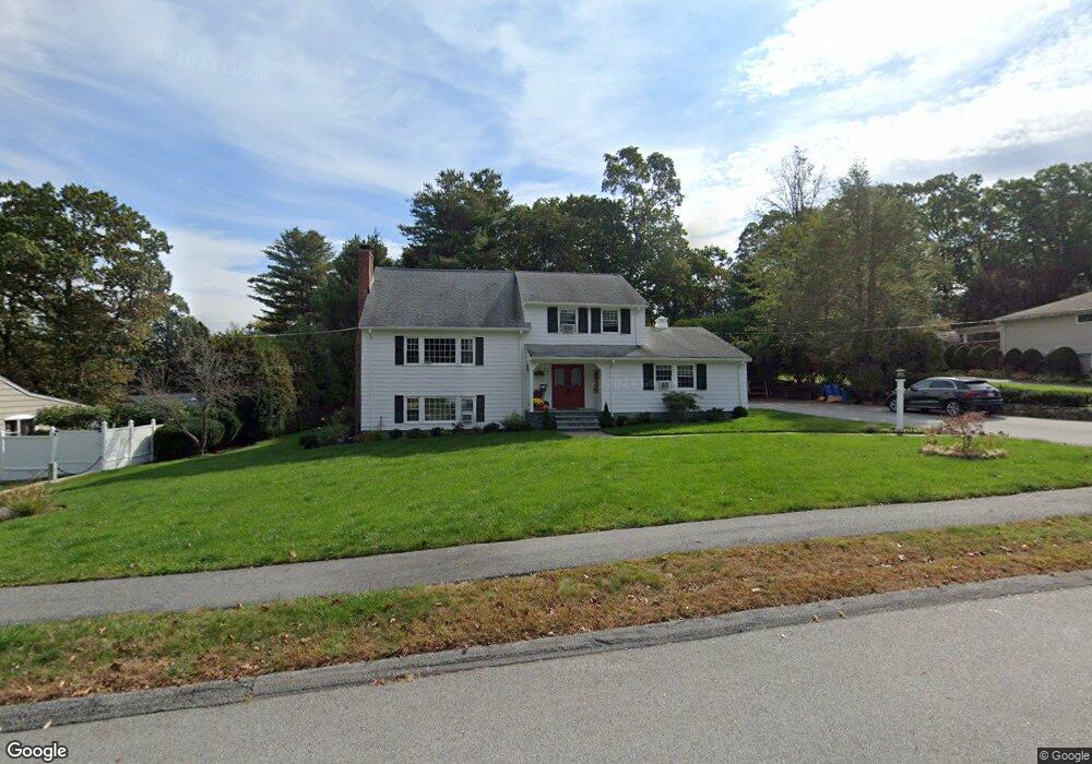
20 Hobbs Brook Rd Waltham, MA 02451
North Waltham NeighborhoodEstimated Value: $1,053,000 - $1,263,000
3
Beds
3
Baths
2,991
Sq Ft
$383/Sq Ft
Est. Value
About This Home
This home is located at 20 Hobbs Brook Rd, Waltham, MA 02451 and is currently estimated at $1,146,553, approximately $383 per square foot. 20 Hobbs Brook Rd is a home located in Middlesex County with nearby schools including Douglas Macarthur Elementary School, John F Kennedy Middle School, and Waltham Sr High School.
Ownership History
Date
Name
Owned For
Owner Type
Purchase Details
Closed on
May 27, 2010
Sold by
Fanara Joseph F and Fanara Brenda A
Bought by
Steede Daniel P
Current Estimated Value
Home Financials for this Owner
Home Financials are based on the most recent Mortgage that was taken out on this home.
Original Mortgage
$360,000
Outstanding Balance
$243,159
Interest Rate
5.13%
Mortgage Type
Purchase Money Mortgage
Estimated Equity
$903,394
Create a Home Valuation Report for This Property
The Home Valuation Report is an in-depth analysis detailing your home's value as well as a comparison with similar homes in the area
Home Values in the Area
Average Home Value in this Area
Purchase History
| Date | Buyer | Sale Price | Title Company |
|---|---|---|---|
| Steede Daniel P | $657,500 | -- |
Source: Public Records
Mortgage History
| Date | Status | Borrower | Loan Amount |
|---|---|---|---|
| Open | Steede Daniel P | $360,000 |
Source: Public Records
Tax History Compared to Growth
Tax History
| Year | Tax Paid | Tax Assessment Tax Assessment Total Assessment is a certain percentage of the fair market value that is determined by local assessors to be the total taxable value of land and additions on the property. | Land | Improvement |
|---|---|---|---|---|
| 2025 | $8,587 | $874,400 | $530,000 | $344,400 |
| 2024 | $8,148 | $845,200 | $505,000 | $340,200 |
| 2023 | $8,094 | $784,300 | $460,000 | $324,300 |
| 2022 | $8,266 | $742,000 | $440,000 | $302,000 |
| 2021 | $8,193 | $723,800 | $440,000 | $283,800 |
| 2020 | $7,986 | $668,300 | $410,000 | $258,300 |
| 2019 | $8,410 | $664,300 | $406,000 | $258,300 |
| 2018 | $7,697 | $610,400 | $376,000 | $234,400 |
| 2017 | $7,152 | $569,400 | $335,000 | $234,400 |
| 2016 | $6,357 | $519,400 | $285,000 | $234,400 |
| 2015 | $6,506 | $495,500 | $285,000 | $210,500 |
Source: Public Records
Map
Nearby Homes
- 17 Hobbs Brook Rd Unit 8
- 17 Hobbs Brook Rd Unit Lot 8
- 15 Hobbs Brook Rd Unit Lot 7
- 10 Hobbs Brook Rd
- 30 Hobbs Brook Rd
- 1710 Trapelo Rd
- 1710 Trapelo Rd Unit 1
- 21 Hobbs Brook Rd
- 1738 Trapelo Rd
- 40 Hobbs Brook Rd
- 33 Hobbs Brook Rd
- 1725 Trapelo Rd
- 1700 Trapelo Rd
- 36 Agrillo Cir
- 1 Leslie Rd
- 1715 Trapelo Rd
- 1707 Trapelo Rd
- 42 Agrillo Cir
- 1731 Trapelo Rd
- 1748 Trapelo Rd