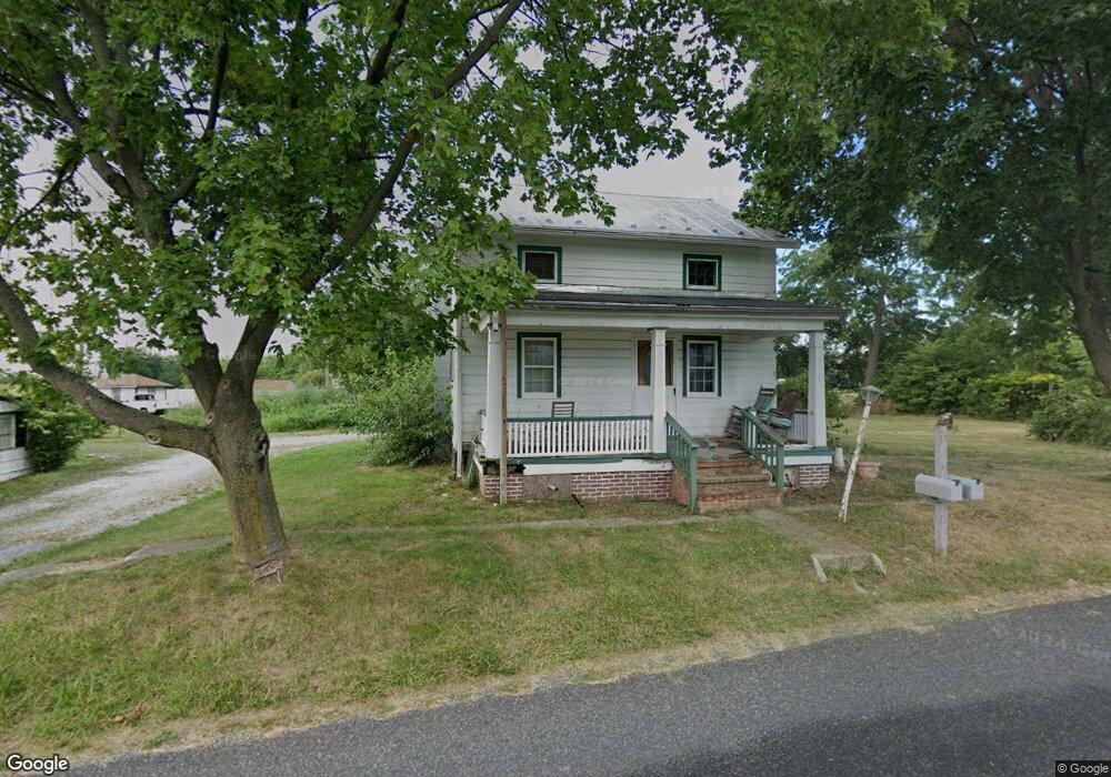
20 Hoffacker Rd Littlestown, PA 17340
Estimated Value: $180,000 - $238,000
2
Beds
1
Bath
1,041
Sq Ft
$202/Sq Ft
Est. Value
About This Home
This home is located at 20 Hoffacker Rd, Littlestown, PA 17340 and is currently estimated at $210,789, approximately $202 per square foot. 20 Hoffacker Rd is a home located in Adams County with nearby schools including Rolling Acres El School, Maple Avenue Middle School, and Littlestown Senior High School.
Ownership History
Date
Name
Owned For
Owner Type
Purchase Details
Closed on
Jul 9, 2021
Sold by
Groft Gerald J
Bought by
Sensenig Real Estate Llc
Current Estimated Value
Purchase Details
Closed on
Jun 13, 2019
Sold by
Groft Gerald J
Bought by
Groft Gerald J
Purchase Details
Closed on
Oct 11, 2005
Sold by
Baugher Geneva C
Bought by
Groft Gerald J
Home Financials for this Owner
Home Financials are based on the most recent Mortgage that was taken out on this home.
Original Mortgage
$73,600
Interest Rate
5.79%
Mortgage Type
New Conventional
Create a Home Valuation Report for This Property
The Home Valuation Report is an in-depth analysis detailing your home's value as well as a comparison with similar homes in the area
Purchase History
| Date | Buyer | Sale Price | Title Company |
|---|---|---|---|
| Sensenig Real Estate Llc | $125,950 | None Available | |
| Groft Gerald J | -- | -- | |
| Groft Gerald J | $92,000 | -- |
Source: Public Records
Mortgage History
| Date | Status | Borrower | Loan Amount |
|---|---|---|---|
| Previous Owner | Groft Gerald J | $73,600 |
Source: Public Records
Tax History
| Year | Tax Paid | Tax Assessment Tax Assessment Total Assessment is a certain percentage of the fair market value that is determined by local assessors to be the total taxable value of land and additions on the property. | Land | Improvement |
|---|---|---|---|---|
| 2025 | $2,857 | $147,400 | $52,400 | $95,000 |
| 2023 | $2,681 | $147,400 | $52,400 | $95,000 |
| 2022 | $2,662 | $147,400 | $52,400 | $95,000 |
| 2021 | $2,570 | $147,400 | $52,400 | $95,000 |
| 2020 | $2,534 | $147,400 | $52,400 | $95,000 |
| 2019 | $2,134 | $126,800 | $40,400 | $86,400 |
| 2018 | $2,089 | $126,800 | $40,400 | $86,400 |
| 2017 | $2,026 | $126,800 | $40,400 | $86,400 |
| 2016 | -- | $126,800 | $40,400 | $86,400 |
| 2015 | -- | $126,800 | $40,400 | $86,400 |
| 2014 | -- | $126,800 | $40,400 | $86,400 |
Source: Public Records
Map
Nearby Homes
- 780 White Hall Rd
- 678 Littlestown Rd Unit 1
- 464 Locust Ln
- 345 Smoketown Rd
- 28 Bonniefield Cir Unit 25
- 38 Bonniefield Cir Unit 20
- 505 Basehoar School Rd Unit 245
- 27 Maple St
- 0 Locust Dr Unit PAAD2015910
- 5160 Baltimore Pike Unit 3
- 162 Newark St
- 123 Derby Dr Unit 23
- 99 Jessica Dr Unit 8
- 4 Straw Ct Unit 166
- 43 Ashfield Dr Unit 14
- 41 Smith Cir
- 86 Barley Cir Unit 9
- 13 N Pine St
- 24 Ashfield Dr Unit 48
- 5 Sunset Dr
Your Personal Tour Guide
Ask me questions while you tour the home.