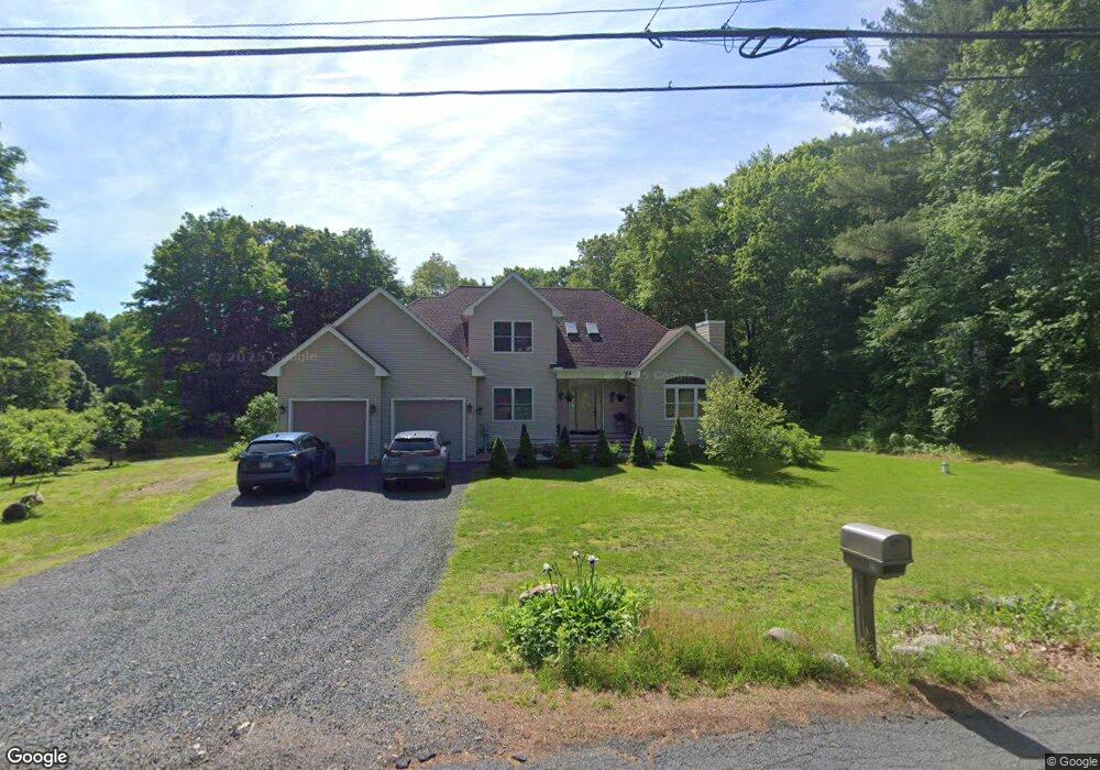
20 Honey Pot Rd Westfield, MA 01085
Estimated Value: $424,000 - $623,802
3
Beds
3
Baths
2,664
Sq Ft
$196/Sq Ft
Est. Value
About This Home
This home is located at 20 Honey Pot Rd, Westfield, MA 01085 and is currently estimated at $522,201, approximately $196 per square foot. 20 Honey Pot Rd is a home with nearby schools including Westfield High School.
Ownership History
Date
Name
Owned For
Owner Type
Purchase Details
Closed on
Dec 10, 2010
Sold by
Ruva Rt and Bean Karin
Bought by
Chepurina Yelena and Kononchuk Sergey
Current Estimated Value
Purchase Details
Closed on
Mar 6, 2009
Sold by
Kononchuk Sergey and Chepurina Yelena
Bought by
Ruva Rt
Purchase Details
Closed on
Sep 30, 2008
Sold by
Katykhin Andrei
Bought by
Chepurina Yelena and Kononchuk Sergey
Home Financials for this Owner
Home Financials are based on the most recent Mortgage that was taken out on this home.
Original Mortgage
$55,400
Interest Rate
6.57%
Mortgage Type
Purchase Money Mortgage
Create a Home Valuation Report for This Property
The Home Valuation Report is an in-depth analysis detailing your home's value as well as a comparison with similar homes in the area
Home Values in the Area
Average Home Value in this Area
Purchase History
| Date | Buyer | Sale Price | Title Company |
|---|---|---|---|
| Chepurina Yelena | -- | -- | |
| Ruva Rt | -- | -- | |
| Chepurina Yelena | $69,250 | -- |
Source: Public Records
Mortgage History
| Date | Status | Borrower | Loan Amount |
|---|---|---|---|
| Previous Owner | Chepurina Yelena | $55,400 |
Source: Public Records
Tax History Compared to Growth
Tax History
| Year | Tax Paid | Tax Assessment Tax Assessment Total Assessment is a certain percentage of the fair market value that is determined by local assessors to be the total taxable value of land and additions on the property. | Land | Improvement |
|---|---|---|---|---|
| 2025 | $8,235 | $542,500 | $129,900 | $412,600 |
| 2024 | $8,296 | $519,500 | $118,600 | $400,900 |
| 2023 | $8,143 | $498,500 | $112,800 | $385,700 |
| 2022 | $8,143 | $440,400 | $100,600 | $339,800 |
| 2021 | $7,899 | $418,400 | $95,000 | $323,400 |
| 2020 | $7,500 | $389,600 | $95,000 | $294,600 |
| 2019 | $7,335 | $372,900 | $90,600 | $282,300 |
| 2018 | $7,219 | $372,900 | $90,600 | $282,300 |
| 2017 | $7,028 | $361,900 | $91,900 | $270,000 |
| 2016 | $7,035 | $361,900 | $91,900 | $270,000 |
| 2015 | $6,254 | $337,300 | $91,900 | $245,400 |
| 2014 | $6,132 | $337,300 | $91,900 | $245,400 |
Source: Public Records
Map
Nearby Homes
- 156 Honey Pot Rd
- 162 Honey Pot Rd
- 197 Loomis Rg
- 3 Angelica Dr
- 444 Loomis St
- 126 Western Cir
- 40 Heritage Ln
- 508 Granville Rd
- 53 Yankee Cir
- 0 Fox Hill Dr
- 555 Russell Rd Unit U A3
- 555 Russell Rd Unit D18
- 110 Kensington Ave
- 66 Stoney Ln
- 549 Russell Rd Unit 6B
- 324 Russell Rd Unit 204
- 16 Spruce St
- 11 Highland Cir
- 78 Granville Rd Unit 11
- 205 Russell Rd
- 24 Honey Pot Rd
- 11R Honey Pot Rd
- 1140 Granville Rd
- 21 Honey Pot Rd
- 1152 Granville Rd
- 1130 Granville Rd
- 1164 Granville Rd
- 29 Honey Pot Rd
- 1176 Granville Rd
- 36 Honey Pot Rd
- 1188 Granville Rd
- 0 Honey Pot Rd
- 1175 Granville Rd
- 1139 Granville Rd
- 1102 Granville Rd
- 1109 Granville Rd
- 467 Northwest Rd
- 468 Northwest Rd
- 55 Honey Pot Rd
- 1097 Granville Rd