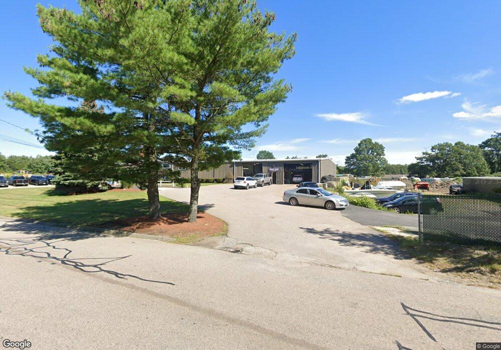
20 Industrial Rd Wrentham, MA 02093
Estimated Value: $3,117,469
--
Bed
--
Bath
12,720
Sq Ft
$245/Sq Ft
Est. Value
About This Home
This home is located at 20 Industrial Rd, Wrentham, MA 02093 and is currently estimated at $3,117,469, approximately $245 per square foot. 20 Industrial Rd is a home located in Norfolk County with nearby schools including Delaney Elementary School and Charles E Roderick.
Ownership History
Date
Name
Owned For
Owner Type
Purchase Details
Closed on
Mar 1, 2005
Sold by
Diplacido Annamarie and Diplacido Thomas W
Bought by
Badd Bros Realty Llc
Current Estimated Value
Create a Home Valuation Report for This Property
The Home Valuation Report is an in-depth analysis detailing your home's value as well as a comparison with similar homes in the area
Home Values in the Area
Average Home Value in this Area
Purchase History
| Date | Buyer | Sale Price | Title Company |
|---|---|---|---|
| Badd Bros Realty Llc | $1,400,000 | -- |
Source: Public Records
Tax History Compared to Growth
Tax History
| Year | Tax Paid | Tax Assessment Tax Assessment Total Assessment is a certain percentage of the fair market value that is determined by local assessors to be the total taxable value of land and additions on the property. | Land | Improvement |
|---|---|---|---|---|
| 2025 | $0 | $1,397,700 | $626,800 | $770,900 |
| 2024 | $21,914 | $1,397,700 | $626,800 | $770,900 |
| 2023 | $11,801 | $1,422,000 | $626,800 | $795,200 |
| 2022 | $0 | $1,349,000 | $626,800 | $722,200 |
| 2021 | $0 | $1,349,000 | $626,800 | $722,200 |
| 2020 | $21,914 | $1,191,600 | $589,000 | $602,600 |
| 2019 | $23,457 | $1,286,000 | $589,000 | $697,000 |
| 2018 | $24,174 | $1,324,600 | $569,300 | $755,300 |
| 2017 | $24,281 | $1,295,000 | $558,100 | $736,900 |
| 2016 | $23,573 | $1,270,800 | $547,100 | $723,700 |
| 2015 | $23,005 | $1,226,300 | $530,800 | $695,500 |
| 2014 | $22,451 | $1,210,300 | $520,400 | $689,900 |
Source: Public Records
Map
Nearby Homes
- 570 Franklin St
- 50 Reed Fulton Ave Unit Lot 61
- 11 Elliot Mills Unit 11
- 12 Waites Crossing Way
- 45 Joshua Rd
- 131 Creek St Unit 7
- 1 Uncas Ave
- 70 Uncas Ave
- 64 Uncas Ave
- 82 Uncas Ave Unit 1
- 55 Lawrence Dr Unit 55
- Lot 3 - 14 Earle Stewart Ln
- 29 Lawrence Dr
- 159 E Central St
- 67 Milliken Ave Unit 22
- 11 Earle Stewart Ln
- Lot 1 - Blueberry 2 Car Plan at King Philip Estates
- Lot 8 - Blueberry 2 Car Plan at King Philip Estates
- Lot 5 - Hughes 2 car Plan at King Philip Estates
- Lot 6 - Blueberry 3 Car Plan at King Philip Estates
- 880 Franklin St
- 865 Franklin St
- 850 Franklin St Unit 16
- 850 Franklin St
- 25 Industrial Rd
- 875 Franklin St
- 100 Stonewall Blvd Unit 102
- 100 Stonewall Blvd Unit 1
- 100 Stonewall Blvd Unit 5
- 35 Industrial Rd
- 881 Franklin St
- 844 Franklin St Unit 5A
- 844 Franklin St Unit 3 & 4
- 844 Franklin St
- 844 Franklin St Unit 1
- 844 Franklin St Unit 5
- 844 Franklin St Unit 7
- 844 Franklin St Unit 7 sub
- 851 Franklin St Unit 8
- 851 Franklin St Unit 3