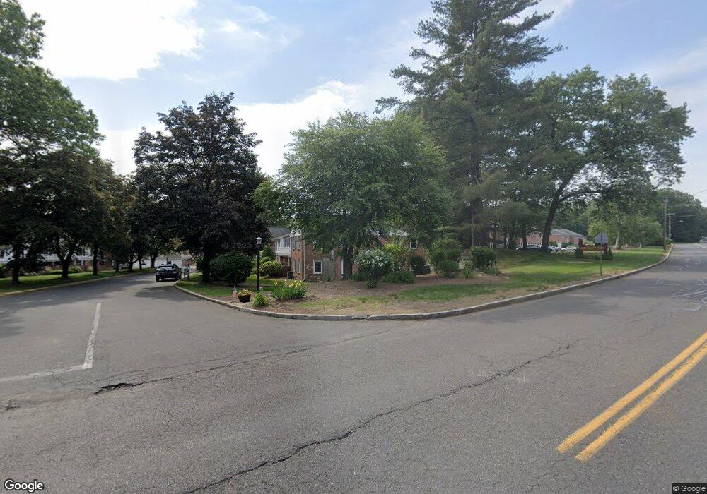
20 Jamestown Dr Unit F Springfield, MA 01108
Forest Park NeighborhoodEstimated Value: $229,000 - $310,000
2
Beds
2
Baths
1,096
Sq Ft
$253/Sq Ft
Est. Value
About This Home
This home is located at 20 Jamestown Dr Unit F, Springfield, MA 01108 and is currently estimated at $276,801, approximately $252 per square foot. 20 Jamestown Dr Unit F is a home located in Hampden County with nearby schools including Frederick Harris Elementary School, Forest Park Middle School, and High School Of Commerce.
Ownership History
Date
Name
Owned For
Owner Type
Purchase Details
Closed on
Nov 29, 2023
Sold by
S-Fairchild Karen M
Bought by
Fairchild Karen M and Fairchild Eric D
Current Estimated Value
Home Financials for this Owner
Home Financials are based on the most recent Mortgage that was taken out on this home.
Original Mortgage
$166,667
Outstanding Balance
$163,766
Interest Rate
7.76%
Mortgage Type
Commercial
Estimated Equity
$113,035
Purchase Details
Closed on
Apr 27, 2011
Sold by
Southerland William B
Bought by
Southerland Michael C and Southerland Southland-Fairchild K
Purchase Details
Closed on
Oct 29, 2010
Sold by
Katsounakis Katherine
Bought by
Southerland William B and Southerland Michael C
Purchase Details
Closed on
Aug 10, 2001
Sold by
Fain Ruth H Est and Warshaw
Bought by
Katsounakis Katherine
Home Financials for this Owner
Home Financials are based on the most recent Mortgage that was taken out on this home.
Original Mortgage
$90,400
Interest Rate
7.1%
Mortgage Type
Purchase Money Mortgage
Create a Home Valuation Report for This Property
The Home Valuation Report is an in-depth analysis detailing your home's value as well as a comparison with similar homes in the area
Home Values in the Area
Average Home Value in this Area
Purchase History
| Date | Buyer | Sale Price | Title Company |
|---|---|---|---|
| Fairchild Karen M | -- | None Available | |
| S-Fairchild Karen M | $158,334 | None Available | |
| Southerland Michael C | -- | -- | |
| Southerland William B | $175,000 | -- | |
| Southerland William B | $175,000 | -- | |
| Southerland William B | $175,000 | -- | |
| Katsounakis Katherine | $122,900 | -- |
Source: Public Records
Mortgage History
| Date | Status | Borrower | Loan Amount |
|---|---|---|---|
| Open | S-Fairchild Karen M | $166,667 | |
| Closed | Fairchild Karen M | $166,667 | |
| Previous Owner | Katsounakis Katherine | $71,000 | |
| Previous Owner | Katsounakis Katherine | $90,400 |
Source: Public Records
Tax History Compared to Growth
Tax History
| Year | Tax Paid | Tax Assessment Tax Assessment Total Assessment is a certain percentage of the fair market value that is determined by local assessors to be the total taxable value of land and additions on the property. | Land | Improvement |
|---|---|---|---|---|
| 2025 | $3,824 | $243,900 | $0 | $243,900 |
| 2024 | $3,569 | $222,200 | $0 | $222,200 |
| 2023 | $3,420 | $200,600 | $0 | $200,600 |
| 2022 | $3,406 | $181,000 | $0 | $181,000 |
| 2021 | $3,109 | $164,500 | $0 | $164,500 |
| 2020 | $2,998 | $153,500 | $0 | $153,500 |
| 2019 | $2,982 | $151,500 | $0 | $151,500 |
| 2018 | $2,982 | $151,500 | $0 | $151,500 |
| 2017 | $2,978 | $151,500 | $0 | $151,500 |
| 2016 | $2,868 | $145,900 | $0 | $145,900 |
| 2015 | $2,805 | $142,600 | $0 | $142,600 |
Source: Public Records
Map
Nearby Homes
- 52 Smithfield Ct
- 80 Williamsburg Dr Unit 8
- 0 Eunice Dr Unit 73446102
- 21 Brentwood St
- 19 Normandy Rd
- 25 Bremen St
- 15 Bronson Terrace
- 11 Copeland St
- 44 Wendover Rd
- 137 Carroll St
- 82-84 Maryland St
- Lot 30 Carver St
- 93 Cooper St
- 11-15 Groveland St
- 114 Park Dr
- 5 Corning St
- 911 Williams St
- 137-139 Fountain St
- 147 Belvidere St
- 60 Blake St
- 20 Jamestown Dr Unit H
- 20 Jamestown Dr Unit G
- 20 Jamestown Dr Unit E
- 20 Jamestown Dr Unit D
- 20 Jamestown Dr Unit C
- 20 Jamestown Dr Unit B
- 20 Jamestown Dr Unit A
- 20 Jamestown Dr Unit 20 C
- 20 Jamestown Dr Unit 20E
- 20 Jamestown Dr Unit 20D
- 20G Jamestown Dr
- 1145 Dickinson St
- 1147 Dickinson St
- 1149 Dickinson St
- 1153 Dickinson St
- 1157 Dickinson St
- 1161 Dickinson St
- 1163 Dickinson St
- 1149 Dickinson St Unit 1149
- 1147 Dickinson St Unit 1147