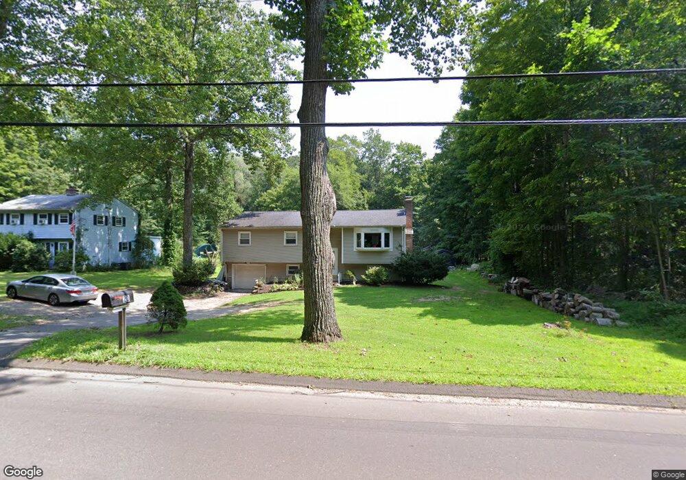
20 Kelseytown Rd Clinton, CT 06413
Estimated Value: $422,171 - $515,000
3
Beds
7
Baths
1,276
Sq Ft
$364/Sq Ft
Est. Value
About This Home
This home is located at 20 Kelseytown Rd, Clinton, CT 06413 and is currently estimated at $465,043, approximately $364 per square foot. 20 Kelseytown Rd is a home located in Middlesex County with nearby schools including Lewin G. Joel Jr. School and The Morgan School.
Ownership History
Date
Name
Owned For
Owner Type
Purchase Details
Closed on
Jul 31, 2015
Sold by
Pinargote Jophre
Bought by
Riera Giovanny
Current Estimated Value
Purchase Details
Closed on
Jul 19, 2005
Sold by
Gee John E and Gee Dolores I
Bought by
Dinargote Jophra
Home Financials for this Owner
Home Financials are based on the most recent Mortgage that was taken out on this home.
Original Mortgage
$201,750
Interest Rate
5.67%
Create a Home Valuation Report for This Property
The Home Valuation Report is an in-depth analysis detailing your home's value as well as a comparison with similar homes in the area
Home Values in the Area
Average Home Value in this Area
Purchase History
| Date | Buyer | Sale Price | Title Company |
|---|---|---|---|
| Riera Giovanny | -- | -- | |
| Riera Giovanny | -- | -- | |
| Dinargote Jophra | $269,000 | -- | |
| Dinargote Jophra | $269,000 | -- |
Source: Public Records
Mortgage History
| Date | Status | Borrower | Loan Amount |
|---|---|---|---|
| Previous Owner | Dinargote Jophra | $201,750 | |
| Previous Owner | Dinargote Jophra | $15,000 | |
| Previous Owner | Dinargote Jophra | $17,500 |
Source: Public Records
Tax History
| Year | Tax Paid | Tax Assessment Tax Assessment Total Assessment is a certain percentage of the fair market value that is determined by local assessors to be the total taxable value of land and additions on the property. | Land | Improvement |
|---|---|---|---|---|
| 2025 | $5,593 | $179,600 | $56,000 | $123,600 |
| 2024 | $5,435 | $179,600 | $56,000 | $123,600 |
| 2023 | $5,357 | $179,600 | $56,000 | $123,600 |
| 2022 | $5,357 | $179,600 | $56,000 | $123,600 |
| 2021 | $5,095 | $170,800 | $56,000 | $114,800 |
| 2020 | $5,338 | $170,800 | $56,000 | $114,800 |
| 2019 | $5,338 | $170,800 | $56,000 | $114,800 |
| 2018 | $5,216 | $170,800 | $56,000 | $114,800 |
| 2017 | $5,168 | $172,800 | $56,000 | $116,800 |
| 2016 | $4,690 | $172,800 | $56,000 | $116,800 |
| 2015 | $4,819 | $180,000 | $62,200 | $117,800 |
| 2014 | $4,729 | $180,000 | $62,200 | $117,800 |
Source: Public Records
Map
Nearby Homes
- 50 Kelseytown Rd
- 48A Ironworks Rd
- 166 Glenwood Rd
- 34 Hurd Bridge Rd
- 94 Kelseytown Rd
- 106 Glenwood Rd
- 43 Evergreen Park
- 4 Laurel Ln
- 0 Fairy Dell Rd
- 8 Egypt Ln
- 10 Stonewall Ln
- 6 Evergreen Dr
- 19 Evergreen Dr
- 131 Cow Hill Rd
- 244 Cow Hill Rd
- 16 Silverbrook Ln
- 37 Nolin Rd
- 113 Winthrop Rd
- 407 Grove Beach Rd N
- 110 E Main St
- 22 Kelseytown Rd
- 24 Kelseytown Rd
- 16 Kelseytown Rd
- 26 Kelseytown Rd
- 3 Carter Hill Rd
- 19 Kelseytown Rd
- 5 Carter Hill Rd
- 15 Kelseytown Rd
- 7 Carter Hill Rd
- 72 Brickyard Rd
- 25 Kelseytown Rd
- 11 Kelseytown Rd
- 0 Kelseytown Rd
- 59 Brickyard Rd
- 11 Carter Hill Rd
- 4 Carter Hill Rd
- 13 Carter Hill Rd
- 57 Brickyard Rd
- 29 Kelseytown Rd
- 26 Ironworks Rd
Your Personal Tour Guide
Ask me questions while you tour the home.