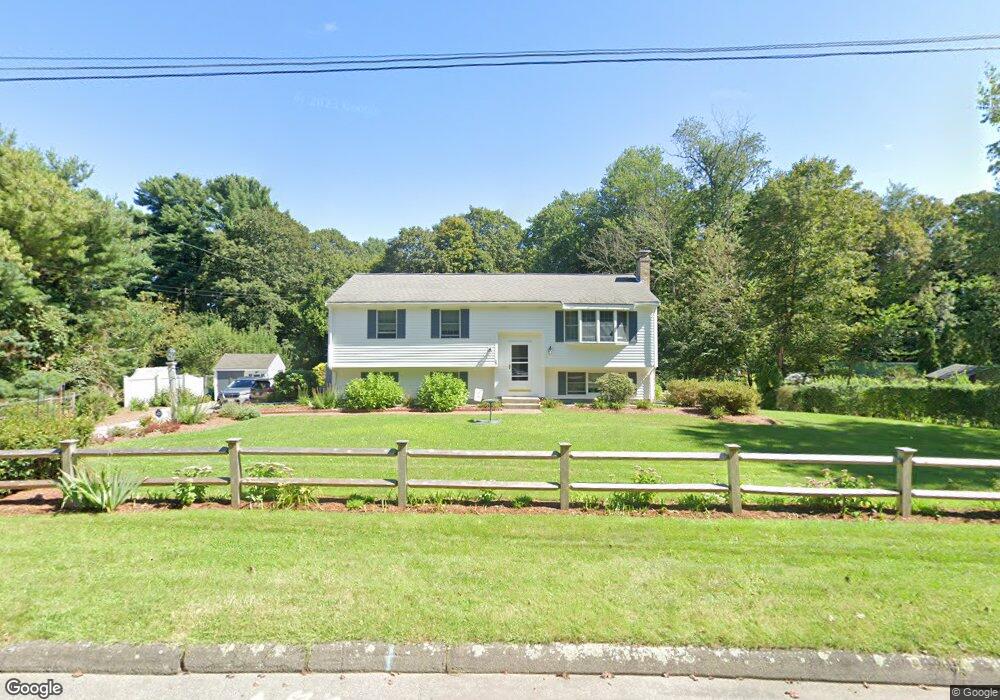
20 King James Way Wrentham, MA 02093
Estimated Value: $575,000 - $645,000
3
Beds
2
Baths
1,377
Sq Ft
$449/Sq Ft
Est. Value
About This Home
This home is located at 20 King James Way, Wrentham, MA 02093 and is currently estimated at $618,002, approximately $448 per square foot. 20 King James Way is a home located in Norfolk County with nearby schools including Delaney Elementary School, Charles E Roderick, and Foxborough Regional Charter School.
Ownership History
Date
Name
Owned For
Owner Type
Purchase Details
Closed on
Aug 29, 2018
Sold by
Neviackas William J and Neviackas Anne
Bought by
Neviackas Rt
Current Estimated Value
Purchase Details
Closed on
Jul 23, 1976
Bought by
Neviackas William J and Neviackas Anne E
Create a Home Valuation Report for This Property
The Home Valuation Report is an in-depth analysis detailing your home's value as well as a comparison with similar homes in the area
Home Values in the Area
Average Home Value in this Area
Purchase History
| Date | Buyer | Sale Price | Title Company |
|---|---|---|---|
| Neviackas Rt | -- | -- | |
| Neviackas William J | -- | -- |
Source: Public Records
Tax History Compared to Growth
Tax History
| Year | Tax Paid | Tax Assessment Tax Assessment Total Assessment is a certain percentage of the fair market value that is determined by local assessors to be the total taxable value of land and additions on the property. | Land | Improvement |
|---|---|---|---|---|
| 2025 | $6,561 | $566,100 | $292,300 | $273,800 |
| 2024 | $6,227 | $518,900 | $292,300 | $226,600 |
| 2023 | $5,947 | $471,200 | $265,800 | $205,400 |
| 2022 | $5,823 | $426,000 | $248,000 | $178,000 |
| 2021 | $4,972 | $353,400 | $216,500 | $136,900 |
| 2020 | $5,422 | $380,500 | $192,500 | $188,000 |
| 2019 | $5,219 | $369,600 | $192,500 | $177,100 |
| 2018 | $5,225 | $366,900 | $192,800 | $174,100 |
| 2017 | $4,955 | $347,700 | $189,000 | $158,700 |
| 2016 | $4,845 | $339,300 | $183,600 | $155,700 |
| 2015 | $4,695 | $313,400 | $176,500 | $136,900 |
| 2014 | $4,429 | $289,300 | $155,600 | $133,700 |
Source: Public Records
Map
Nearby Homes
- 362 East St
- 1 Lorraine Metcalf Dr
- 270 Dedham St
- 65 Pond St
- 10 Nature View Dr
- 15 Nature View Dr
- 319 Taunton St
- 120 Hawes St
- 483 Thurston St
- 25 Foxboro Rd
- 131 Creek St Unit 7
- 11 Earle Stewart Ln
- Lot 3 - 14 Earle Stewart Ln
- Lot 1 - Blueberry 2 Car Plan at King Philip Estates
- Lot 8 - Blueberry 2 Car Plan at King Philip Estates
- Lot 5 - Hughes 2 car Plan at King Philip Estates
- Lot 6 - Blueberry 3 Car Plan at King Philip Estates
- Lot 2 - Camden 2 Car Plan at King Philip Estates
- Lot 7 - Cedar Plan at King Philip Estates
- Lot 4 - Hemingway 2 Car Plan at King Philip Estates
- 30 King James Way
- 35 King James Way
- 40 King James Way
- 10 King James Way
- 44 Woodland Rd
- 45 King James Way
- 36 Woodland Rd
- 39 Woodland Rd
- 28 Woodland Rd
- 55 King James Way
- 33 Woodland Rd
- 27 Woodland Rd
- 20 Trafalgar Square
- 65 King James Way
- 20 Woodland Rd
- 50 King James Way
- 21 Woodland Rd
- 411 East St
- 40 Trafalgar Square
- 397 East St