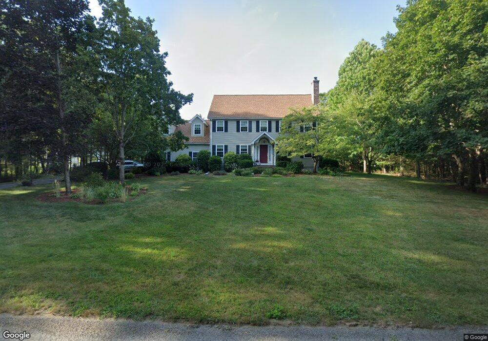
20 King Philip Dr Rehoboth, MA 02769
Estimated Value: $747,213 - $860,000
3
Beds
3
Baths
2,582
Sq Ft
$309/Sq Ft
Est. Value
About This Home
This home is located at 20 King Philip Dr, Rehoboth, MA 02769 and is currently estimated at $799,053, approximately $309 per square foot. 20 King Philip Dr is a home located in Bristol County with nearby schools including Dighton-Rehoboth Regional High School, Grace Baptist Christian Academy, and The Pinecroft School.
Ownership History
Date
Name
Owned For
Owner Type
Purchase Details
Closed on
May 11, 2023
Sold by
Goudreau Robert A and Goudreau Lindy L
Bought by
Goudreau Lt
Current Estimated Value
Purchase Details
Closed on
Mar 11, 1993
Sold by
Fisk Jeffrey H and Marshall Manuel D
Bought by
Goudreau Robert A and Goudreau Lindy L
Home Financials for this Owner
Home Financials are based on the most recent Mortgage that was taken out on this home.
Original Mortgage
$180,000
Interest Rate
7.8%
Mortgage Type
Purchase Money Mortgage
Create a Home Valuation Report for This Property
The Home Valuation Report is an in-depth analysis detailing your home's value as well as a comparison with similar homes in the area
Home Values in the Area
Average Home Value in this Area
Purchase History
| Date | Buyer | Sale Price | Title Company |
|---|---|---|---|
| Goudreau Lt | -- | None Available | |
| Goudreau Robert A | $65,000 | -- |
Source: Public Records
Mortgage History
| Date | Status | Borrower | Loan Amount |
|---|---|---|---|
| Previous Owner | Goudreau Robert A | $140,000 | |
| Previous Owner | Goudreau Robert A | $10,000 | |
| Previous Owner | Goudreau Robert A | $150,000 | |
| Previous Owner | Goudreau Robert A | $180,000 |
Source: Public Records
Tax History Compared to Growth
Tax History
| Year | Tax Paid | Tax Assessment Tax Assessment Total Assessment is a certain percentage of the fair market value that is determined by local assessors to be the total taxable value of land and additions on the property. | Land | Improvement |
|---|---|---|---|---|
| 2025 | $68 | $611,200 | $194,700 | $416,500 |
| 2024 | $6,948 | $611,600 | $194,700 | $416,900 |
| 2023 | $6,488 | $560,300 | $190,700 | $369,600 |
| 2022 | $6,297 | $497,000 | $182,300 | $314,700 |
| 2021 | $6,057 | $457,500 | $166,000 | $291,500 |
| 2020 | $6,047 | $460,900 | $166,000 | $294,900 |
| 2018 | $5,266 | $398,800 | $158,200 | $240,600 |
| 2017 | $4,571 | $363,900 | $158,200 | $205,700 |
| 2016 | $4,421 | $363,900 | $158,200 | $205,700 |
| 2015 | $4,172 | $338,900 | $151,000 | $187,900 |
| 2014 | $4,126 | $331,700 | $143,800 | $187,900 |
Source: Public Records
Map
Nearby Homes
- 99 Brigham Hill Rd
- 240 Smith St
- 8 Kasmira Way
- 2 Round Farm Rd
- 1 Round Farm Rd
- 48 Round Farm Rd
- 45 Spruce Ln
- 58 Peck St
- 3 Wilmarth St
- 8 Preservation Way
- 20 Mine Brook Rd
- 730 Pike Ave
- 73 Butterworth Dr
- 14 Tremont St
- 4 Colonial Dr Unit 4
- 84 Fairview Ave
- 36 Catherine Dr
- 64 Ridgehill Rd
- 366 & 0 Pike Ave
- 29 & 43 Francis St
- 31 Pass Farm Rd
- 37 Pass Farm Rd
- 25 Pass Farm Rd Unit LOT 316
- 43 Pass Farm Rd Unit L319
- 21 King Phillip Dr
- 12 King Philip Dr
- 12 King Phillip Dr
- Lot 310 Pass Farm Rd
- 311 Pass Farm Rd Unit L311
- L309 Pass Farm Rd Unit L309
- L308 Pass Farm Rd Unit L308
- Lot 313 Pass Farm Rd
- Lot 312 Pass Farm Rd
- 19 Pass Farm Rd Unit L315
- 49 Pass Farm Rd Unit L320
- Lot 314 Pass Farm Rd
- L317 Pass Farm Rd
- 48 Pass Farm Rd Unit L304
- 42 Pass Farm Rd Unit L304
- 42 Pass Farm Rd Unit L305