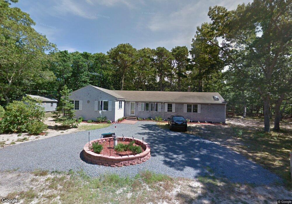
20 Lillian Rd Eastham, MA 02642
Estimated Value: $646,000 - $800,000
4
Beds
2
Baths
1,666
Sq Ft
$439/Sq Ft
Est. Value
About This Home
This home is located at 20 Lillian Rd, Eastham, MA 02642 and is currently estimated at $731,182, approximately $438 per square foot. 20 Lillian Rd is a home located in Barnstable County with nearby schools including Eastham Elementary School, Nauset Regional Middle School, and Nauset Regional High School.
Ownership History
Date
Name
Owned For
Owner Type
Purchase Details
Closed on
Jun 16, 2017
Sold by
Abramo Salvatore and Abramo Catherine J
Bought by
Abramo Ft
Current Estimated Value
Purchase Details
Closed on
Jul 8, 1986
Bought by
Abramo Salvatore M and Abramo Catherine J
Create a Home Valuation Report for This Property
The Home Valuation Report is an in-depth analysis detailing your home's value as well as a comparison with similar homes in the area
Home Values in the Area
Average Home Value in this Area
Purchase History
We collect this data history from publicly available records. To have your information removed, we recommend requesting removal directly through your county’s website.
| Date | Buyer | Sale Price | Title Company |
|---|---|---|---|
| Abramo Ft | -- | -- | |
| Abramo Salvatore M | $99,500 | -- |
Source: Public Records
Mortgage History
We collect this data history from publicly available records. To have your information removed, we recommend requesting removal directly through your county’s website.
| Date | Status | Borrower | Loan Amount |
|---|---|---|---|
| Previous Owner | Abramo Salvatore M | $69,100 |
Source: Public Records
Tax History
| Year | Tax Paid | Tax Assessment Tax Assessment Total Assessment is a certain percentage of the fair market value that is determined by local assessors to be the total taxable value of land and additions on the property. | Land | Improvement |
|---|---|---|---|---|
| 2025 | $5,006 | $649,300 | $286,200 | $363,100 |
| 2024 | $4,453 | $635,200 | $277,800 | $357,400 |
| 2023 | $4,149 | $573,100 | $257,300 | $315,800 |
| 2022 | $3,930 | $458,100 | $229,700 | $228,400 |
| 2021 | $3,823 | $416,500 | $208,800 | $207,700 |
| 2020 | $3,576 | $410,100 | $213,100 | $197,000 |
| 2019 | $3,131 | $379,500 | $188,100 | $191,400 |
| 2018 | $3,098 | $371,000 | $182,600 | $188,400 |
| 2017 | $2,873 | $363,700 | $179,000 | $184,700 |
| 2016 | $2,636 | $354,300 | $179,000 | $175,300 |
| 2015 | $2,456 | $345,900 | $175,500 | $170,400 |
Source: Public Records
Map
Nearby Homes
- 50 Silver Oak Rd
- 155 Sea Gull Ln
- 1230 Massasoit Rd
- 190 Serb St
- 495 Aspinet Rd
- 1295 Massasoit Rd
- 190 Silver Spring Beach Rd
- 20 Oak Rd
- 95 Toland Dr
- 5 Anderson Ln
- 90 Rolling Ln
- 125 Wamsutta Rd
- 18 Jay Dee Ln
- 311 S Sunken Meadow Rd
- 80 Runway Ln
- 15 Runway Ln
- 10 Field Rd
- 300 Brackett Rd
- 2560 Nauset Rd
- 5470 State Hwy
- 15 Hidden Ln
- 60 Lillian Rd
- 25 Lillian Rd
- 25 Hidden Ln
- 245 Oak Ridge Rd
- 20 Maurice Rd
- 265 Oak Ridge Rd
- 225 Oak Ridge Rd
- 50 Maurice Rd
- 185 Cooks Brook Rd
- 225 Cooks Brook Rd
- 150 Oak Ridge Rd
- 95 Lillian Rd
- 260 Massasoit Trail
- 0 Oak Ridge Rd
- 20 Hidden Ln
- 155 Cooks Brook Rd
- 280 Massasoit Trail
- 295 Oak Ridge Rd
- 180 Massasoit Trail
Your Personal Tour Guide
Ask me questions while you tour the home.