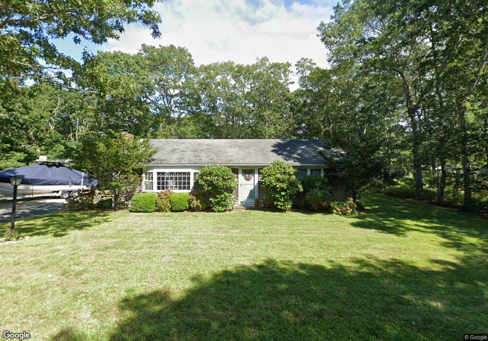
20 Longfellow Dr Dennis, MA 02638
Dennis Village NeighborhoodEstimated Value: $626,432 - $996,000
3
Beds
1
Bath
1,001
Sq Ft
$737/Sq Ft
Est. Value
About This Home
This home is located at 20 Longfellow Dr, Dennis, MA 02638 and is currently estimated at $737,358, approximately $736 per square foot. 20 Longfellow Dr is a home located in Barnstable County with nearby schools including Dennis-Yarmouth Regional High School.
Ownership History
Date
Name
Owned For
Owner Type
Purchase Details
Closed on
Sep 22, 2016
Sold by
Nylin Ernest P and Nylin Kathleen M
Bought by
Longfellow Drive Rt
Current Estimated Value
Purchase Details
Closed on
Jul 2, 1999
Sold by
Alexanian Rose T and Alexanian Nicholas P
Bought by
Nylin Ernest Peter and Nylin Kathleen M
Purchase Details
Closed on
Feb 3, 1993
Sold by
Griffin Stephen M and Griffin Lisa M
Bought by
Ahearn Christine A and Alexanian Roste T
Purchase Details
Closed on
Jun 19, 1991
Sold by
Griffin Carol M
Bought by
Griffin Stephen M
Home Financials for this Owner
Home Financials are based on the most recent Mortgage that was taken out on this home.
Original Mortgage
$76,000
Interest Rate
9.37%
Mortgage Type
Purchase Money Mortgage
Create a Home Valuation Report for This Property
The Home Valuation Report is an in-depth analysis detailing your home's value as well as a comparison with similar homes in the area
Home Values in the Area
Average Home Value in this Area
Purchase History
| Date | Buyer | Sale Price | Title Company |
|---|---|---|---|
| Longfellow Drive Rt | -- | -- | |
| Nylin Ernest Peter | $146,000 | -- | |
| Ahearn Christine A | $99,000 | -- | |
| Griffin Stephen M | $95,000 | -- |
Source: Public Records
Mortgage History
| Date | Status | Borrower | Loan Amount |
|---|---|---|---|
| Previous Owner | Griffin Stephen M | $76,000 | |
| Closed | Griffin Stephen M | $0 |
Source: Public Records
Tax History
| Year | Tax Paid | Tax Assessment Tax Assessment Total Assessment is a certain percentage of the fair market value that is determined by local assessors to be the total taxable value of land and additions on the property. | Land | Improvement |
|---|---|---|---|---|
| 2025 | $2,350 | $542,800 | $176,400 | $366,400 |
| 2024 | $2,250 | $512,600 | $177,700 | $334,900 |
| 2023 | $2,177 | $466,100 | $161,600 | $304,500 |
| 2022 | $2,008 | $358,500 | $132,300 | $226,200 |
| 2021 | $1,916 | $317,700 | $129,700 | $188,000 |
| 2020 | $1,831 | $300,200 | $129,700 | $170,500 |
| 2019 | $1,800 | $291,800 | $139,900 | $151,900 |
| 2018 | $1,633 | $257,500 | $121,100 | $136,400 |
| 2017 | $1,557 | $253,200 | $121,100 | $132,100 |
| 2016 | $1,699 | $260,200 | $151,300 | $108,900 |
| 2015 | $1,665 | $260,200 | $151,300 | $108,900 |
| 2014 | $1,476 | $232,400 | $121,100 | $111,300 |
Source: Public Records
Map
Nearby Homes
- 26 S West Dr
- 268 Main St
- 59 Main St Unit 19-2
- 59 Route 6a Unit 29-4
- 568 Route 6a
- 59 Massachusetts 6a Unit 19-2
- 6 Thomas Ct
- 15 Signal Hill Dr
- 480 Main St
- 35 Crown Grant Dr
- 20 Bray Farm Rd S
- 930 Old Bass River Rd
- 9 Split Rock Rd
- 645 Main St Back Lot
- 16 Hazelwood Rd
- 32 Captain Walsh Dr
- 15 Musket Ln
- 54 Kates Path Unit 54
- 10 Uncle Bills Way
- 15 John Hall Cartway Unit 15
- 53 Whittier Dr
- 21 Longfellow Dr
- 12 Longfellow Dr
- 29 Longfellow Dr
- 47 Whittier Dr
- 32 Longfellow Dr
- 46 Whittier Dr
- 54 Whittier Dr
- 63 Whittier Dr
- 20 S West Dr
- 32 Sou Dr W
- 13 Longfellow Dr
- 20 Southwest Dr
- 37 Longfellow Dr
- 32 S West Dr
- 14 S West Dr
- 24 S West Dr
- 36 Whittier Dr
- 4 Longfellow Dr
- 39 Whittier Dr
Your Personal Tour Guide
Ask me questions while you tour the home.