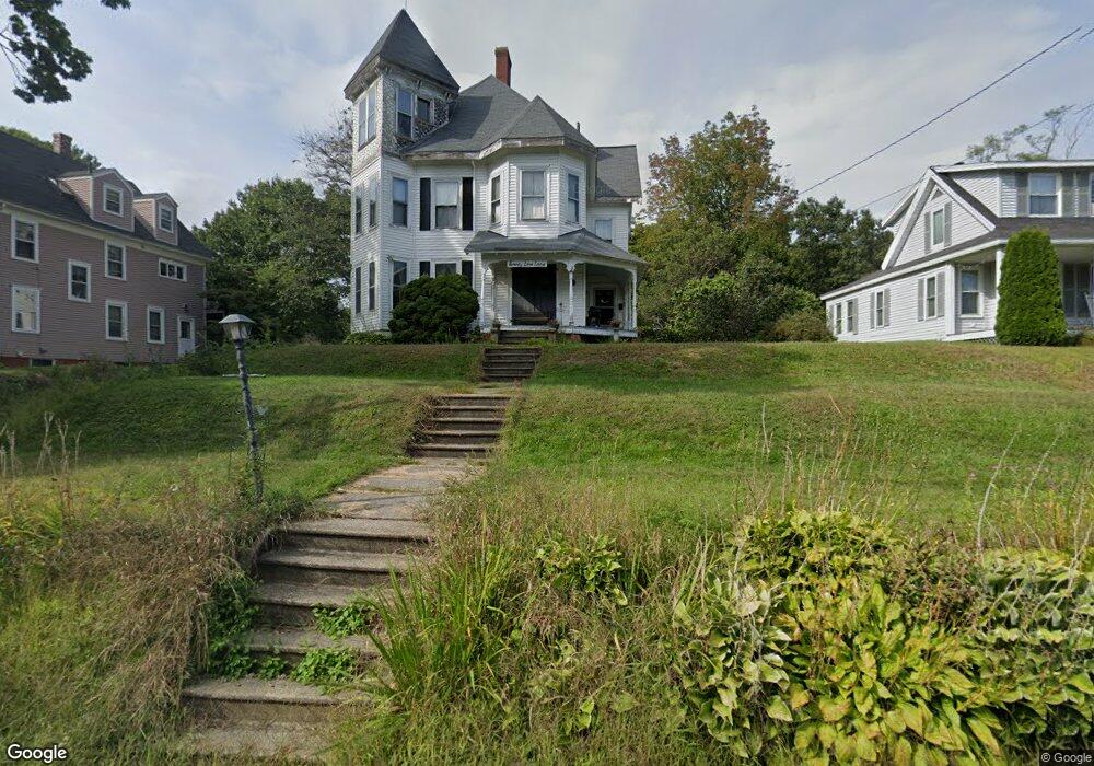
20 Love Ln Kittery, ME 03904
Estimated Value: $709,000 - $840,000
4
Beds
3
Baths
2,025
Sq Ft
$390/Sq Ft
Est. Value
About This Home
This home is located at 20 Love Ln, Kittery, ME 03904 and is currently estimated at $788,750, approximately $389 per square foot. 20 Love Ln is a home with nearby schools including Shapleigh School, Horace Mitchell Primary School, and Robert W Traip Academy.
Ownership History
Date
Name
Owned For
Owner Type
Purchase Details
Closed on
Feb 1, 2010
Sold by
Colbert Nancy
Bought by
Bailey Emily W
Current Estimated Value
Home Financials for this Owner
Home Financials are based on the most recent Mortgage that was taken out on this home.
Original Mortgage
$209,142
Outstanding Balance
$141,632
Interest Rate
5.5%
Mortgage Type
FHA
Estimated Equity
$647,118
Create a Home Valuation Report for This Property
The Home Valuation Report is an in-depth analysis detailing your home's value as well as a comparison with similar homes in the area
Home Values in the Area
Average Home Value in this Area
Purchase History
| Date | Buyer | Sale Price | Title Company |
|---|---|---|---|
| Bailey Emily W | -- | -- |
Source: Public Records
Mortgage History
| Date | Status | Borrower | Loan Amount |
|---|---|---|---|
| Open | Bailey Emily W | $209,142 |
Source: Public Records
Tax History Compared to Growth
Tax History
| Year | Tax Paid | Tax Assessment Tax Assessment Total Assessment is a certain percentage of the fair market value that is determined by local assessors to be the total taxable value of land and additions on the property. | Land | Improvement |
|---|---|---|---|---|
| 2024 | $6,026 | $424,400 | $208,200 | $216,200 |
| 2023 | $5,776 | $424,400 | $208,200 | $216,200 |
| 2022 | $5,721 | $424,400 | $208,200 | $216,200 |
| 2021 | $5,517 | $424,400 | $208,200 | $216,200 |
| 2020 | $3,809 | $424,400 | $208,200 | $216,200 |
| 2019 | $3,809 | $251,300 | $69,600 | $181,700 |
| 2018 | $4,148 | $246,900 | $69,600 | $177,300 |
| 2017 | $3,942 | $246,900 | $69,600 | $177,300 |
| 2016 | $3,963 | $246,900 | $69,600 | $177,300 |
| 2015 | $3,869 | $246,900 | $69,600 | $177,300 |
| 2014 | $3,832 | $246,900 | $69,600 | $177,300 |
| 2013 | $3,758 | $246,900 | $69,600 | $177,300 |
Source: Public Records
Map
Nearby Homes
- 10-12 Pine St
- 8 Water St Unit 2
- 8 Water St Unit 1
- 20 Mendum Ave
- 2 Wainwright Ave
- 116 Whipple Rd
- 165 Rogers Rd
- 12 Gillis Dr Unit 3
- 35 Badgers Island W Unit 203
- 35 Badgers Island W Unit 301
- 35 Badgers Island W Unit 204
- 35 Badgers Island W Unit 103
- 35 Badgers Island W Unit 102
- 27 Oak Terrace
- 25 Oak Terrace
- 1 Harbour Place Unit 4i
- 36 State St
- 58 State St
- 197 State Rd
- 5 Spinney Way Unit 9