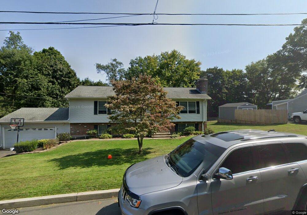
20 Lucinda Ln Middletown, CT 06457
Westfield NeighborhoodEstimated Value: $398,000 - $402,633
3
Beds
3
Baths
1,098
Sq Ft
$365/Sq Ft
Est. Value
About This Home
This home is located at 20 Lucinda Ln, Middletown, CT 06457 and is currently estimated at $401,158, approximately $365 per square foot. 20 Lucinda Ln is a home located in Middlesex County with nearby schools including St John Paul II School.
Ownership History
Date
Name
Owned For
Owner Type
Purchase Details
Closed on
Feb 6, 2019
Sold by
Brennan Kevin J
Bought by
Brennan Chelsea E and Brennan Catlin V
Current Estimated Value
Purchase Details
Closed on
May 4, 2009
Sold by
Sadosky Joseph L and Sadosky Kathy L
Bought by
Brennan Kevin J
Home Financials for this Owner
Home Financials are based on the most recent Mortgage that was taken out on this home.
Original Mortgage
$214,000
Interest Rate
4.86%
Purchase Details
Closed on
May 27, 2005
Sold by
Est Russo Glen J and Eldridge Elaine
Bought by
Sadosky Joseph L and Sadosky Kathy L
Home Financials for this Owner
Home Financials are based on the most recent Mortgage that was taken out on this home.
Original Mortgage
$122,500
Interest Rate
5.94%
Create a Home Valuation Report for This Property
The Home Valuation Report is an in-depth analysis detailing your home's value as well as a comparison with similar homes in the area
Home Values in the Area
Average Home Value in this Area
Purchase History
| Date | Buyer | Sale Price | Title Company |
|---|---|---|---|
| Brennan Chelsea E | -- | -- | |
| Brennan Kevin J | $249,000 | -- | |
| Sadosky Joseph L | $242,500 | -- |
Source: Public Records
Mortgage History
| Date | Status | Borrower | Loan Amount |
|---|---|---|---|
| Previous Owner | Sadosky Joseph L | $214,000 | |
| Previous Owner | Sadosky Joseph L | $76,200 | |
| Previous Owner | Sadosky Joseph L | $122,500 | |
| Previous Owner | Sadosky Joseph L | $35,000 |
Source: Public Records
Tax History Compared to Growth
Tax History
| Year | Tax Paid | Tax Assessment Tax Assessment Total Assessment is a certain percentage of the fair market value that is determined by local assessors to be the total taxable value of land and additions on the property. | Land | Improvement |
|---|---|---|---|---|
| 2025 | $8,037 | $206,610 | $64,380 | $142,230 |
| 2024 | $7,603 | $206,610 | $64,380 | $142,230 |
| 2023 | $7,252 | $206,610 | $64,380 | $142,230 |
| 2022 | $6,450 | $146,600 | $42,920 | $103,680 |
| 2021 | $6,450 | $146,600 | $42,920 | $103,680 |
| 2020 | $6,480 | $146,600 | $42,920 | $103,680 |
| 2019 | $6,509 | $146,600 | $42,920 | $103,680 |
| 2018 | $6,406 | $146,600 | $42,920 | $103,680 |
| 2017 | $6,599 | $155,630 | $46,200 | $109,430 |
| 2016 | $6,412 | $155,630 | $46,200 | $109,430 |
| 2015 | $6,163 | $155,630 | $46,200 | $109,430 |
| 2014 | $6,225 | $155,630 | $46,200 | $109,430 |
Source: Public Records
Map
Nearby Homes
- 36 Brookview Ln
- 94 Cynthia Ln Unit D-5
- 404 Newfield St
- 180 Bailey Rd
- 85 Aspen Dr
- 27 Valley Dr
- 136 Westfield St
- 122 Nejako Dr
- 30 Hemlock Place
- 80 Birchwood Dr
- 3 Nathan Hale Rd
- 4 Nathan Hale Rd
- 1 Nathan Hale Rd
- 2 Nathan Hale Rd
- 10 Talias Trail
- 59 Willow Bee Ln
- 82 Westfield Terrace
- 59 Westfield Terrace
- 18 Phedon Pkwy
- 31 Broadview Pkwy