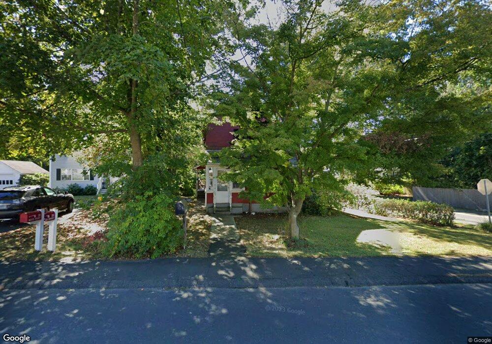
20 Maple St Darien, CT 06820
Estimated Value: $929,000 - $1,449,000
3
Beds
3
Baths
1,806
Sq Ft
$663/Sq Ft
Est. Value
About This Home
This home is located at 20 Maple St, Darien, CT 06820 and is currently estimated at $1,196,826, approximately $662 per square foot. 20 Maple St is a home located in Fairfield County with nearby schools including Hindley Elementary School, Middlesex Middle School, and Darien High School.
Ownership History
Date
Name
Owned For
Owner Type
Purchase Details
Closed on
Sep 20, 2002
Sold by
Hewitt Fiona M
Bought by
Mccarthy Paula D and Mccarthy Kevin H
Current Estimated Value
Home Financials for this Owner
Home Financials are based on the most recent Mortgage that was taken out on this home.
Original Mortgage
$250,000
Interest Rate
6.36%
Purchase Details
Closed on
Aug 7, 1995
Sold by
Bay Peter and Bay Ellen
Bought by
Hewitt Guy and Hewitt Fiona
Home Financials for this Owner
Home Financials are based on the most recent Mortgage that was taken out on this home.
Original Mortgage
$279,000
Interest Rate
7%
Mortgage Type
Unknown
Purchase Details
Closed on
Jun 30, 1989
Sold by
Scott Judy
Bought by
Bay Peter
Create a Home Valuation Report for This Property
The Home Valuation Report is an in-depth analysis detailing your home's value as well as a comparison with similar homes in the area
Home Values in the Area
Average Home Value in this Area
Purchase History
| Date | Buyer | Sale Price | Title Company |
|---|---|---|---|
| Mccarthy Paula D | $465,000 | -- | |
| Hewitt Guy | $310,000 | -- | |
| Bay Peter | $270,000 | -- |
Source: Public Records
Mortgage History
| Date | Status | Borrower | Loan Amount |
|---|---|---|---|
| Closed | Bay Peter | $247,871 | |
| Closed | Bay Peter | $250,000 | |
| Previous Owner | Bay Peter | $279,000 | |
| Previous Owner | Bay Peter | $218,500 |
Source: Public Records
Tax History Compared to Growth
Tax History
| Year | Tax Paid | Tax Assessment Tax Assessment Total Assessment is a certain percentage of the fair market value that is determined by local assessors to be the total taxable value of land and additions on the property. | Land | Improvement |
|---|---|---|---|---|
| 2025 | $8,822 | $569,870 | $415,800 | $154,070 |
| 2024 | $8,371 | $569,870 | $415,800 | $154,070 |
| 2023 | $7,618 | $432,600 | $297,010 | $135,590 |
| 2022 | $7,454 | $432,600 | $297,010 | $135,590 |
| 2021 | $9,192 | $432,600 | $297,010 | $135,590 |
| 2020 | $7,077 | $432,600 | $297,010 | $135,590 |
| 2019 | $7,125 | $432,600 | $297,010 | $135,590 |
| 2018 | $7,000 | $435,330 | $278,180 | $157,150 |
| 2017 | $7,035 | $435,330 | $278,180 | $157,150 |
| 2016 | $6,865 | $435,330 | $278,180 | $157,150 |
| 2015 | $6,620 | $431,270 | $278,180 | $153,090 |
| 2014 | $6,473 | $431,270 | $278,180 | $153,090 |
Source: Public Records
Map
Nearby Homes
- 77 Maple St
- 166 Hollow Tree Ridge Rd
- 13 Patton Dr
- 47 Hollow Tree Ridge Rd
- 223 Middlesex Rd
- 22 Radio Place Unit 10
- 105 Houston Terrace
- 100 Maple Tree Ave Unit 7
- 10 Stony Brook Rd
- 76 Deepwood Rd
- 69 Maple Tree Ave Unit 2
- 151 Courtland Ave Unit 6
- 151 Courtland Ave Unit 4
- 59 Courtland Ave Unit 2T
- 74 Standish Rd Unit 3
- 171 Sylvan Knoll Rd
- 28 Aquila Rd
- 20 Locust Hill Rd
- 5 Shipway Rd
- 209 Seaside Ave Unit 2