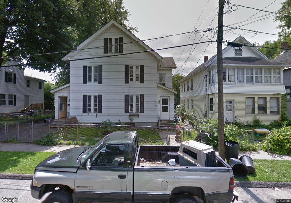
20 Maple St Pittsfield, MA 01201
Estimated Value: $178,000 - $224,000
6
Beds
2
Baths
2,296
Sq Ft
$90/Sq Ft
Est. Value
About This Home
This home is located at 20 Maple St, Pittsfield, MA 01201 and is currently estimated at $207,463, approximately $90 per square foot. 20 Maple St is a home located in Berkshire County with nearby schools including Morningside Community School, Theodore Herberg Middle School, and Pittsfield High School.
Ownership History
Date
Name
Owned For
Owner Type
Purchase Details
Closed on
Jun 27, 2002
Sold by
Thomson Graham C and Thomson Jeffrey J
Bought by
Sturles Rhonda M
Current Estimated Value
Home Financials for this Owner
Home Financials are based on the most recent Mortgage that was taken out on this home.
Original Mortgage
$55,300
Outstanding Balance
$23,792
Interest Rate
6.92%
Mortgage Type
Purchase Money Mortgage
Estimated Equity
$183,671
Purchase Details
Closed on
Jul 21, 2000
Sold by
Thompson Graham C
Bought by
Pittsfield City Of
Purchase Details
Closed on
Jan 24, 1995
Sold by
Rosenberg Eugene H
Bought by
Thomson Graham C and Thomson Jeffrey J
Home Financials for this Owner
Home Financials are based on the most recent Mortgage that was taken out on this home.
Original Mortgage
$40,000
Interest Rate
9.16%
Mortgage Type
Purchase Money Mortgage
Purchase Details
Closed on
Oct 13, 1989
Sold by
Labbe Jeffrey A
Bought by
Slutzkin Robert B
Create a Home Valuation Report for This Property
The Home Valuation Report is an in-depth analysis detailing your home's value as well as a comparison with similar homes in the area
Home Values in the Area
Average Home Value in this Area
Purchase History
| Date | Buyer | Sale Price | Title Company |
|---|---|---|---|
| Sturles Rhonda M | $58,500 | -- | |
| Sturles Rhonda M | $58,500 | -- | |
| Pittsfield City Of | $1,616 | -- | |
| Pittsfield City Of | $1,616 | -- | |
| Thomson Graham C | $39,000 | -- | |
| Thomson Graham C | $39,000 | -- | |
| Slutzkin Robert B | $93,000 | -- | |
| Slutzkin Robert B | $93,000 | -- |
Source: Public Records
Mortgage History
| Date | Status | Borrower | Loan Amount |
|---|---|---|---|
| Open | Slutzkin Robert B | $55,300 | |
| Closed | Slutzkin Robert B | $55,300 | |
| Previous Owner | Slutzkin Robert B | $40,000 |
Source: Public Records
Tax History Compared to Growth
Tax History
| Year | Tax Paid | Tax Assessment Tax Assessment Total Assessment is a certain percentage of the fair market value that is determined by local assessors to be the total taxable value of land and additions on the property. | Land | Improvement |
|---|---|---|---|---|
| 2025 | $3,669 | $204,500 | $29,500 | $175,000 |
| 2024 | $3,140 | $170,200 | $29,500 | $140,700 |
| 2023 | $2,900 | $158,300 | $29,500 | $128,800 |
| 2022 | $2,738 | $147,500 | $27,200 | $120,300 |
| 2021 | $2,630 | $136,600 | $27,200 | $109,400 |
| 2020 | $2,623 | $133,100 | $27,200 | $105,900 |
| 2019 | $2,560 | $131,800 | $27,200 | $104,600 |
| 2018 | $2,545 | $127,200 | $27,200 | $100,000 |
| 2017 | $2,413 | $122,900 | $25,400 | $97,500 |
| 2016 | $2,343 | $124,900 | $25,400 | $99,500 |
| 2015 | $2,256 | $124,900 | $25,400 | $99,500 |
Source: Public Records
Map
Nearby Homes
- 98 Lincoln St
- 48 Brown St
- 52 Brown St
- 24 Glenwood Ave
- 29 Glenwood Ave
- 68 Orchard St
- 71 Maplewood Ave
- 51 Adam St
- 9 Myrtle St
- LOT 20 Plunkett St
- 33 Maplewood Ave Unit 305
- 33 Maplewood Ave Unit 103
- 26 Springside Ave
- 762 East St
- 58 Seymour St
- 17 - 23 Linden St
- 41 Perrine Ave
- 40 Roland St
- 22 Copley Terrace
- 25 Ashley St