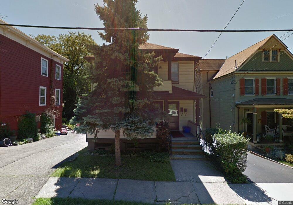
20 Maple St Sleepy Hollow, NY 10591
Estimated Value: $856,000 - $945,838
5
Beds
3
Baths
2,484
Sq Ft
$366/Sq Ft
Est. Value
About This Home
This home is located at 20 Maple St, Sleepy Hollow, NY 10591 and is currently estimated at $907,960, approximately $365 per square foot. 20 Maple St is a home located in Westchester County with nearby schools including John Paulding School, W L Morse School, and Washington Irving Interm School.
Ownership History
Date
Name
Owned For
Owner Type
Purchase Details
Closed on
Dec 3, 2019
Sold by
Venditti Rosa A
Bought by
Bendak Linda
Current Estimated Value
Home Financials for this Owner
Home Financials are based on the most recent Mortgage that was taken out on this home.
Original Mortgage
$377,000
Outstanding Balance
$333,351
Interest Rate
3.75%
Mortgage Type
New Conventional
Estimated Equity
$574,609
Create a Home Valuation Report for This Property
The Home Valuation Report is an in-depth analysis detailing your home's value as well as a comparison with similar homes in the area
Home Values in the Area
Average Home Value in this Area
Purchase History
| Date | Buyer | Sale Price | Title Company |
|---|---|---|---|
| Bendak Linda | $580,000 | Great American Ttl Agcy Inc |
Source: Public Records
Mortgage History
| Date | Status | Borrower | Loan Amount |
|---|---|---|---|
| Open | Bendak Linda | $377,000 |
Source: Public Records
Tax History Compared to Growth
Tax History
| Year | Tax Paid | Tax Assessment Tax Assessment Total Assessment is a certain percentage of the fair market value that is determined by local assessors to be the total taxable value of land and additions on the property. | Land | Improvement |
|---|---|---|---|---|
| 2024 | $20,582 | $117,845 | $45,300 | $72,545 |
| 2023 | $19,199 | $117,845 | $45,300 | $72,545 |
| 2022 | $19,004 | $117,845 | $45,300 | $72,545 |
| 2021 | $18,672 | $117,845 | $45,300 | $72,545 |
| 2020 | $18,371 | $117,845 | $45,300 | $72,545 |
| 2019 | $2,465 | $117,845 | $45,300 | $72,545 |
| 2018 | $17,809 | $117,845 | $45,300 | $72,545 |
| 2017 | -- | $117,845 | $45,300 | $72,545 |
| 2016 | $23,920 | $117,845 | $45,300 | $72,545 |
| 2015 | -- | $7,650 | $650 | $7,000 |
| 2014 | -- | $7,650 | $650 | $7,000 |
| 2013 | -- | $7,650 | $650 | $7,000 |
Source: Public Records
Map
Nearby Homes
- 37 Devries Ave
- 57 Cobb Ln
- 46 Andrews Ln
- 34 Andrews Ln
- 42 Andrews Ln
- 29 Woodland Ave
- 4 Harwood Ave
- 4 Lighthouse Landing Unit 318
- 4 Lighthouse Landing Unit 208
- 4 Lighthouse Landing Unit 224
- 4 Lighthouse Landing Unit 301
- 4 Lighthouse Landing Unit PH518
- 4 Lighthouse Landing Unit PH515
- 4 Lighthouse Landing Unit PH520
- 4 Lighthouse Landing Unit PH519
- 4 Lighthouse Landing Unit 209
- 4 Lighthouse Landing Unit 203
- 4 Lighthouse Landing Unit TH02
- 4 Lighthouse Landing Unit 421
- 4 Lighthouse Landing Unit 414