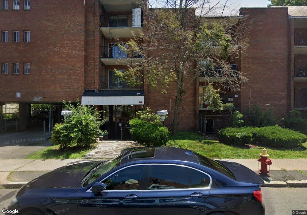
20 May St Unit 210 Hartford, CT 06105
Asylum Hill NeighborhoodEstimated Value: $63,884 - $100,000
1
Bed
1
Bath
610
Sq Ft
$122/Sq Ft
Est. Value
About This Home
This home is located at 20 May St Unit 210, Hartford, CT 06105 and is currently estimated at $74,471, approximately $122 per square foot. 20 May St Unit 210 is a home located in Hartford County with nearby schools including Noah Webster Micro Society School, Rawson School, and McKinley School.
Ownership History
Date
Name
Owned For
Owner Type
Purchase Details
Closed on
Aug 18, 2022
Sold by
963 Capitol Avenue Llc
Bought by
Ct Evergreen Apt Llc
Current Estimated Value
Home Financials for this Owner
Home Financials are based on the most recent Mortgage that was taken out on this home.
Original Mortgage
$16,350,000
Outstanding Balance
$15,583,099
Interest Rate
5.3%
Mortgage Type
Purchase Money Mortgage
Estimated Equity
-$15,508,628
Purchase Details
Closed on
Jun 26, 2014
Sold by
May Realty Holding Co
Bought by
20 May Street Llc
Purchase Details
Closed on
Apr 29, 2014
Sold by
Hartford Realty Holdin
Bought by
May Realty Holding Co
Purchase Details
Closed on
Jul 24, 1991
Sold by
Johnson Tr Terrell R
Bought by
Alexander Arndrew and Albertinie Margaret
Home Financials for this Owner
Home Financials are based on the most recent Mortgage that was taken out on this home.
Original Mortgage
$32,900
Interest Rate
9.58%
Mortgage Type
Unknown
Create a Home Valuation Report for This Property
The Home Valuation Report is an in-depth analysis detailing your home's value as well as a comparison with similar homes in the area
Home Values in the Area
Average Home Value in this Area
Purchase History
| Date | Buyer | Sale Price | Title Company |
|---|---|---|---|
| Ct Evergreen Apt Llc | $59,269,640 | None Available | |
| 20 May Street Llc | $1,662,000 | -- | |
| May Realty Holding Co | -- | -- | |
| New York Community Ban | -- | -- | |
| Alexander Arndrew | $35,000 | -- |
Source: Public Records
Mortgage History
| Date | Status | Borrower | Loan Amount |
|---|---|---|---|
| Open | Ct Evergreen Apt Llc | $16,350,000 | |
| Previous Owner | Alexander Arndrew | $32,900 |
Source: Public Records
Tax History Compared to Growth
Tax History
| Year | Tax Paid | Tax Assessment Tax Assessment Total Assessment is a certain percentage of the fair market value that is determined by local assessors to be the total taxable value of land and additions on the property. | Land | Improvement |
|---|---|---|---|---|
| 2025 | $818 | $11,870 | $0 | $11,870 |
| 2024 | $818 | $11,870 | $0 | $11,870 |
| 2023 | $818 | $11,870 | $0 | $11,870 |
| 2022 | $818 | $11,870 | $0 | $11,870 |
| 2021 | $647 | $8,715 | $0 | $8,715 |
| 2020 | $647 | $8,715 | $0 | $8,715 |
| 2019 | $647 | $8,715 | $0 | $8,715 |
| 2018 | $626 | $8,421 | $0 | $8,421 |
| 2016 | $577 | $7,763 | $0 | $7,763 |
| 2015 | $549 | $7,394 | $0 | $7,394 |
| 2014 | $536 | $7,213 | $0 | $7,213 |
Source: Public Records
Map
Nearby Homes
- 25 May St
- 251 Collins St
- 52 Atwood St Unit 3B
- 16 Townley St Unit G3
- 96 Sargeant St Unit 98
- 290 Sargeant St Unit 292
- 10 Burton St Unit 12
- 8 Sterling St
- 33 Sargeant St
- 364 Woodland St
- 68 Sterling St Unit 70
- 62 Burton St
- 78-80 Cabot St
- 59 Magnolia St
- 232 Farmington Ave Unit D8
- 337 Laurel St
- 300 Garden St
- 11 Marshall St
- 235 Farmington Ave Unit A
- 237 Farmington Ave Unit B
- 20 May St Unit 312
- 20 May St Unit 311
- 20 May St Unit 310
- 20 May St Unit 309
- 20 May St Unit 308
- 20 May St Unit 307
- 20 May St Unit 306
- 20 May St Unit 305
- 20 May St Unit 304
- 20 May St Unit 303
- 20 May St Unit 302
- 20 May St Unit 301
- 20 May St Unit 212
- 20 May St Unit 211
- 20 May St Unit 209
- 20 May St Unit 208
- 20 May St Unit 207
- 20 May St Unit 205
- 20 May St Unit 204
- 20 May St Unit 203