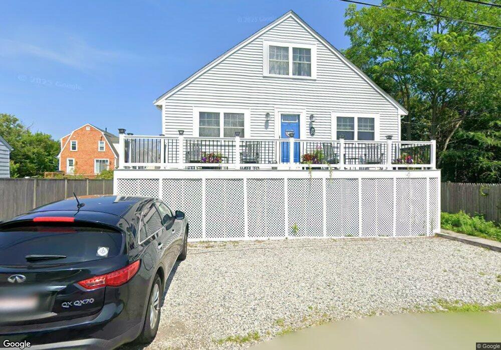
20 Mayflower Ln Marshfield, MA 02050
Ocean Bluff-Brant Rock NeighborhoodEstimated Value: $789,000 - $865,000
2
Beds
2
Baths
1,410
Sq Ft
$583/Sq Ft
Est. Value
About This Home
This home is located at 20 Mayflower Ln, Marshfield, MA 02050 and is currently estimated at $822,660, approximately $583 per square foot. 20 Mayflower Ln is a home located in Plymouth County with nearby schools including Daniel Webster, Furnace Brook Middle School, and Marshfield High School.
Ownership History
Date
Name
Owned For
Owner Type
Purchase Details
Closed on
Nov 13, 2015
Sold by
Bohan Natalie
Bought by
Flynn Virginia G
Current Estimated Value
Home Financials for this Owner
Home Financials are based on the most recent Mortgage that was taken out on this home.
Original Mortgage
$277,500
Outstanding Balance
$210,955
Interest Rate
3%
Mortgage Type
New Conventional
Estimated Equity
$611,705
Purchase Details
Closed on
Sep 7, 2012
Sold by
Prior Nancy D and Prior Mary
Bought by
Bohan Natalie
Create a Home Valuation Report for This Property
The Home Valuation Report is an in-depth analysis detailing your home's value as well as a comparison with similar homes in the area
Home Values in the Area
Average Home Value in this Area
Purchase History
| Date | Buyer | Sale Price | Title Company |
|---|---|---|---|
| Flynn Virginia G | $370,000 | -- | |
| Bohan Natalie | $320,000 | -- |
Source: Public Records
Mortgage History
| Date | Status | Borrower | Loan Amount |
|---|---|---|---|
| Open | Flynn Virginia G | $277,500 | |
| Closed | Flynn Virginia G | $277,500 |
Source: Public Records
Tax History Compared to Growth
Tax History
| Year | Tax Paid | Tax Assessment Tax Assessment Total Assessment is a certain percentage of the fair market value that is determined by local assessors to be the total taxable value of land and additions on the property. | Land | Improvement |
|---|---|---|---|---|
| 2025 | $7,071 | $714,200 | $317,700 | $396,500 |
| 2024 | $6,685 | $643,400 | $297,900 | $345,500 |
| 2023 | $5,938 | $555,500 | $268,100 | $287,400 |
| 2022 | $5,938 | $458,500 | $228,400 | $230,100 |
| 2021 | $5,772 | $437,600 | $218,400 | $219,200 |
| 2020 | $5,289 | $396,800 | $188,600 | $208,200 |
| 2019 | $5,163 | $385,900 | $188,600 | $197,300 |
| 2018 | $5,159 | $385,900 | $188,600 | $197,300 |
| 2017 | $4,928 | $359,200 | $178,700 | $180,500 |
| 2016 | $4,643 | $334,500 | $168,800 | $165,700 |
| 2015 | $4,446 | $334,500 | $168,800 | $165,700 |
| 2014 | $3,954 | $297,500 | $168,800 | $128,700 |
Source: Public Records
Map
Nearby Homes
- 20 Mayflower Ln
- 20 Mayflower Ln Unit 1
- 26 Mayflower Ln
- 14 Mayflower Ln
- 75 Monitor Rd
- 65 Monitor Rd
- 21 Mayflower Ln
- 21 Mayflower Ln
- 21 Mayflower Lane (Winter Rental) Unit 1
- 21 Mayflower Lane (Winter Rental)
- 10 Mayflower Ln
- 61 Monitor Rd
- 85 Monitor Rd
- 34 Mayflower Ln
- 34 Mayflower Ln
- 34 Mayflower Ln Unit 1
- 76 Monitor Rd
- 78 Hartford Rd
- 66 Hartford Rd
- 83 Surf Ave