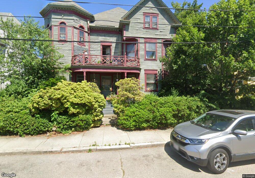
20 Maynard St Pawtucket, RI 02860
Pleasant View NeighborhoodEstimated Value: $724,000 - $903,000
4
Beds
4
Baths
6,359
Sq Ft
$123/Sq Ft
Est. Value
About This Home
This home is located at 20 Maynard St, Pawtucket, RI 02860 and is currently estimated at $780,900, approximately $122 per square foot. 20 Maynard St is a home located in Providence County with nearby schools including International Charter School, Blackstone Academy Charter School, and Saint Raphael Academy.
Ownership History
Date
Name
Owned For
Owner Type
Purchase Details
Closed on
Jun 28, 2023
Sold by
Patriot Builders Inc
Bought by
Szulc Marcin K and Szulc Tatiana
Current Estimated Value
Home Financials for this Owner
Home Financials are based on the most recent Mortgage that was taken out on this home.
Original Mortgage
$470,324
Outstanding Balance
$457,246
Interest Rate
6.39%
Mortgage Type
FHA
Estimated Equity
$323,654
Create a Home Valuation Report for This Property
The Home Valuation Report is an in-depth analysis detailing your home's value as well as a comparison with similar homes in the area
Home Values in the Area
Average Home Value in this Area
Purchase History
| Date | Buyer | Sale Price | Title Company |
|---|---|---|---|
| Szulc Marcin K | $479,000 | None Available |
Source: Public Records
Mortgage History
| Date | Status | Borrower | Loan Amount |
|---|---|---|---|
| Open | Szulc Marcin K | $470,324 |
Source: Public Records
Tax History
| Year | Tax Paid | Tax Assessment Tax Assessment Total Assessment is a certain percentage of the fair market value that is determined by local assessors to be the total taxable value of land and additions on the property. | Land | Improvement |
|---|---|---|---|---|
| 2025 | $8,470 | $644,100 | $106,400 | $537,700 |
| 2024 | $7,948 | $644,100 | $106,400 | $537,700 |
| 2023 | $7,462 | $440,500 | $61,700 | $378,800 |
| 2022 | $7,303 | $440,500 | $61,700 | $378,800 |
| 2021 | $7,303 | $440,500 | $61,700 | $378,800 |
| 2020 | $6,288 | $301,000 | $51,400 | $249,600 |
| 2019 | $6,288 | $301,000 | $51,400 | $249,600 |
| 2018 | $6,059 | $301,000 | $51,400 | $249,600 |
| 2017 | $4,821 | $212,200 | $42,000 | $170,200 |
| 2016 | $4,645 | $212,200 | $42,000 | $170,200 |
| 2015 | $4,645 | $212,200 | $42,000 | $170,200 |
| 2014 | $5,458 | $236,700 | $42,000 | $194,700 |
Source: Public Records
Map
Nearby Homes
- 23 Spring St
- 36 Underwood St
- 89 Armistice Blvd
- 133 Cottage St
- 48 Kossuth St
- 150 N Bend St
- 146 S Bend St
- 70 Brewster St
- 153 Central Ave
- 100 Pond St
- 35 Laurel St
- 256 High St
- 396 Roosevelt Ave
- 76 Lake St
- 300 Front St Unit 409
- 54 Sabin St
- 211 Carnation St
- 28 Bayley St Unit 107
- 28 Bayley St Unit 301
- 88 Barton St
- 16 Maynard St
- 140 Walcott St
- 16 Maynard St
- 150 Walcott St
- 10 Maynard St Unit 3
- 10 Maynard St
- 12 Maynard St Unit 6
- 12 Maynard St
- 11 Walnut St
- 134 Walcott St
- 21 Maynard St
- 11 Maynard St
- 147 Walcott St
- 21 Armistice Blvd
- 13 Armistice Blvd
- 38 Maynard St
- 128 Walcott St
- 25 Armistice Blvd
- 25 Armistice Blvd Unit 2
- 25 Armistice Blvd Unit 3
Your Personal Tour Guide
Ask me questions while you tour the home.