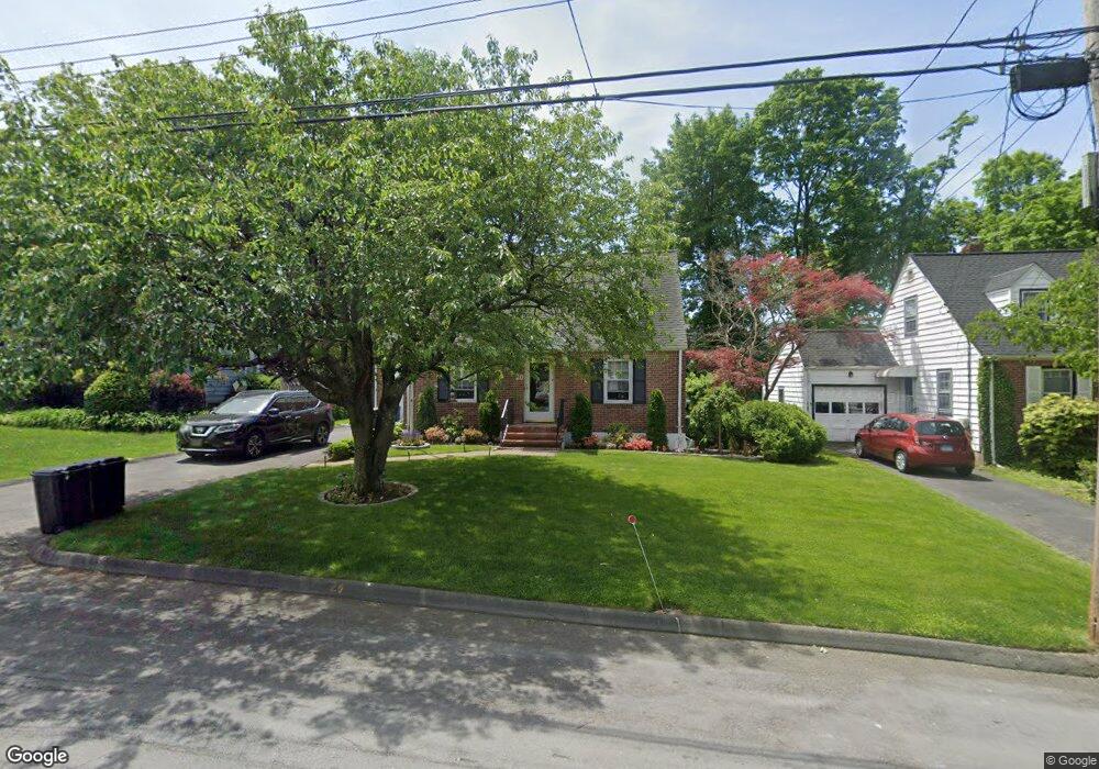
20 Maywood Ave Port Chester, NY 10573
Estimated Value: $734,000 - $844,000
3
Beds
2
Baths
1,600
Sq Ft
$488/Sq Ft
Est. Value
About This Home
This home is located at 20 Maywood Ave, Port Chester, NY 10573 and is currently estimated at $780,243, approximately $487 per square foot. 20 Maywood Ave is a home located in Westchester County with nearby schools including Port Chester Senior High School, Corpus Christi Holy Rosary School, and Westchester Fairfield Hebrew A.
Ownership History
Date
Name
Owned For
Owner Type
Purchase Details
Closed on
Nov 23, 2020
Sold by
Rafferty Brian and Rafferty Elizabeth B
Bought by
Bretones James and Bretones Anne
Current Estimated Value
Home Financials for this Owner
Home Financials are based on the most recent Mortgage that was taken out on this home.
Original Mortgage
$467,500
Outstanding Balance
$415,255
Interest Rate
2.7%
Mortgage Type
New Conventional
Estimated Equity
$364,988
Purchase Details
Closed on
Jun 28, 2013
Sold by
Grogan Loretta and Ciero Linda M
Bought by
Grogan Loretta and Ciero Linda M
Purchase Details
Closed on
Sep 12, 2011
Sold by
Bologna Barbara and Bologna John B
Bought by
Rafferty Brian and Rafferty Elizabeth B
Create a Home Valuation Report for This Property
The Home Valuation Report is an in-depth analysis detailing your home's value as well as a comparison with similar homes in the area
Home Values in the Area
Average Home Value in this Area
Purchase History
| Date | Buyer | Sale Price | Title Company |
|---|---|---|---|
| Bretones James | $550,000 | Record & Return Title Agency | |
| Grogan Loretta | -- | Benchmark Title Agency Llc | |
| Rafferty Brian | $425,000 | Judicial Title Insurance |
Source: Public Records
Mortgage History
| Date | Status | Borrower | Loan Amount |
|---|---|---|---|
| Open | Bretones James | $467,500 |
Source: Public Records
Tax History Compared to Growth
Tax History
| Year | Tax Paid | Tax Assessment Tax Assessment Total Assessment is a certain percentage of the fair market value that is determined by local assessors to be the total taxable value of land and additions on the property. | Land | Improvement |
|---|---|---|---|---|
| 2024 | $14,250 | $636,000 | $201,000 | $435,000 |
| 2023 | $12,125 | $611,500 | $191,500 | $420,000 |
| 2022 | $12,598 | $555,900 | $191,500 | $364,400 |
| 2021 | $13,410 | $514,700 | $191,500 | $323,200 |
| 2020 | $9,708 | $514,700 | $191,500 | $323,200 |
| 2019 | $12,893 | $459,700 | $170,000 | $289,700 |
| 2018 | $7,545 | $450,300 | $163,100 | $287,200 |
| 2017 | $1,853 | $438,800 | $157,900 | $280,900 |
| 2016 | $9,147 | $437,500 | $166,100 | $271,400 |
| 2015 | -- | $399,800 | $150,400 | $249,400 |
| 2014 | -- | $432,900 | $145,900 | $287,000 |
| 2013 | -- | $446,300 | $148,300 | $298,000 |
Source: Public Records
Map
Nearby Homes
- 15 Maywood Ave
- 10 Maywood Ave
- 180 Fairview Ave
- 11 Whittemore Place
- 27 Avon Cir Unit C
- 22 Ridge Blvd
- 10 Irenhyl Ave
- 22 Breckenridge Ave
- 9 Wilton Rd
- 485 Westchester Ave
- 431 Irving Ave
- 80 Valley Terrace
- 24 Park Place
- 90 Windsor Rd
- 494 Franklin St
- 60 Lafayette Dr
- 413 Franklin St
- 345 Betsy Brown Rd
- 23 Sylvan Rd
- 410 Westchester Ave Unit 202
- 22 Maywood Ave
- 18 Maywood Ave
- 24 Maywood Ave
- 16 Maywood Ave
- 253 Irenhyl Ave
- 249 Irenhyl Ave
- 257 Irenhyl Ave
- 19 Maywood Ave
- 245 Irenhyl Ave
- 17 Maywood Ave
- 21 Maywood Ave
- 259 Irenhyl Ave
- 14 Maywood Ave
- 83 N Ridge St
- 23 Maywood Ave
- 81 N Ridge St
- 79 N Ridge St
- 12 Maywood Ave
- 237 Irenhyl Ave
- 13 Maywood Ave