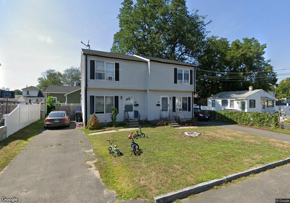
20 Mcbride St Unit 22 Springfield, MA 01104
Liberty Heights NeighborhoodEstimated Value: $356,000 - $446,000
4
Beds
4
Baths
1,976
Sq Ft
$199/Sq Ft
Est. Value
About This Home
This home is located at 20 Mcbride St Unit 22, Springfield, MA 01104 and is currently estimated at $392,392, approximately $198 per square foot. 20 Mcbride St Unit 22 is a home located in Hampden County with nearby schools including Mary O. Pottenger Elementary School, Van Sickle Academy, and Springfield Central High School.
Ownership History
Date
Name
Owned For
Owner Type
Purchase Details
Closed on
Sep 9, 2009
Sold by
Deutsche Bank Natl T C
Bought by
Housman Randall S
Current Estimated Value
Purchase Details
Closed on
Jul 27, 2009
Sold by
Rodriguez Juan E
Bought by
Deutsche Bank Natl T C
Purchase Details
Closed on
May 18, 2006
Sold by
Houle Real L
Bought by
Rodriguez Juan E
Home Financials for this Owner
Home Financials are based on the most recent Mortgage that was taken out on this home.
Original Mortgage
$175,200
Interest Rate
6.42%
Mortgage Type
Purchase Money Mortgage
Purchase Details
Closed on
Jul 25, 2000
Sold by
Carando Michael J and Carando Kathleen R
Bought by
Houle Real L
Home Financials for this Owner
Home Financials are based on the most recent Mortgage that was taken out on this home.
Original Mortgage
$78,400
Interest Rate
8.28%
Mortgage Type
Purchase Money Mortgage
Purchase Details
Closed on
Sep 16, 1991
Sold by
Carando Michael J
Bought by
Carando Steven A
Create a Home Valuation Report for This Property
The Home Valuation Report is an in-depth analysis detailing your home's value as well as a comparison with similar homes in the area
Home Values in the Area
Average Home Value in this Area
Purchase History
| Date | Buyer | Sale Price | Title Company |
|---|---|---|---|
| Housman Randall S | $39,900 | -- | |
| Deutsche Bank Natl T C | $131,750 | -- | |
| Rodriguez Juan E | $219,000 | -- | |
| Houle Real L | $98,000 | -- | |
| Carando Steven A | $10,944 | -- |
Source: Public Records
Mortgage History
| Date | Status | Borrower | Loan Amount |
|---|---|---|---|
| Previous Owner | Rodriguez Juan E | $175,200 | |
| Previous Owner | Rodriguez Juan E | $43,800 | |
| Previous Owner | Carando Steven A | $77,000 | |
| Previous Owner | Carando Steven A | $78,400 |
Source: Public Records
Tax History
| Year | Tax Paid | Tax Assessment Tax Assessment Total Assessment is a certain percentage of the fair market value that is determined by local assessors to be the total taxable value of land and additions on the property. | Land | Improvement |
|---|---|---|---|---|
| 2025 | $5,802 | $370,000 | $38,000 | $332,000 |
| 2024 | $5,428 | $338,000 | $38,000 | $300,000 |
| 2023 | $5,516 | $323,500 | $33,700 | $289,800 |
| 2022 | $4,280 | $227,400 | $31,500 | $195,900 |
| 2021 | $4,075 | $215,600 | $28,600 | $187,000 |
| 2020 | $3,812 | $195,200 | $28,600 | $166,600 |
| 2019 | $3,617 | $183,800 | $31,100 | $152,700 |
| 2018 | $3,399 | $180,500 | $31,100 | $149,400 |
| 2017 | $3,399 | $172,900 | $28,100 | $144,800 |
| 2016 | $3,201 | $162,800 | $26,700 | $136,100 |
| 2015 | $2,980 | $151,500 | $26,700 | $124,800 |
Source: Public Records
Map
Nearby Homes
- 119 Littleton St
- 52 Vadnais St
- 9 Utica St
- 33 Drexel St
- 34 Savoy Ave Unit 36
- 27 Parallel St
- 35 Merrimac Ave
- 116 Stockman St
- 28 Porter St
- 49 Upland St
- 28-30 Cherrelyn St
- 73 Melville
- 491-493 Newbury St
- 59 Piedmont St
- 774-776 Liberty St
- 393 Saint James Ave
- 744-746 Carew St
- 17 Stuyvesant St
- 148 Yale St
- 106 Amherst St
- 20-22 Mcbride St
- 12 Mcbride St Unit 14
- 12 Mc Bride St
- V/L Mc Bride St
- 28 Mcbride St
- 146 Parallel St
- 147 Parallel St
- 17 Mcbride St
- 267 Nottingham St
- 17 Griffin St
- 17 Griffin St Unit 1
- 15 Griffin St
- 273 Nottingham St
- 27 Mcbride St
- 11 Mcbride St
- 27 Griffin St
- 36 Mcbride St
- 279 Nottingham St Unit 281
- 279 Nottingham St Unit 279 Nottingham St.
- 253 Nottingham St
Your Personal Tour Guide
Ask me questions while you tour the home.