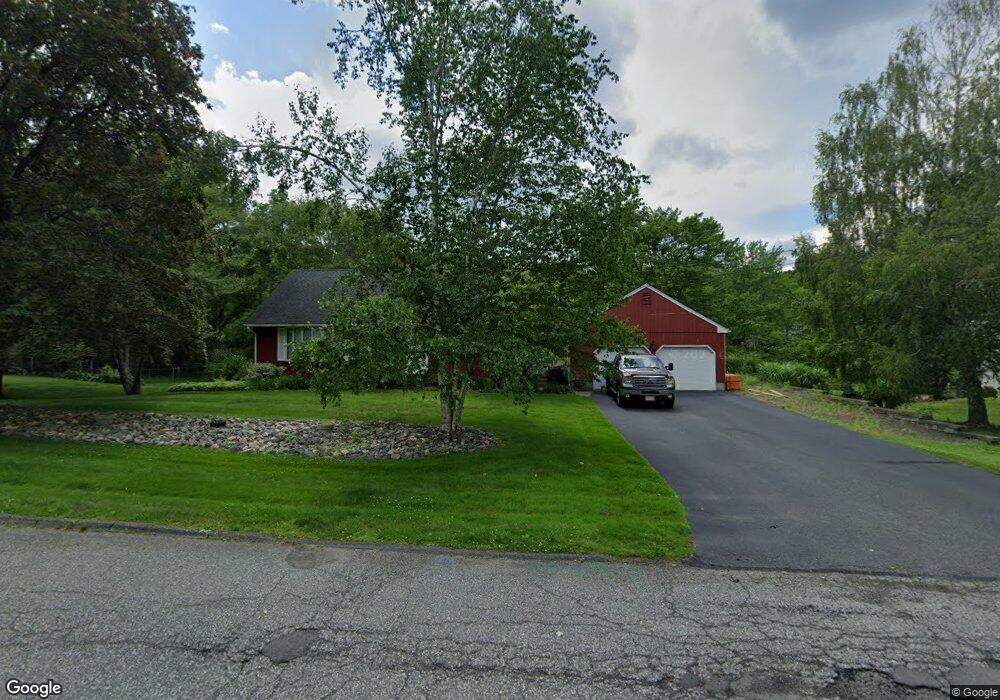
20 Meadow Rd East Longmeadow, MA 01028
Estimated Value: $453,000 - $491,000
3
Beds
3
Baths
1,960
Sq Ft
$241/Sq Ft
Est. Value
About This Home
This home is located at 20 Meadow Rd, East Longmeadow, MA 01028 and is currently estimated at $472,017, approximately $240 per square foot. 20 Meadow Rd is a home located in Hampden County with nearby schools including Meadowbrook Elementary School, Birchland Park Middle School, and East Longmeadow High School.
Ownership History
Date
Name
Owned For
Owner Type
Purchase Details
Closed on
Feb 10, 2023
Sold by
Marafioti Anthony B
Bought by
Marafioti Dino A
Current Estimated Value
Purchase Details
Closed on
May 20, 2021
Sold by
Marafioti Geraldine F and Marafioti Anthony B
Bought by
Marafioti Anthony B
Purchase Details
Closed on
Apr 23, 2021
Sold by
Marafioti Dino A
Bought by
Marafioti Anthony B and Marafioti Geraldine F
Purchase Details
Closed on
Dec 11, 2018
Sold by
Marafioti Anthony B and Marafioti Geraldine F
Bought by
Marufiori Dina A
Purchase Details
Closed on
Jun 7, 1968
Bought by
Marafioti Anthony B and Marafioti Geraldine F
Create a Home Valuation Report for This Property
The Home Valuation Report is an in-depth analysis detailing your home's value as well as a comparison with similar homes in the area
Home Values in the Area
Average Home Value in this Area
Purchase History
| Date | Buyer | Sale Price | Title Company |
|---|---|---|---|
| Marafioti Dino A | -- | None Available | |
| Marafioti Anthony B | -- | None Available | |
| Marafioti Anthony B | -- | None Available | |
| Marufiori Dina A | -- | -- | |
| Marafioti Anthony B | -- | -- |
Source: Public Records
Mortgage History
| Date | Status | Borrower | Loan Amount |
|---|---|---|---|
| Previous Owner | Marafioti Anthony B | $63,000 | |
| Previous Owner | Marafioti Anthony B | $73,072 | |
| Previous Owner | Marafioti Anthony B | $32,400 | |
| Previous Owner | Marafioti Anthony B | $81,000 |
Source: Public Records
Tax History Compared to Growth
Tax History
| Year | Tax Paid | Tax Assessment Tax Assessment Total Assessment is a certain percentage of the fair market value that is determined by local assessors to be the total taxable value of land and additions on the property. | Land | Improvement |
|---|---|---|---|---|
| 2025 | $7,314 | $395,800 | $143,300 | $252,500 |
| 2024 | $6,984 | $376,700 | $143,300 | $233,400 |
| 2023 | $6,595 | $343,500 | $129,700 | $213,800 |
| 2022 | $6,249 | $308,000 | $116,800 | $191,200 |
| 2021 | $6,139 | $291,500 | $108,100 | $183,400 |
| 2020 | $5,879 | $282,100 | $108,100 | $174,000 |
| 2019 | $5,561 | $270,600 | $105,000 | $165,600 |
| 2018 | $5,446 | $260,100 | $105,000 | $155,100 |
| 2017 | $5,330 | $256,600 | $102,900 | $153,700 |
| 2016 | $5,314 | $251,600 | $99,600 | $152,000 |
| 2015 | $5,213 | $251,600 | $99,600 | $152,000 |
Source: Public Records
Map
Nearby Homes