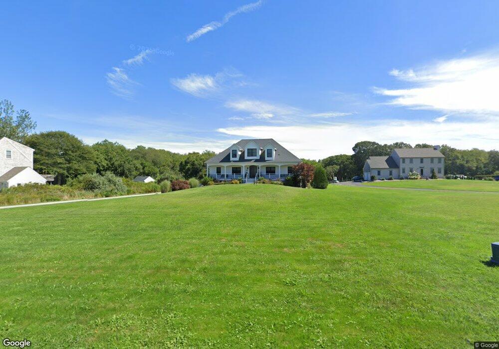
20 Meadowbrook Ln Westport, MA 02790
Booth/Handy Four Corners NeighborhoodEstimated Value: $875,000 - $1,138,000
3
Beds
--
Bath
3,916
Sq Ft
$269/Sq Ft
Est. Value
About This Home
This home is located at 20 Meadowbrook Ln, Westport, MA 02790 and is currently estimated at $1,052,040, approximately $268 per square foot. 20 Meadowbrook Ln is a home located in Bristol County with nearby schools including Alice A. Macomber Primary School, Westport Elementary School, and Westport Middle-High School.
Ownership History
Date
Name
Owned For
Owner Type
Purchase Details
Closed on
Apr 15, 2005
Sold by
190 Cw T and Carricorp Ind Ltd
Bought by
Medeiros Leonardo A and Medeiros Maryjo
Current Estimated Value
Purchase Details
Closed on
Mar 1, 2005
Sold by
190 Cw T
Bought by
Carmichael Jay and Carmichael Scott
Purchase Details
Closed on
Oct 24, 2001
Sold by
Manchester Cheryl
Bought by
Habib Robert A and Habib Ana S
Purchase Details
Closed on
Feb 26, 1999
Sold by
190 Cw T
Bought by
Manchester Cheryl
Create a Home Valuation Report for This Property
The Home Valuation Report is an in-depth analysis detailing your home's value as well as a comparison with similar homes in the area
Home Values in the Area
Average Home Value in this Area
Purchase History
| Date | Buyer | Sale Price | Title Company |
|---|---|---|---|
| Medeiros Leonardo A | $499,900 | -- | |
| Carmichael Jay | $10,000 | -- | |
| Carmichael Jay | $10,000 | -- | |
| Habib Robert A | $280,000 | -- | |
| Manchester Cheryl | $185,000 | -- |
Source: Public Records
Mortgage History
| Date | Status | Borrower | Loan Amount |
|---|---|---|---|
| Open | Manchester Cheryl | $312,000 | |
| Closed | Manchester Cheryl | $333,740 |
Source: Public Records
Tax History Compared to Growth
Tax History
| Year | Tax Paid | Tax Assessment Tax Assessment Total Assessment is a certain percentage of the fair market value that is determined by local assessors to be the total taxable value of land and additions on the property. | Land | Improvement |
|---|---|---|---|---|
| 2025 | $6,882 | $923,700 | $265,000 | $658,700 |
| 2024 | $6,952 | $899,400 | $245,500 | $653,900 |
| 2023 | $6,770 | $829,600 | $220,100 | $609,500 |
| 2022 | $6,724 | $800,100 | $220,100 | $580,000 |
| 2021 | $6,724 | $780,100 | $200,100 | $580,000 |
| 2020 | $6,509 | $772,100 | $192,100 | $580,000 |
| 2019 | $6,003 | $725,900 | $174,100 | $551,800 |
| 2018 | $5,067 | $620,200 | $178,800 | $441,400 |
| 2017 | $4,905 | $615,400 | $178,800 | $436,600 |
| 2016 | $4,498 | $568,600 | $178,800 | $389,800 |
| 2015 | $2,592 | $326,900 | $178,800 | $148,100 |
Source: Public Records
Map
Nearby Homes
- 118 Charlotte White Rd
- 8 Strawberry Ln
- 978 Sodom Rd
- 6 Angel Ct
- 118 Charlotte White Rd Extension
- 0 Hidden Glen Ln
- Lot 0 Marcotte
- 15 Village Way
- 4 Main Rd
- 7 Village Way
- 8 Village Way
- 308 Robert St
- 218 American Legion Hwy
- 47 Fallon Dr
- 47 Robert St
- 837 Main Rd
- 837 Main Road & Lot 2
- 40 Robert St
- 33 Moniz Dr
- 101 Adamsville Rd
- 26 Meadowbrook Ln
- 14 Meadowbrook Ln
- 8 Meadowbrook Ln
- 32 Meadowbrook Ln
- 7 Meadowbrook Ln
- 1 Old Pasture Ln
- 31 Meadowbrook Ln
- 2 Meadowbrook Ln
- 9 Fernmarsh Ln
- 38 Meadowbrook Ln
- 1 Meadowbrook Ln
- 5 Rogue Dr
- 37 Meadowbrook Ln
- 42 Meadowbrook Ln
- 7 Rogue Dr
- 7 Rogue Dr Unit Lot 11
- 11 Rogue Dr
- 11 Rogue Dr
- 43 Meadowbrook Ln
- 194 Charlotte White Rd