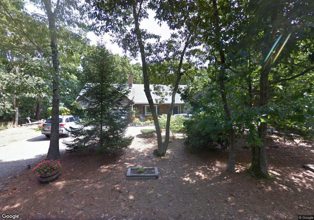
20 Meigs Ln Eastham, MA 02642
Estimated Value: $736,000 - $821,000
4
Beds
2
Baths
1,644
Sq Ft
$479/Sq Ft
Est. Value
About This Home
This home is located at 20 Meigs Ln, Eastham, MA 02642 and is currently estimated at $788,124, approximately $479 per square foot. 20 Meigs Ln is a home located in Barnstable County with nearby schools including Eastham Elementary School, Nauset Regional Middle School, and Nauset Regional High School.
Ownership History
Date
Name
Owned For
Owner Type
Purchase Details
Closed on
May 9, 2023
Sold by
Rizzotti Ft and Rizzotti
Bought by
B A St Martin Suppelement and Rizzotti
Current Estimated Value
Purchase Details
Closed on
Mar 4, 2021
Sold by
Rizzotti Alfred E
Bought by
Rizzotti Ft and Rizzotti
Purchase Details
Closed on
Feb 27, 2019
Sold by
Rizzotti Alfred E and Rizzotti Joan M
Bought by
Rizzotti Alfred E
Purchase Details
Closed on
Sep 17, 1982
Bought by
Rizzotti Alfred E and Rizzotti Joan M
Create a Home Valuation Report for This Property
The Home Valuation Report is an in-depth analysis detailing your home's value as well as a comparison with similar homes in the area
Home Values in the Area
Average Home Value in this Area
Purchase History
We collect this data history from publicly available records. To have your information removed, we recommend requesting removal directly through your county’s website.
| Date | Buyer | Sale Price | Title Company |
|---|---|---|---|
| B A St Martin Suppelement | -- | None Available | |
| B A St Martin Suppelement | -- | None Available | |
| Rizzotti Ft | -- | None Available | |
| Rizzotti Ft | -- | None Available | |
| Rizzotti Alfred E | -- | -- | |
| Rizzotti Alfred E | -- | -- | |
| Rizzotti Alfred E | -- | -- |
Source: Public Records
Tax History
| Year | Tax Paid | Tax Assessment Tax Assessment Total Assessment is a certain percentage of the fair market value that is determined by local assessors to be the total taxable value of land and additions on the property. | Land | Improvement |
|---|---|---|---|---|
| 2025 | $5,423 | $703,400 | $266,700 | $436,700 |
| 2024 | $4,753 | $678,000 | $258,900 | $419,100 |
| 2023 | $4,379 | $604,800 | $239,700 | $365,100 |
| 2022 | $4,113 | $479,400 | $214,000 | $265,400 |
| 2021 | $4,001 | $435,800 | $194,500 | $241,300 |
| 2020 | $3,701 | $424,400 | $198,600 | $225,800 |
| 2019 | $3,422 | $414,800 | $192,800 | $222,000 |
| 2018 | $3,364 | $402,900 | $187,200 | $215,700 |
| 2017 | $3,120 | $394,900 | $183,500 | $211,400 |
| 2016 | $2,931 | $394,000 | $183,500 | $210,500 |
| 2015 | $2,729 | $384,300 | $179,900 | $204,400 |
Source: Public Records
Map
Nearby Homes
- 3 Lighthouse Ln
- 95 Queen Anne Dr
- 300 Brackett Rd
- 255 Epanow Rd
- 2560 Nauset Rd
- 535 School House Rd
- 495 Schoolhouse Rd
- 20 Oak Rd
- 82 Old Orchard Rd
- 10 Alston Ct
- 80 Chipman St
- 18 Jay Dee Ln
- 1065 Great Pond Rd
- 5 Anderson Ln
- 80 Runway Ln
- 95 Toland Dr
- 3098 State Hwy
- 155 Sea Gull Ln
- 3315 State Hwy
- 245 Nauset Light Rd Unit R
- 10 Meigs Ln
- 15 Meigs Ln
- 25 Burrows Rd
- 30 Meigs Ln
- 15 Burrows Rd
- 5 Burrows Rd
- 20 Capt Penniman Rd
- 35 Burrows Rd
- 5 Captain Penniman Rd
- 725 Brackett Rd
- 185 Thoreau Dr
- 720 Brackett Rd
- 20 Captain Penniman Rd
- 65 Meigs Ln
- 20 Burrows Rd
- 60 Meigs Ln
- 30 Burrows Rd
- 800 Brackett Rd
- 15 Captain Penniman Rd
- 10 Burrows Rd
Your Personal Tour Guide
Ask me questions while you tour the home.