Estimated Value: $218,593 - $253,000
Studio
2
Baths
1,633
Sq Ft
$142/Sq Ft
Est. Value
About This Home
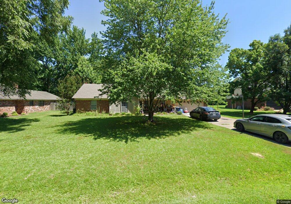
This home is located at 20 Michael Dr, Cabot, AR 72023 and is currently estimated at $232,398, approximately $142 per square foot. 20 Michael Dr is a home located in Lonoke County with nearby schools including Southside Elementary School, Cabot Junior High South, and Cabot Middle School South.
Ownership History
Date
Name
Owned For
Owner Type
Purchase Details
Closed on
Apr 15, 2003
Bought by
Stephens
Current Estimated Value
Purchase Details
Closed on
Nov 29, 1995
Bought by
Stephens and Wife Susan
Purchase Details
Closed on
Oct 10, 1991
Bought by
Allgood and Allgood Allgood
Create a Home Valuation Report for This Property
The Home Valuation Report is an in-depth analysis detailing your home's value as well as a comparison with similar homes in the area
Purchase History
| Date | Buyer | Sale Price | Title Company |
|---|---|---|---|
| Stephens | -- | -- | |
| Stephens | $87,000 | -- | |
| Stephens | $87,000 | -- | |
| Allgood | $10,000 | -- |
Source: Public Records
Tax History
| Year | Tax Paid | Tax Assessment Tax Assessment Total Assessment is a certain percentage of the fair market value that is determined by local assessors to be the total taxable value of land and additions on the property. | Land | Improvement |
|---|---|---|---|---|
| 2025 | $1,023 | $28,440 | $3,600 | $24,840 |
| 2024 | $1,023 | $28,440 | $3,600 | $24,840 |
| 2023 | $1,023 | $28,440 | $3,600 | $24,840 |
| 2022 | $1,073 | $28,440 | $3,600 | $24,840 |
| 2021 | $1,073 | $28,440 | $3,600 | $24,840 |
| 2020 | $1,011 | $27,220 | $3,600 | $23,620 |
| 2019 | $1,011 | $27,220 | $3,600 | $23,620 |
| 2018 | $995 | $27,220 | $3,600 | $23,620 |
| 2017 | $1,249 | $27,220 | $3,600 | $23,620 |
| 2016 | $995 | $27,220 | $3,600 | $23,620 |
| 2015 | $1,368 | $29,800 | $3,600 | $26,200 |
| 2014 | $1,122 | $29,800 | $3,600 | $26,200 |
Source: Public Records
Map
Nearby Homes
- 12 Michael Dr
- 507 Southhaven Ave
- 1 Bill Foster Memorial Hwy E
- 10 Bill Foster Memorial Hwy E
- 2702 Bill Foster Memorial Hwy E Unit Hwy 321
- 11 Dale Ct
- 15 Judith Ct
- Lot 107 Southhaven
- 12 Daytona
- 3215 Kerr Station Rd
- Lots 44 &45 Broadmoor Cir
- 105 Earnhardt Cir
- 19 Talladega Dr
- 35 Warren St
- 21 Wolfsbridge Loop
- 17 Wolfsbridge Loop
- 11 Warren St
- 61 Wolfsbridge Loop
- 60 Wolfsbridge Loop
- 54 Wolfsbridge Loop
- 0 Michael
- 22 Michael Dr
- 18 Michael Dr
- 19 Michael Dr
- 16 Michael Dr
- 24 Michael Dr
- 404 Southhaven Ave
- 14 Michael Dr
- 20 Vicki Lynn St
- 400 Southhaven Ave
- 26 Michael Dr
- 0 Southhaven Ave Unit 17027967
- 0 Southhaven Ave Unit 20026902
- 17 Chad Ct
- 10 Michael Dr
- 16 Vicki Lynn St
- 15 Chad Ct
- 403 Southhaven Ave
- 18 Chad Ct
- 501 Southhaven Ave
Your Personal Tour Guide
Ask me questions while you tour the home.