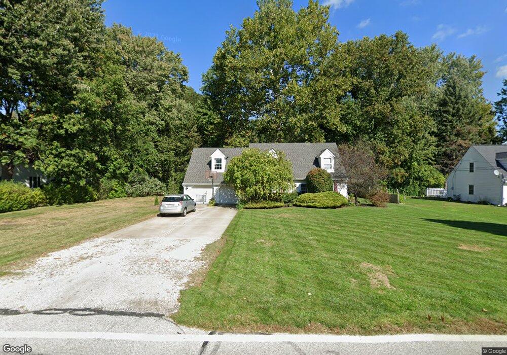
20 Mill Morr Dr Painesville, OH 44077
Estimated Value: $242,000 - $263,000
3
Beds
2
Baths
1,384
Sq Ft
$181/Sq Ft
Est. Value
About This Home
This home is located at 20 Mill Morr Dr, Painesville, OH 44077 and is currently estimated at $250,698, approximately $181 per square foot. 20 Mill Morr Dr is a home located in Lake County with nearby schools including Henry F. Lamuth Middle School, Riverside Junior/Senior High School, and St Gabriel School.
Ownership History
Date
Name
Owned For
Owner Type
Purchase Details
Closed on
Nov 21, 1997
Sold by
Soth Michael L and Soth Mary L
Bought by
Majoros Richard J and Majoros Kimberly L
Current Estimated Value
Home Financials for this Owner
Home Financials are based on the most recent Mortgage that was taken out on this home.
Original Mortgage
$116,350
Outstanding Balance
$19,264
Interest Rate
7.38%
Estimated Equity
$231,434
Purchase Details
Closed on
Oct 6, 1987
Bought by
Soth Mary L
Create a Home Valuation Report for This Property
The Home Valuation Report is an in-depth analysis detailing your home's value as well as a comparison with similar homes in the area
Home Values in the Area
Average Home Value in this Area
Purchase History
| Date | Buyer | Sale Price | Title Company |
|---|---|---|---|
| Majoros Richard J | $122,500 | Enterprise Title Agency Inc | |
| Soth Mary L | -- | -- |
Source: Public Records
Mortgage History
| Date | Status | Borrower | Loan Amount |
|---|---|---|---|
| Open | Majoros Richard J | $116,350 |
Source: Public Records
Tax History Compared to Growth
Tax History
| Year | Tax Paid | Tax Assessment Tax Assessment Total Assessment is a certain percentage of the fair market value that is determined by local assessors to be the total taxable value of land and additions on the property. | Land | Improvement |
|---|---|---|---|---|
| 2024 | -- | $68,620 | $18,600 | $50,020 |
| 2023 | $3,292 | $53,690 | $16,140 | $37,550 |
| 2022 | $3,214 | $53,690 | $16,140 | $37,550 |
| 2021 | $3,225 | $53,690 | $16,140 | $37,550 |
| 2020 | $2,927 | $42,960 | $12,920 | $30,040 |
| 2019 | $2,949 | $42,960 | $12,920 | $30,040 |
| 2018 | $3,178 | $47,950 | $15,840 | $32,110 |
| 2017 | $3,397 | $47,950 | $15,840 | $32,110 |
| 2016 | $2,999 | $47,950 | $15,840 | $32,110 |
| 2015 | $2,816 | $47,950 | $15,840 | $32,110 |
| 2014 | $2,863 | $47,950 | $15,840 | $32,110 |
| 2013 | $2,800 | $47,950 | $15,840 | $32,110 |
Source: Public Records
Map
Nearby Homes
- 322 Chesapeake Cove
- 1936 Mentor Ave
- 6509 Hudson Ave
- 135 Nantucket Cir
- 2155 Ridgebury Dr
- 146 Garfield Dr
- 2051 Kingsborough Dr
- 81 Fairfield Rd
- 6931 Chairmans Ct
- 9681 Abbeyshire Way
- 113 Palm Ct
- 9820 Old Johnnycake Ridge Rd Unit 5
- 1651 Mentor Ave Unit 2008
- 1651 Mentor Ave Unit 2804
- 1651 Mentor Ave Unit 1706
- 41 Warrington Ln
- 9846 Old Johnnycake Ridge Rd
- 339 Barrington Ridge Rd
- 1958 S Ashwood Ln
- 7093 Village Dr Unit 7093
- 34 Mill Morr Dr
- 10 Mill Morr Dr
- 2046 Mentor Ave
- 44 Mill Morr Dr
- 11 Mill Morr Dr
- 5 Mill Morr Dr
- 33 Mill Morr Dr
- 2074 Mentor Ave
- 54 Mill Morr Dr
- 43 Mill Morr Dr
- 2036 Mentor Ave
- 57 Mill Morr Dr
- 2100 Mentor Ave
- 2024 Mentor Ave
- 80 Mill Morr Dr
- 69 Mill Morr Dr
- 19 Chatham Dr
- 27 Chatham Dr
- 9 Chatham Dr
- 33 Chatham Dr