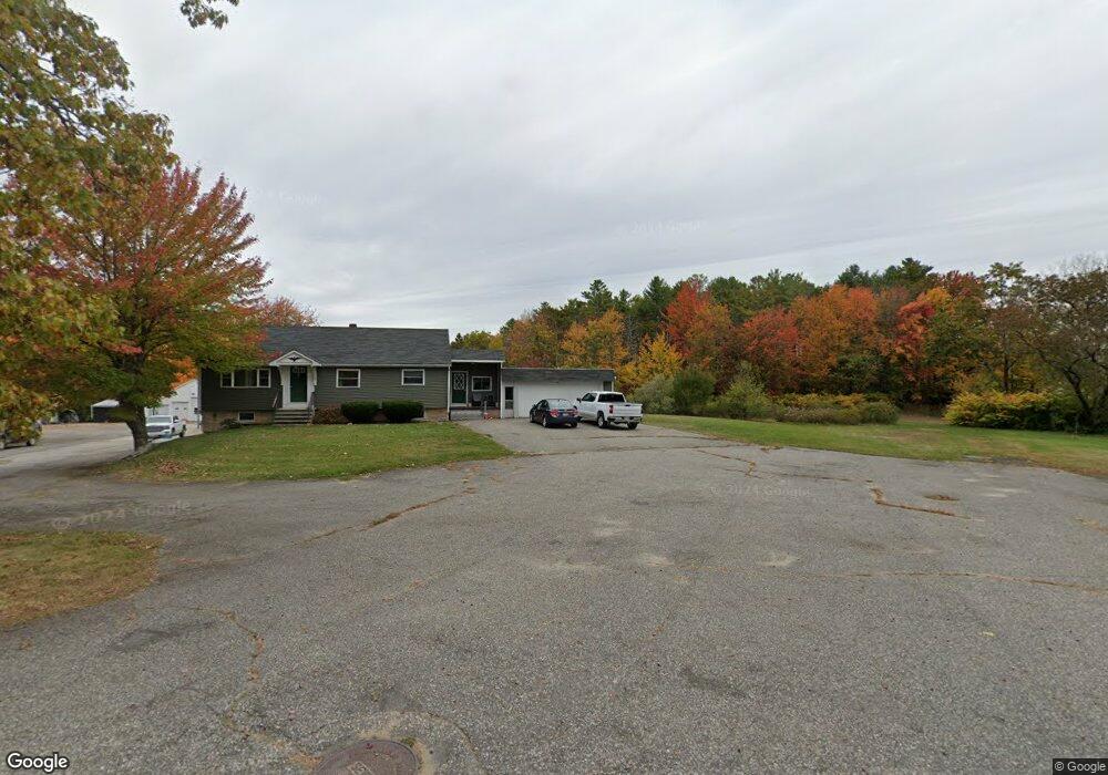
20 Millbrook Rd Scarborough, ME 04074
Estimated Value: $475,000 - $611,000
2
Beds
3
Baths
1,215
Sq Ft
$439/Sq Ft
Est. Value
About This Home
This home is located at 20 Millbrook Rd, Scarborough, ME 04074 and is currently estimated at $533,201, approximately $438 per square foot. 20 Millbrook Rd is a home located in Cumberland County with nearby schools including Scarborough High School and Cornerstone Baptist Academy.
Ownership History
Date
Name
Owned For
Owner Type
Purchase Details
Closed on
Sep 9, 2005
Sold by
Martinelli Carol T
Bought by
Delano Mark T and Delano Cynthia A
Current Estimated Value
Home Financials for this Owner
Home Financials are based on the most recent Mortgage that was taken out on this home.
Original Mortgage
$220,000
Outstanding Balance
$117,256
Interest Rate
5.79%
Mortgage Type
Commercial
Estimated Equity
$415,945
Purchase Details
Closed on
Mar 29, 2005
Sold by
Santerre Bertha D Est
Bought by
Martinelli Carol T
Home Financials for this Owner
Home Financials are based on the most recent Mortgage that was taken out on this home.
Original Mortgage
$150,000
Interest Rate
7%
Mortgage Type
Commercial
Create a Home Valuation Report for This Property
The Home Valuation Report is an in-depth analysis detailing your home's value as well as a comparison with similar homes in the area
Home Values in the Area
Average Home Value in this Area
Purchase History
| Date | Buyer | Sale Price | Title Company |
|---|---|---|---|
| Delano Mark T | -- | -- | |
| Martinelli Carol T | -- | -- |
Source: Public Records
Mortgage History
| Date | Status | Borrower | Loan Amount |
|---|---|---|---|
| Open | Delano Mark T | $220,000 | |
| Previous Owner | Martinelli Carol T | $150,000 |
Source: Public Records
Tax History Compared to Growth
Tax History
| Year | Tax Paid | Tax Assessment Tax Assessment Total Assessment is a certain percentage of the fair market value that is determined by local assessors to be the total taxable value of land and additions on the property. | Land | Improvement |
|---|---|---|---|---|
| 2024 | $5,596 | $512,000 | $178,500 | $333,500 |
| 2023 | $5,395 | $337,800 | $128,400 | $209,400 |
| 2022 | $5,199 | $337,800 | $128,400 | $209,400 |
| 2021 | $5,074 | $337,800 | $128,400 | $209,400 |
| 2020 | $4,788 | $337,800 | $128,400 | $209,400 |
| 2019 | $4,737 | $337,800 | $128,400 | $209,400 |
| 2017 | $4,320 | $322,600 | $206,900 | $115,700 |
| 2016 | $5,136 | $322,600 | $206,900 | $115,700 |
| 2015 | $4,997 | $322,600 | $206,900 | $115,700 |
| 2014 | $4,871 | $322,600 | $206,900 | $115,700 |
| 2013 | -- | $322,600 | $206,900 | $115,700 |
Source: Public Records
Map
Nearby Homes
- 19 Millbrook Rd
- 14 Herbert Dr
- 8 Ballantyne Dr
- 5 Estate Dr
- 46 Pacer Way
- 14 Oakdale Dr Unit 14
- 11 Westwood Ave
- 5 Traditional St
- 29-31 Haigis Pkwy
- 1 Cross St Unit 212
- 1 Cross St Unit 213
- 1 Cross St Unit 220
- 1 Cross St Unit 437
- 1 Cross St Unit 445
- 1 Cross St Unit 110
- 1 Cross St Unit 108
- 1 Cross St Unit 106
- 1 Cross St Unit 105
- 1 Cross St Unit 103
- 1 Cross St Unit 107
- 18 Millbrook Rd
- 26 Millbrook Rd
- 15 Millbrook Rd
- 18 Juneberry Ln
- 28 Millbrook Rd
- 13 Millbrook Rd
- 20 Juneberry Ln
- 12 Millbrook Rd
- 26 Juneberry Ln
- 16 Juneberry Ln
- 21 Juneberry Ln
- 10 Millbrook Rd
- 17 Juneberry Ln
- 14 Juneberry Ln
- 17 Mill Commons Dr Unit 17
- 19 Mill Commons Dr Unit 19
- 15 Mill Commons Dr Unit 15
- 21 Mill Commons Dr Unit 21
- 7 Millbrook Rd
- 13 Mill Commons Dr Unit 13