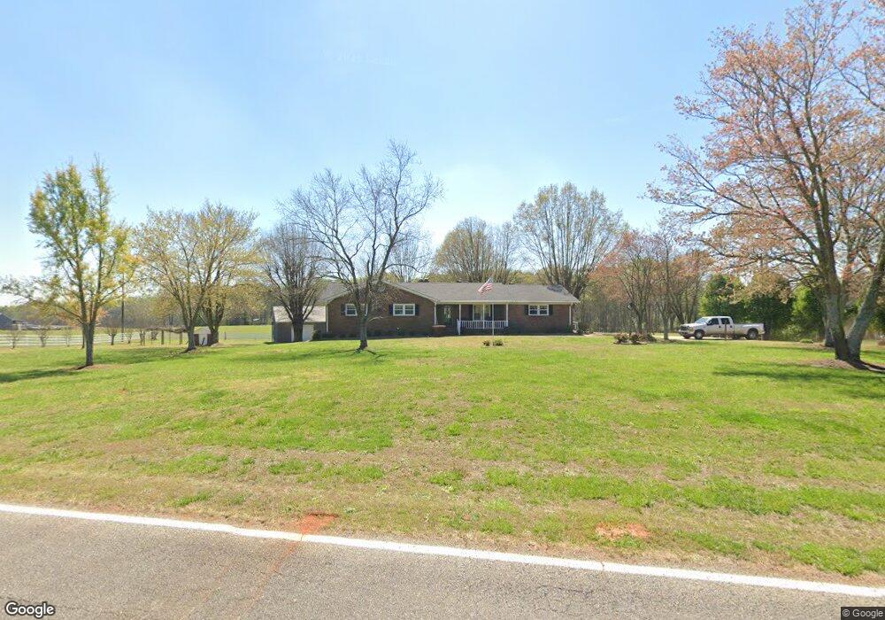
20 Miller McElreath Rd Danielsville, GA 30633
Estimated Value: $237,904 - $509,000
--
Bed
2
Baths
1,813
Sq Ft
$193/Sq Ft
Est. Value
About This Home
This home is located at 20 Miller McElreath Rd, Danielsville, GA 30633 and is currently estimated at $349,476, approximately $192 per square foot. 20 Miller McElreath Rd is a home located in Madison County with nearby schools including Madison County High School.
Ownership History
Date
Name
Owned For
Owner Type
Purchase Details
Closed on
Mar 5, 2025
Sold by
Miller Robert V
Bought by
Miller Robert V and Miller Linda P
Current Estimated Value
Purchase Details
Closed on
Jan 1, 1974
Bought by
Miller Robert V
Create a Home Valuation Report for This Property
The Home Valuation Report is an in-depth analysis detailing your home's value as well as a comparison with similar homes in the area
Home Values in the Area
Average Home Value in this Area
Purchase History
| Date | Buyer | Sale Price | Title Company |
|---|---|---|---|
| Miller Robert V | -- | -- | |
| Miller Linda P | -- | -- | |
| Miller Robert V | -- | -- |
Source: Public Records
Tax History Compared to Growth
Tax History
| Year | Tax Paid | Tax Assessment Tax Assessment Total Assessment is a certain percentage of the fair market value that is determined by local assessors to be the total taxable value of land and additions on the property. | Land | Improvement |
|---|---|---|---|---|
| 2024 | $1,358 | $70,161 | $6,058 | $64,103 |
| 2023 | $2,142 | $70,161 | $6,058 | $64,103 |
| 2022 | $1,173 | $72,027 | $8,187 | $63,840 |
| 2021 | $1,224 | $58,100 | $8,187 | $49,913 |
| 2020 | $1,442 | $56,909 | $6,996 | $49,913 |
| 2019 | $1,233 | $54,802 | $5,954 | $48,848 |
| 2018 | $1,236 | $54,802 | $5,954 | $48,848 |
| 2017 | $1,578 | $54,802 | $5,954 | $48,848 |
| 2016 | $1,167 | $47,102 | $5,173 | $41,929 |
| 2015 | $1,167 | $47,102 | $5,173 | $41,929 |
| 2014 | $1,145 | $46,593 | $5,656 | $40,937 |
| 2013 | -- | $46,568 | $5,656 | $40,912 |
Source: Public Records
Map
Nearby Homes
- 0 Highway 29 N Unit 10525658
- 84 Woodpecker Point
- 135 Woodpecker Point
- 4274 Highway 98 W
- 135 Woodpecker Pte
- 0 Cedar Ln Unit 1026097
- 0 Cedar Ln Unit 10530523
- 107 Hill Lake Rd
- 15 Pine St
- 0 New Haven Church Rd Unit CL334534
- 0 New Haven Church Rd Unit 10566118
- 0 New Haven Church Rd Unit CL334526
- 0 New Haven Church Rd Unit 10566119
- 287 Pine St
- 28 Acres Irvin Kirk Rd
- 0 Brewer Phillips Rd Unit 10462348
- 0 Carey-Ford Rd
- 1885 Highway 29 N
- 125 Rock St
- 0 Kirk Langford Rd Unit 7671084
- 0 Miller McClreath Rd
- 00 Miller McClreath Rd
- 0 Miller McElreath Rd Unit LOT 1B 3174187
- 0 Miller McElreath Rd Unit LOT 1B 7277041
- 0 Miller McElreath Rd Unit 3152941
- 0 Miller McElreath Rd Unit 7100464
- 1 Miller McElreath Rd Unit B
- 128 Miller McElreath Rd
- 2810 Macedonia Church Rd
- 2530 Macedonia Church Rd
- 264 Miller McElreath Rd
- 3020 Macedonia Church Rd
- 3136 Macedonia Church Rd
- 0 Tabor Church Rd Unit 9076107
- 1144 Friendship Church Rd
- 980 Friendship Church Rd
- 388 Miller McElreath Rd
- 388 Miller McClreath Rd
- 264 Sandy Creek Rd
- 386 Sandy Creek Rd