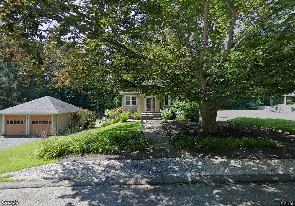
20 Mitchell St Wayland, MA 01778
Estimated Value: $947,000 - $1,058,000
3
Beds
3
Baths
2,203
Sq Ft
$448/Sq Ft
Est. Value
About This Home
This home is located at 20 Mitchell St, Wayland, MA 01778 and is currently estimated at $985,921, approximately $447 per square foot. 20 Mitchell St is a home located in Middlesex County with nearby schools including Wayland High School and Veritas Christian Academy.
Ownership History
Date
Name
Owned For
Owner Type
Purchase Details
Closed on
Jun 30, 2005
Sold by
Harrod Nancy K
Bought by
Getz Ellen W M and Getz Geoffrey W
Current Estimated Value
Purchase Details
Closed on
Sep 5, 1989
Sold by
Zaltas Arnold I
Bought by
Corey Thomas C
Create a Home Valuation Report for This Property
The Home Valuation Report is an in-depth analysis detailing your home's value as well as a comparison with similar homes in the area
Home Values in the Area
Average Home Value in this Area
Purchase History
| Date | Buyer | Sale Price | Title Company |
|---|---|---|---|
| Getz Ellen W M | $568,645 | -- | |
| Getz Ellen W M | $568,645 | -- | |
| Corey Thomas C | $237,500 | -- |
Source: Public Records
Mortgage History
| Date | Status | Borrower | Loan Amount |
|---|---|---|---|
| Open | Corey Thomas C | $290,000 | |
| Closed | Corey Thomas C | $290,000 | |
| Closed | Corey Thomas C | $337,000 |
Source: Public Records
Tax History Compared to Growth
Tax History
| Year | Tax Paid | Tax Assessment Tax Assessment Total Assessment is a certain percentage of the fair market value that is determined by local assessors to be the total taxable value of land and additions on the property. | Land | Improvement |
|---|---|---|---|---|
| 2025 | $13,904 | $889,600 | $489,300 | $400,300 |
| 2024 | $13,178 | $849,100 | $466,000 | $383,100 |
| 2023 | $12,606 | $757,100 | $423,600 | $333,500 |
| 2022 | $12,417 | $676,700 | $350,900 | $325,800 |
| 2021 | $11,905 | $642,800 | $318,900 | $323,900 |
| 2020 | $11,247 | $633,300 | $318,900 | $314,400 |
| 2019 | $11,341 | $620,400 | $303,800 | $316,600 |
| 2018 | $10,331 | $573,000 | $303,800 | $269,200 |
| 2017 | $9,877 | $544,500 | $289,200 | $255,300 |
| 2016 | $9,279 | $535,100 | $283,500 | $251,600 |
| 2015 | $9,565 | $520,100 | $283,500 | $236,600 |
Source: Public Records
Map
Nearby Homes
- 177 Main St
- 3 Keith Rd
- 62 E Plain St
- 37 Pemberton Rd
- 15 Crest Rd
- 233 Lakeshore Dr
- 123 Dudley Rd
- 26 Dudley Rd
- 108 Dudley Rd
- 9 French Ave
- 15 Parkridge Rd
- 96 Lake Shore Dr
- 96 Lakeshore Dr
- 22 Lakeshore Dr
- 5 Forest Ln
- 454 Old Connecticut Path
- 260 Cochituate Rd
- 35 Snake Brook Rd
- 37 Pequot Rd
- 14 Ferndale Rd
- 24 Mitchell St
- 21 King St
- 26 Mitchell St
- 15 Mitchell St
- 25 Mitchell St
- 13 Mitchell St
- 10 Mitchell St
- 3 Barber Way
- 69 W Plain St
- 1 Barber Way
- 20 King St
- 9 Mitchell St
- 16 King St Unit B
- 16 King St Unit A
- 16 King St
- 65 W Plain St
- 65 W Plain St Unit 2
- 65 W Plain St Unit 1
- 65 W Plain St Unit 65
- 13 King St