Estimated Value: $584,539 - $642,000
3
Beds
2
Baths
1,204
Sq Ft
$510/Sq Ft
Est. Value
About This Home
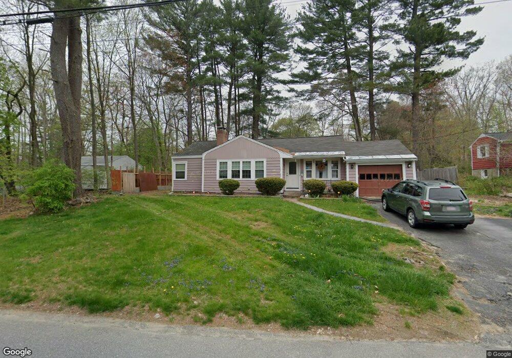
This home is located at 20 Mohawk Dr, Acton, MA 01720 and is currently estimated at $614,135, approximately $510 per square foot. 20 Mohawk Dr is a home located in Middlesex County with nearby schools including Acton-Boxborough Regional High School.
Ownership History
Date
Name
Owned For
Owner Type
Purchase Details
Closed on
May 26, 2011
Sold by
Boyer Douglas C
Bought by
Szewczyk Rosemary
Current Estimated Value
Home Financials for this Owner
Home Financials are based on the most recent Mortgage that was taken out on this home.
Original Mortgage
$56,105
Outstanding Balance
$39,236
Interest Rate
4.94%
Mortgage Type
Purchase Money Mortgage
Estimated Equity
$574,899
Purchase Details
Closed on
Feb 18, 1986
Bought by
Szewczyk Rosemary
Create a Home Valuation Report for This Property
The Home Valuation Report is an in-depth analysis detailing your home's value as well as a comparison with similar homes in the area
Home Values in the Area
Average Home Value in this Area
Purchase History
| Date | Buyer | Sale Price | Title Company |
|---|---|---|---|
| Szewczyk Rosemary | -- | -- | |
| Szewczyk Rosemary | $142,500 | -- |
Source: Public Records
Mortgage History
| Date | Status | Borrower | Loan Amount |
|---|---|---|---|
| Open | Szewczyk Rosemary | $56,105 | |
| Closed | Szewczyk Rosemary | $25,000 | |
| Previous Owner | Szewczyk Rosemary | $73,900 |
Source: Public Records
Tax History
| Year | Tax Paid | Tax Assessment Tax Assessment Total Assessment is a certain percentage of the fair market value that is determined by local assessors to be the total taxable value of land and additions on the property. | Land | Improvement |
|---|---|---|---|---|
| 2025 | $8,966 | $522,800 | $314,300 | $208,500 |
| 2024 | $8,685 | $521,000 | $314,300 | $206,700 |
| 2023 | $8,295 | $472,400 | $285,700 | $186,700 |
| 2022 | $8,202 | $421,700 | $248,400 | $173,300 |
| 2021 | $7,843 | $387,700 | $230,000 | $157,700 |
| 2020 | $7,375 | $383,300 | $230,000 | $153,300 |
| 2019 | $7,016 | $362,200 | $230,000 | $132,200 |
| 2018 | $6,773 | $349,500 | $230,000 | $119,500 |
| 2017 | $6,661 | $349,500 | $230,000 | $119,500 |
| 2016 | $6,373 | $331,400 | $230,000 | $101,400 |
| 2015 | $6,586 | $345,700 | $230,000 | $115,700 |
| 2014 | $6,625 | $340,600 | $230,000 | $110,600 |
Source: Public Records
Map
Nearby Homes
- 4 Littlefield Rd
- 5 Perkins Ln
- 235 Arlington St
- 631 Massachusetts Ave Unit 631
- 20 Joseph Reed Ln
- 134 Russet Ln Unit 134
- 79 Charter Rd
- 92 Willow St Unit 3
- 92 Willow St Unit 2
- 90 Willow St Unit 1
- 96 Newtown Rd
- 7 Kelley Rd
- 18 Hayward Rd
- 4 Omega Way
- 11 Braebrook
- 184 Main St Unit 3
- 8 Highland Rd
- 18 Woodchester Dr
- 6 Beacon Ct
- 46 Taylor Rd
Your Personal Tour Guide
Ask me questions while you tour the home.