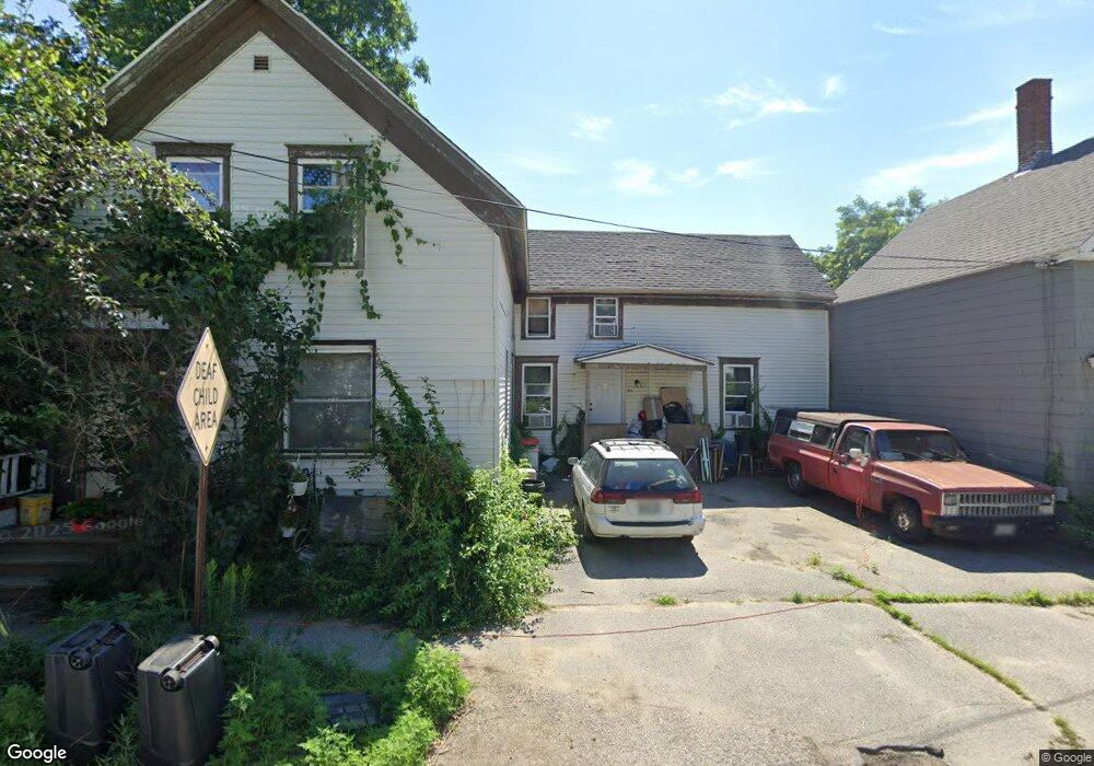
20 Myrtle St Auburn, ME 04210
Estimated Value: $281,000 - $329,000
Studio
2
Baths
2,172
Sq Ft
$139/Sq Ft
Est. Value
About This Home
This home is located at 20 Myrtle St, Auburn, ME 04210 and is currently estimated at $302,000, approximately $139 per square foot. 20 Myrtle St is a home located in Androscoggin County with nearby schools including Sherwood Heights Elementary School, Auburn Middle School, and Edward Little High School.
Ownership History
Date
Name
Owned For
Owner Type
Purchase Details
Closed on
Aug 31, 2005
Sold by
Hill Dorothy M and Hill Michael
Bought by
Farrington Alyson R
Current Estimated Value
Home Financials for this Owner
Home Financials are based on the most recent Mortgage that was taken out on this home.
Original Mortgage
$105,000
Outstanding Balance
$59,139
Interest Rate
6.7%
Mortgage Type
Adjustable Rate Mortgage/ARM
Estimated Equity
$242,861
Create a Home Valuation Report for This Property
The Home Valuation Report is an in-depth analysis detailing your home's value as well as a comparison with similar homes in the area
Home Values in the Area
Average Home Value in this Area
Purchase History
| Date | Buyer | Sale Price | Title Company |
|---|---|---|---|
| Farrington Alyson R | -- | -- |
Source: Public Records
Mortgage History
| Date | Status | Borrower | Loan Amount |
|---|---|---|---|
| Open | Farrington Alyson R | $105,000 |
Source: Public Records
Tax History
| Year | Tax Paid | Tax Assessment Tax Assessment Total Assessment is a certain percentage of the fair market value that is determined by local assessors to be the total taxable value of land and additions on the property. | Land | Improvement |
|---|---|---|---|---|
| 2024 | $2,895 | $130,100 | $13,700 | $116,400 |
| 2023 | $2,632 | $115,700 | $12,200 | $103,500 |
| 2022 | $2,193 | $96,400 | $10,100 | $86,300 |
| 2021 | $2,296 | $96,400 | $10,100 | $86,300 |
| 2020 | $2,228 | $93,800 | $10,100 | $83,700 |
| 2019 | $2,228 | $93,800 | $10,100 | $83,700 |
| 2018 | $2,221 | $93,800 | $10,100 | $83,700 |
| 2017 | $2,156 | $93,800 | $10,100 | $83,700 |
| 2016 | $2,096 | $93,800 | $10,100 | $83,700 |
| 2015 | $1,993 | $93,800 | $10,100 | $83,700 |
| 2013 | $1,914 | $93,700 | $10,100 | $83,600 |
Source: Public Records
Map
Nearby Homes