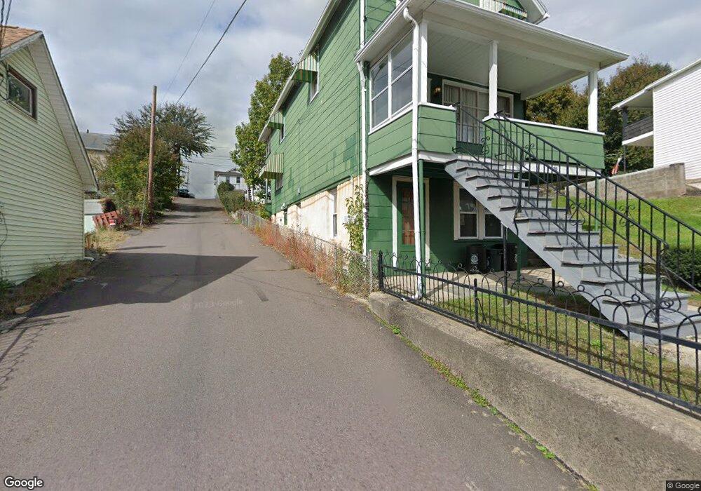
20 N Empire St Wilkes Barre, PA 18702
Estimated Value: $93,369 - $141,000
4
Beds
2
Baths
1,509
Sq Ft
$82/Sq Ft
Est. Value
About This Home
This home is located at 20 N Empire St, Wilkes Barre, PA 18702 and is currently estimated at $123,842, approximately $82 per square foot. 20 N Empire St is a home located in Luzerne County with nearby schools including Heights Murray Elementary School, Cradock Middle School, and Solomon/Plains Junior High School.
Ownership History
Date
Name
Owned For
Owner Type
Purchase Details
Closed on
Sep 24, 2021
Sold by
Makuch Paul S and Makuch Paul S
Bought by
Lee Sandra
Current Estimated Value
Home Financials for this Owner
Home Financials are based on the most recent Mortgage that was taken out on this home.
Original Mortgage
$74,623
Outstanding Balance
$68,049
Interest Rate
2.8%
Mortgage Type
FHA
Estimated Equity
$55,793
Purchase Details
Closed on
Dec 15, 1992
Bought by
Makuch Paul S
Create a Home Valuation Report for This Property
The Home Valuation Report is an in-depth analysis detailing your home's value as well as a comparison with similar homes in the area
Home Values in the Area
Average Home Value in this Area
Purchase History
| Date | Buyer | Sale Price | Title Company |
|---|---|---|---|
| Lee Sandra | $76,000 | None Available | |
| Makuch Paul S | -- | -- |
Source: Public Records
Mortgage History
| Date | Status | Borrower | Loan Amount |
|---|---|---|---|
| Open | Lee Sandra | $74,623 |
Source: Public Records
Tax History Compared to Growth
Tax History
| Year | Tax Paid | Tax Assessment Tax Assessment Total Assessment is a certain percentage of the fair market value that is determined by local assessors to be the total taxable value of land and additions on the property. | Land | Improvement |
|---|---|---|---|---|
| 2025 | $7,558 | $45,500 | $13,000 | $32,500 |
| 2024 | $7,558 | $45,500 | $13,000 | $32,500 |
| 2023 | $7,558 | $45,500 | $13,000 | $32,500 |
| 2022 | $7,550 | $45,500 | $13,000 | $32,500 |
| 2021 | $7,550 | $45,500 | $13,000 | $32,500 |
| 2020 | $7,550 | $45,500 | $13,000 | $32,500 |
| 2019 | $7,523 | $45,500 | $13,000 | $32,500 |
| 2018 | $7,496 | $45,500 | $13,000 | $32,500 |
| 2017 | $7,469 | $45,500 | $13,000 | $32,500 |
| 2016 | -- | $45,500 | $13,000 | $32,500 |
| 2015 | -- | $45,500 | $13,000 | $32,500 |
| 2014 | -- | $45,500 | $13,000 | $32,500 |
Source: Public Records
Map
Nearby Homes
- 87-89 Custer St
- 30 Custer St
- 17 N Meade St
- 113 N Meade St
- 110 N Fulton St
- 94 Hillside St
- 58 N Sherman St
- 68 S Meade St
- 78 N Grant St
- 117 S Sherman St
- 187 Rees St
- 51-53 S Welles St
- 228 S Hancock St
- 737 E Northampton St
- 299 Lehigh St
- 171 Scott St
- 273 S Grant St
- 59 Bowman St
- 357 S Meade St
- 368 S Meade St
- 16 N Empire St
- 26 N Empire St
- 1 Reno Ln
- 28 N Empire St
- 454 New Market St
- 15 N Empire St
- 452 New Market St
- 30 N Empire St
- 456 New Market St
- 450 New Market St
- 448 New Market St
- 32 N Empire St
- 464 New Market St
- 446 New Market St
- 21 N Empire St
- 468 New Market St
- 47 Dock Ln
- 8 Reno Ln
- 444 New Market St
- 38 N Empire St