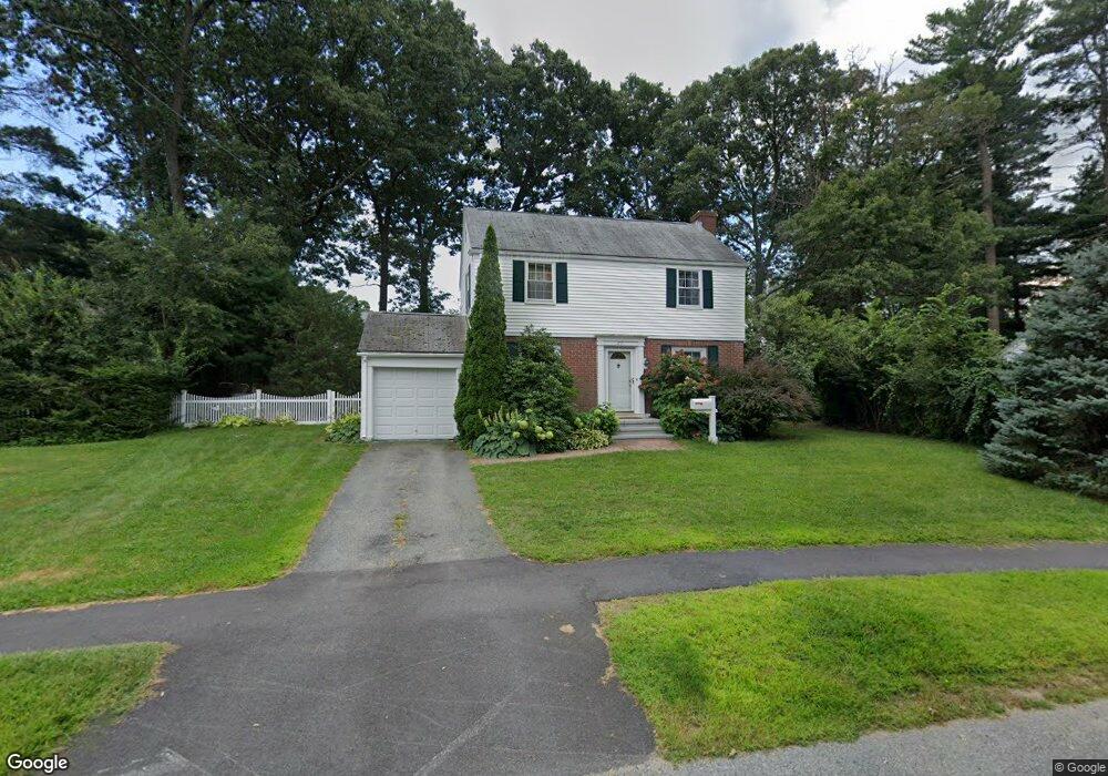
20 Nottingham Dr Natick, MA 01760
Estimated Value: $841,305 - $938,000
3
Beds
3
Baths
1,218
Sq Ft
$742/Sq Ft
Est. Value
About This Home
This home is located at 20 Nottingham Dr, Natick, MA 01760 and is currently estimated at $903,326, approximately $741 per square foot. 20 Nottingham Dr is a home located in Middlesex County with nearby schools including Natick High School, Brown Elementary School, and J F Kennedy Middle School.
Ownership History
Date
Name
Owned For
Owner Type
Purchase Details
Closed on
Mar 12, 2025
Sold by
Latawiec Ft and Latawiec
Bought by
The Latawiec Ft and Latawiec
Current Estimated Value
Purchase Details
Closed on
Sep 16, 1998
Sold by
Mcmanus Paul J and Ryan Elizabeth A
Bought by
Latawiec Andrzej and Latawiec Marzenna
Home Financials for this Owner
Home Financials are based on the most recent Mortgage that was taken out on this home.
Original Mortgage
$179,200
Interest Rate
6.9%
Mortgage Type
Purchase Money Mortgage
Purchase Details
Closed on
Aug 20, 1993
Sold by
Speed Stuart W
Bought by
Mcmanus Paul J and Ryan Elizabeth A
Home Financials for this Owner
Home Financials are based on the most recent Mortgage that was taken out on this home.
Original Mortgage
$161,500
Interest Rate
7.11%
Mortgage Type
Purchase Money Mortgage
Create a Home Valuation Report for This Property
The Home Valuation Report is an in-depth analysis detailing your home's value as well as a comparison with similar homes in the area
Home Values in the Area
Average Home Value in this Area
Purchase History
| Date | Buyer | Sale Price | Title Company |
|---|---|---|---|
| The Latawiec Ft | -- | None Available | |
| Latawiec Andrzej | $224,000 | -- | |
| Mcmanus Paul J | $170,000 | -- | |
| Mcmanus Paul J | $170,000 | -- |
Source: Public Records
Mortgage History
| Date | Status | Borrower | Loan Amount |
|---|---|---|---|
| Previous Owner | Mcmanus Paul J | $100,000 | |
| Previous Owner | Mcmanus Paul J | $179,200 | |
| Previous Owner | Mcmanus Paul J | $161,500 | |
| Previous Owner | Mcmanus Paul J | $20,000 |
Source: Public Records
Tax History
| Year | Tax Paid | Tax Assessment Tax Assessment Total Assessment is a certain percentage of the fair market value that is determined by local assessors to be the total taxable value of land and additions on the property. | Land | Improvement |
|---|---|---|---|---|
| 2025 | $8,848 | $739,800 | $477,200 | $262,600 |
| 2024 | $8,548 | $697,200 | $452,000 | $245,200 |
| 2023 | $8,399 | $664,500 | $421,700 | $242,800 |
| 2022 | $8,064 | $604,500 | $381,400 | $223,100 |
| 2021 | $2,774 | $570,400 | $361,300 | $209,100 |
| 2020 | $24,138 | $555,400 | $346,300 | $209,100 |
| 2019 | $2,624 | $555,400 | $346,300 | $209,100 |
| 2018 | $6,558 | $502,500 | $301,100 | $201,400 |
| 2017 | $2,593 | $453,900 | $256,400 | $197,500 |
| 2016 | $5,851 | $431,200 | $235,400 | $195,800 |
| 2015 | $5,735 | $415,000 | $235,400 | $179,600 |
Source: Public Records
Map
Nearby Homes
- 21 Kelsey Rd
- 40 Nouvelle Way Unit 441
- 15 Edwards Rd
- 8 Edwards Road Aka 12
- 54 Pilgrim Rd
- 293 Bacon St Unit A
- 27 2nd St
- 3 Oxbow Rd
- 7 Jackson Ct Unit B
- 26 Wellesley Ave Unit B
- 10 Nolin St
- 8 Village Way Unit 11
- 15 Village Way Unit 8
- 3 Silver Hill Ln Unit 6
- 132 Howe St Unit B
- 46 Silver Hill Ln Unit 1
- 79 Speen St
- 56 Morency St Unit D
- 56 Greenleaf Cir
- 1 Post Oak Ln Unit 19
- 22 Nottingham Dr
- 18 Nottingham Dr
- 13 Sherwood Rd
- 11 Sherwood Rd
- 15 Sherwood Rd
- 19 Nottingham Dr
- 24 Nottingham Dr
- 16 Nottingham Dr
- 4 Barnesdale Rd
- 9 Sherwood Rd
- 17 Nottingham Dr
- 21 Nottingham Dr
- 17 Sherwood Rd
- 40 Hartford St
- 6 Barnesdale Rd
- 14 Nottingham Dr
- 15 Nottingham Dr
- 7 Sherwood Rd
- 18 Sherwood Rd
- 42 Hartford St
Your Personal Tour Guide
Ask me questions while you tour the home.