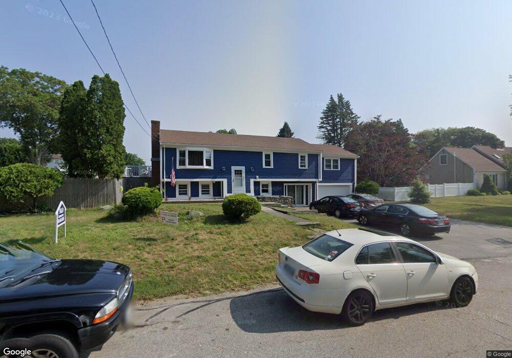
20 Oakdale Ave Portsmouth, RI 02871
Common Fence Point NeighborhoodEstimated Value: $546,000 - $873,000
4
Beds
2
Baths
2,284
Sq Ft
$303/Sq Ft
Est. Value
About This Home
This home is located at 20 Oakdale Ave, Portsmouth, RI 02871 and is currently estimated at $692,754, approximately $303 per square foot. 20 Oakdale Ave is a home located in Newport County with nearby schools including Portsmouth High School.
Ownership History
Date
Name
Owned For
Owner Type
Purchase Details
Closed on
Jan 22, 2023
Sold by
Hamilton Michael W and Hamilton Tracy L
Bought by
Horley Brian A and Horley Courtney A
Current Estimated Value
Purchase Details
Closed on
Jul 2, 2002
Sold by
Konchar Daniel S and Konchar Cynthia
Bought by
Hamilton Michael W and Hamilton Tracey
Purchase Details
Closed on
Aug 19, 1988
Sold by
Kelley William
Bought by
Konchar Daniel
Create a Home Valuation Report for This Property
The Home Valuation Report is an in-depth analysis detailing your home's value as well as a comparison with similar homes in the area
Home Values in the Area
Average Home Value in this Area
Purchase History
| Date | Buyer | Sale Price | Title Company |
|---|---|---|---|
| Horley Brian A | -- | None Available | |
| Hamilton Michael W | $265,000 | -- | |
| Konchar Daniel | $205,000 | -- |
Source: Public Records
Mortgage History
| Date | Status | Borrower | Loan Amount |
|---|---|---|---|
| Previous Owner | Konchar Daniel | $15,000 | |
| Previous Owner | Konchar Daniel | $25,000 | |
| Previous Owner | Konchar Daniel | $50,000 | |
| Previous Owner | Konchar Daniel | $185,000 |
Source: Public Records
Tax History Compared to Growth
Tax History
| Year | Tax Paid | Tax Assessment Tax Assessment Total Assessment is a certain percentage of the fair market value that is determined by local assessors to be the total taxable value of land and additions on the property. | Land | Improvement |
|---|---|---|---|---|
| 2025 | $5,785 | $435,600 | $178,700 | $256,900 |
| 2024 | $5,741 | $435,600 | $178,700 | $256,900 |
| 2023 | $5,567 | $435,600 | $178,700 | $256,900 |
| 2022 | $5,479 | $352,100 | $144,700 | $207,400 |
| 2021 | $5,391 | $352,100 | $144,700 | $207,400 |
| 2020 | $5,306 | $352,100 | $144,700 | $207,400 |
| 2019 | $5,140 | $313,400 | $108,300 | $205,100 |
| 2018 | $5,005 | $313,400 | $108,300 | $205,100 |
| 2017 | $4,833 | $313,400 | $108,300 | $205,100 |
| 2016 | $4,422 | $276,400 | $100,500 | $175,900 |
| 2015 | $4,367 | $276,400 | $100,500 | $175,900 |
| 2014 | $4,367 | $276,400 | $100,500 | $175,900 |
Source: Public Records
Map
Nearby Homes
- 0 Common Fence Blvd Unit 1364650
- 0 Common Fence Blvd Unit 1397142
- 10 Mount Hope Ave
- 169 Narragansett Blvd
- 134 Greenfield Ave
- 72 Rhode Island Blvd
- 0 Island Rd
- 1055 Anthony Rd
- 0 Dighton Ave
- 8 Tucker Ave
- 1350 Anthony Rd
- 42 Lewis St
- 50 Stevens St
- 83 Waters Edge Unit 24
- 87 Waters Edge
- 9 Cutter Ln
- 1660 Main Rd
- 47 Watermark Dr
- 171 Leeshore Ln
- 15 Rocky Ave
- 16 Oakdale Ave
- 12 Oakdale Ave
- 225 Rhode Island Blvd
- 219 Rhode Island Blvd
- 231 Rhode Island Blvd
- 215 Rhode Island Blvd
- 875 Anthony Rd
- 235 Rhode Island Blvd
- 887 Anthony Rd
- 30 Oakdale Ave
- 241 Rhode Island Blvd
- 247 Rhode Island Blvd
- 855 Anthony Rd
- 903 Anthony Rd
- 218 Rhode Island Blvd
- 224 Rhode Island Blvd
- 230 Rhode Island Blvd
- 40 Oakdale Ave
- 251 Rhode Island Blvd
- 244 Rhode Island Blvd