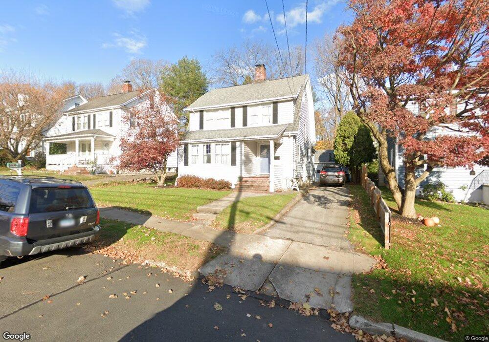
20 Olmstead Place Norwalk, CT 06855
East Norwalk NeighborhoodEstimated Value: $632,000 - $722,000
3
Beds
2
Baths
1,557
Sq Ft
$440/Sq Ft
Est. Value
About This Home
This home is located at 20 Olmstead Place, Norwalk, CT 06855 and is currently estimated at $685,850, approximately $440 per square foot. 20 Olmstead Place is a home located in Fairfield County with nearby schools including Marvin Elementary School, Nathan Hale Middle School, and Norwalk High School.
Ownership History
Date
Name
Owned For
Owner Type
Purchase Details
Closed on
Jan 14, 2003
Sold by
Ranieri James R and Ranieri Yvonne S
Bought by
Mould Cheryl and Ward James
Current Estimated Value
Home Financials for this Owner
Home Financials are based on the most recent Mortgage that was taken out on this home.
Original Mortgage
$286,000
Interest Rate
6.19%
Purchase Details
Closed on
Oct 1, 1993
Sold by
Lillis Richard and Lillis Maureen
Bought by
Ranieri James
Create a Home Valuation Report for This Property
The Home Valuation Report is an in-depth analysis detailing your home's value as well as a comparison with similar homes in the area
Home Values in the Area
Average Home Value in this Area
Purchase History
| Date | Buyer | Sale Price | Title Company |
|---|---|---|---|
| Mould Cheryl | $357,500 | -- | |
| Mould Cheryl | $357,500 | -- | |
| Ranieri James | $185,000 | -- | |
| Ranieri James | $185,000 | -- |
Source: Public Records
Mortgage History
| Date | Status | Borrower | Loan Amount |
|---|---|---|---|
| Open | Ranieri James | $248,000 | |
| Closed | Ranieri James | $65,000 | |
| Closed | Ranieri James | $286,000 |
Source: Public Records
Tax History
| Year | Tax Paid | Tax Assessment Tax Assessment Total Assessment is a certain percentage of the fair market value that is determined by local assessors to be the total taxable value of land and additions on the property. | Land | Improvement |
|---|---|---|---|---|
| 2025 | $9,233 | $385,570 | $160,040 | $225,530 |
| 2024 | $9,096 | $385,570 | $160,040 | $225,530 |
| 2023 | $7,323 | $291,029 | $120,416 | $170,613 |
| 2022 | $7,186 | $291,029 | $120,416 | $170,613 |
| 2021 | $6,999 | $291,029 | $120,416 | $170,613 |
| 2020 | $9,520 | $291,029 | $120,416 | $170,613 |
| 2019 | $6,800 | $291,029 | $120,416 | $170,613 |
| 2018 | $6,411 | $240,450 | $105,340 | $135,110 |
| 2017 | $7,994 | $240,450 | $105,340 | $135,110 |
| 2016 | $6,131 | $240,450 | $105,340 | $135,110 |
| 2015 | $6,115 | $240,450 | $105,340 | $135,110 |
| 2014 | $6,035 | $240,450 | $105,340 | $135,110 |
Source: Public Records
Map
Nearby Homes
- 189 East Ave
- 33 Myrtle St
- 20 Eversley Ave
- 144 East Ave Unit B404
- 142 East Ave Unit A305
- 107 Strawberry Hill Ave
- 136 East Ave Unit 4C
- 71A Osborne Ave Unit A4
- 23 Macintosh Rd
- 16 Sunset Hill Ave
- 18 Cloverly Cir
- 17 Pleasant St
- 47 Lockwood Ln
- 19 Lyncrest Dr
- 30 Merwin St Unit 6
- 30 Merwin St Unit 1
- 30 Merwin St Unit 5
- 1 Howard Ave Unit C4
- 281 East Ave
- 4 van Zant St Unit A2
- 22 Olmstead Place
- 18 Olmstead Place
- 3 Knickerbocker Ave
- 24 Olmstead Place
- 16 Olmstead Place
- 14 Olmstead Place
- 19 Olmstead Place
- 17 Olmstead Place
- 21 Olmstead Place
- 5 Knickerbocker Ave
- 15 Olmstead Place
- 23 Olmstead Place
- 1 Knickerbocker Ave
- 12 Olmstead Place
- 13 Olmstead Place
- 25 Olmstead Place
- 26 Knickerbocker Ave
- 10 Olmstead Place
- 27 Olmstead Place
- 11 Olmstead Place
Your Personal Tour Guide
Ask me questions while you tour the home.