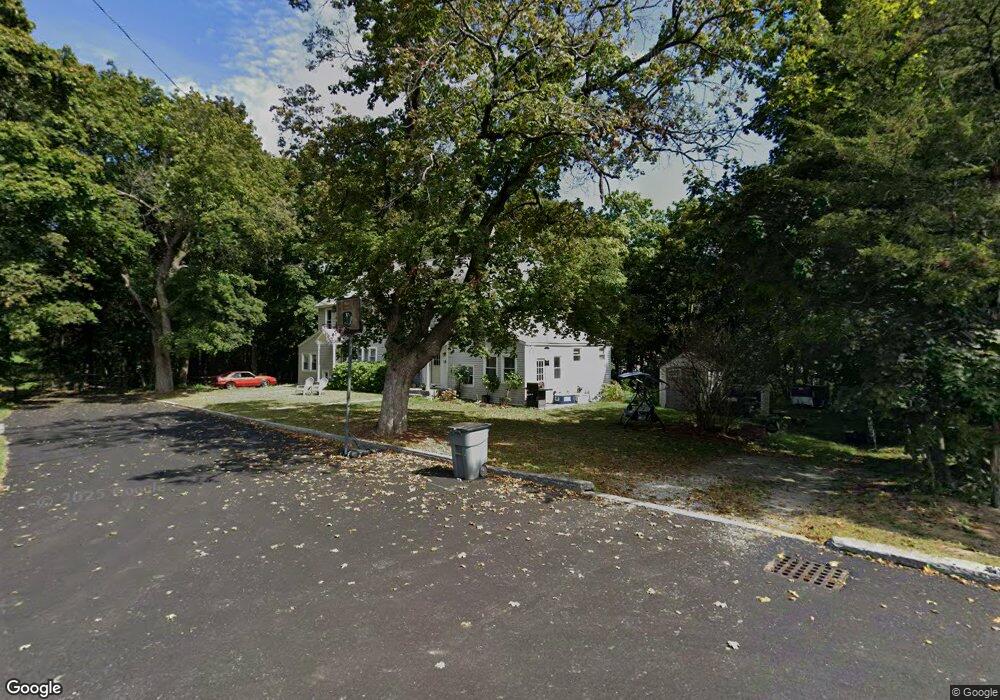
20 Pershing St Westford, MA 01886
Estimated Value: $620,000 - $775,000
6
Beds
2
Baths
2,760
Sq Ft
$257/Sq Ft
Est. Value
About This Home
This home is located at 20 Pershing St, Westford, MA 01886 and is currently estimated at $709,533, approximately $257 per square foot. 20 Pershing St is a home located in Middlesex County with nearby schools including Rita E. Miller Elementary School, Day Elementary School, and Blanchard Middle School.
Ownership History
Date
Name
Owned For
Owner Type
Purchase Details
Closed on
Jun 24, 2016
Sold by
Greenslade Brandon E and Greenslade Kimberly E
Bought by
Veligor Elizabeth and Greenslade Kenneth R
Current Estimated Value
Home Financials for this Owner
Home Financials are based on the most recent Mortgage that was taken out on this home.
Original Mortgage
$175,000
Outstanding Balance
$139,281
Interest Rate
3.57%
Mortgage Type
Unknown
Estimated Equity
$570,252
Purchase Details
Closed on
Jun 30, 2014
Sold by
Greenslade Brandon E and Greenslade Kimberly E
Bought by
Greenslade Brandon E and Greenslade Elizabeth
Purchase Details
Closed on
Sep 6, 2001
Sold by
Greenslade Debra J
Bought by
Greenslade Brandon E
Home Financials for this Owner
Home Financials are based on the most recent Mortgage that was taken out on this home.
Original Mortgage
$197,400
Interest Rate
7.05%
Mortgage Type
Purchase Money Mortgage
Create a Home Valuation Report for This Property
The Home Valuation Report is an in-depth analysis detailing your home's value as well as a comparison with similar homes in the area
Home Values in the Area
Average Home Value in this Area
Purchase History
| Date | Buyer | Sale Price | Title Company |
|---|---|---|---|
| Veligor Elizabeth | -- | -- | |
| Greenslade Brandon E | -- | -- | |
| Greenslade Brandon E | $282,000 | -- |
Source: Public Records
Mortgage History
| Date | Status | Borrower | Loan Amount |
|---|---|---|---|
| Open | Veligor Elizabeth | $175,000 | |
| Previous Owner | Greenslade Brandon E | $197,400 |
Source: Public Records
Tax History Compared to Growth
Tax History
| Year | Tax Paid | Tax Assessment Tax Assessment Total Assessment is a certain percentage of the fair market value that is determined by local assessors to be the total taxable value of land and additions on the property. | Land | Improvement |
|---|---|---|---|---|
| 2025 | $7,736 | $574,300 | $296,200 | $278,100 |
| 2024 | $7,532 | $547,000 | $282,100 | $264,900 |
| 2023 | $7,318 | $495,800 | $236,500 | $259,300 |
| 2022 | $7,702 | $477,800 | $201,000 | $276,800 |
| 2021 | $7,380 | $443,500 | $201,000 | $242,500 |
| 2020 | $7,242 | $443,500 | $201,000 | $242,500 |
| 2019 | $6,745 | $407,300 | $192,700 | $214,600 |
| 2018 | $6,391 | $395,000 | $184,300 | $210,700 |
| 2017 | $6,152 | $374,900 | $184,300 | $190,600 |
| 2016 | $6,111 | $374,900 | $184,300 | $190,600 |
| 2015 | $6,077 | $374,200 | $184,300 | $189,900 |
| 2014 | $5,626 | $338,900 | $177,000 | $161,900 |
Source: Public Records
Map
Nearby Homes
- 9 Elm St
- 16 Abbot St
- 66 Patten Rd
- 8 Sandy Beach Rd
- 12 Brookfield Dr Unit A
- 34 West St
- 66 N Main St Unit 66
- 64 N Main St Unit 64
- 3 Hillside Ave
- 222 Forge Village Rd
- Lot 6 Noble Path
- Lot 7 Noble Path
- 12 Patten Rd
- 19-21 Broadway St
- 11 River St
- 26 Bayberry Rd
- 7 Mill Park Place
- 6 Little Hollow Ln
- 28 Graniteville Rd
- 1 Woodridge Ln
- 14 Pershing St
- 16 Pershing St Unit 16
- 2 Smith St
- 2 Smith St Unit 2
- 2 Smith St Unit 1---2
- 4 Smith St Unit 4
- 4 Smith St
- 4 Smith St Unit 1
- 7 Pershing St
- 38 E Prescott St
- 12 Pershing St
- 36 E Prescott St
- 5 Pershing St
- 40 E Prescott St
- 34 E Prescott St
- 3 Pershing St
- 8 Pershing St
- 22 Town Farm Rd
- 42 E Prescott St
- 32 E Prescott St