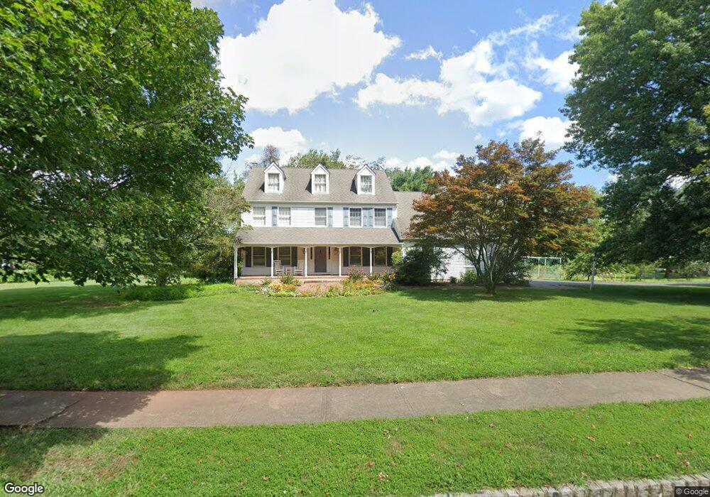
20 Pheasant Run Dr Skillman, NJ 08558
Estimated Value: $974,177 - $1,232,000
4
Beds
3
Baths
3,066
Sq Ft
$364/Sq Ft
Est. Value
About This Home
This home is located at 20 Pheasant Run Dr, Skillman, NJ 08558 and is currently estimated at $1,114,794, approximately $363 per square foot. 20 Pheasant Run Dr is a home located in Somerset County with nearby schools including Orchard Hill Elementary School, Montgomery Lower Mid School, and Village Elementary School.
Ownership History
Date
Name
Owned For
Owner Type
Purchase Details
Closed on
Aug 28, 2023
Sold by
Thornton James Leslie and Thornton Catherine Hunter
Bought by
Thornton James Leslie and Thornton Catherine Hunter
Current Estimated Value
Purchase Details
Closed on
Apr 25, 2011
Sold by
Nijs Michel J L and Carelli Maria I
Bought by
Hunter Catherine M and Thornton James L
Home Financials for this Owner
Home Financials are based on the most recent Mortgage that was taken out on this home.
Original Mortgage
$492,400
Interest Rate
3.82%
Mortgage Type
New Conventional
Purchase Details
Closed on
Dec 3, 2002
Sold by
Wolf Donald
Bought by
Nijs Michel and Carelli Maria
Home Financials for this Owner
Home Financials are based on the most recent Mortgage that was taken out on this home.
Original Mortgage
$300,000
Interest Rate
6.17%
Create a Home Valuation Report for This Property
The Home Valuation Report is an in-depth analysis detailing your home's value as well as a comparison with similar homes in the area
Home Values in the Area
Average Home Value in this Area
Purchase History
| Date | Buyer | Sale Price | Title Company |
|---|---|---|---|
| Thornton James Leslie | -- | None Listed On Document | |
| Thornton James Leslie | -- | None Listed On Document | |
| Hunter Catherine M | $615,500 | Chicago Title Insurance Co | |
| Nijs Michel | $586,000 | -- |
Source: Public Records
Mortgage History
| Date | Status | Borrower | Loan Amount |
|---|---|---|---|
| Previous Owner | Hunter Catherine M | $492,400 | |
| Previous Owner | Nijs Michel | $300,000 |
Source: Public Records
Tax History Compared to Growth
Tax History
| Year | Tax Paid | Tax Assessment Tax Assessment Total Assessment is a certain percentage of the fair market value that is determined by local assessors to be the total taxable value of land and additions on the property. | Land | Improvement |
|---|---|---|---|---|
| 2025 | $19,216 | $560,900 | $237,200 | $323,700 |
| 2024 | $19,216 | $560,900 | $237,200 | $323,700 |
| 2023 | $19,200 | $560,900 | $237,200 | $323,700 |
| 2022 | $18,072 | $560,900 | $237,200 | $323,700 |
| 2021 | $17,921 | $560,900 | $237,200 | $323,700 |
| 2020 | $17,775 | $560,900 | $237,200 | $323,700 |
| 2019 | $17,657 | $560,900 | $237,200 | $323,700 |
| 2018 | $17,248 | $560,900 | $237,200 | $323,700 |
| 2017 | $16,950 | $560,900 | $237,200 | $323,700 |
| 2016 | $16,653 | $560,900 | $237,200 | $323,700 |
| 2015 | $16,272 | $560,900 | $237,200 | $323,700 |
| 2014 | $16,075 | $560,900 | $237,200 | $323,700 |
Source: Public Records
Map
Nearby Homes
- 1723 Us Highway 206
- 11 Cortland Place
- 28 Bedford Dr
- 74 Dublin Rd
- 87 E Hartwick Dr
- 1932 US Highway 206
- 17 Comstock Ln
- 2 E Hartwick Dr
- 16 Dorland Farm Ct
- 17 E Hartwick Dr
- 106 Village Dr
- 110 Village Dr
- 108 Village Dr
- 112 Village Dr
- 59 Montgomery Rd
- 44 Bridle Path
- 43 Dead Tree Run Rd
- 36 Saddlewood Ct
- 18 Oxford Cir
- 00 Route 518
- 34 Pheasant Run Dr
- 55 Meadow Run Dr
- 49 Meadow Run Dr
- 25 Pheasant Run Dr
- 21 Pheasant Run Dr
- 31 Pheasant Run Dr
- 43 Meadow Run Dr
- 15 Pheasant Run Dr
- 63 Meadow Run Dr
- 40 Pheasant Run Dr
- 39 Pheasant Run Dr
- 188 Orchard Rd
- 73 Meadow Run Dr
- 37 Meadow Run Dr
- 50 Meadow Run Dr
- 14 Doe Ct
- 60 Meadow Run Dr
- 190 Orchard Rd
- 45 Pheasant Run Dr
- 15 Doe Ct