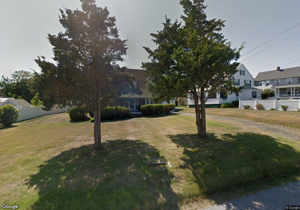
20 Phillips Rd Sagamore Beach, MA 2562
Estimated Value: $799,000 - $1,325,000
4
Beds
2
Baths
1,711
Sq Ft
$677/Sq Ft
Est. Value
About This Home
This home is located at 20 Phillips Rd, Sagamore Beach, MA 2562 and is currently estimated at $1,158,427, approximately $677 per square foot. 20 Phillips Rd is a home located in Barnstable County with nearby schools including Bourne High School, Bridgeview Montessori School, and New Testament Christian School.
Ownership History
Date
Name
Owned For
Owner Type
Purchase Details
Closed on
Jul 28, 2011
Sold by
Cecil N Marchionne T N and Cecil Marchionne
Bought by
Marchionne Invest T and Marchionne
Current Estimated Value
Purchase Details
Closed on
Jul 19, 2011
Sold by
Marchionne Cecil M Est and Msrchionne
Bought by
Marchionne Cecil M T and Marchionne M
Create a Home Valuation Report for This Property
The Home Valuation Report is an in-depth analysis detailing your home's value as well as a comparison with similar homes in the area
Home Values in the Area
Average Home Value in this Area
Purchase History
We collect this data history from publicly available records. To have your information removed, we recommend requesting removal directly through your county’s website.
| Date | Buyer | Sale Price | Title Company |
|---|---|---|---|
| Marchionne Invest T | -- | -- | |
| Marchionne Invest T | -- | -- | |
| Marchionne Cecil M T | -- | -- | |
| Marchionne Cecil M T | -- | -- |
Source: Public Records
Mortgage History
We collect this data history from publicly available records. To have your information removed, we recommend requesting removal directly through your county’s website.
| Date | Status | Borrower | Loan Amount |
|---|---|---|---|
| Previous Owner | Marchionne Cecil M T | $200,000 | |
| Previous Owner | Marchionne Cecil M T | $325,000 |
Source: Public Records
Tax History
| Year | Tax Paid | Tax Assessment Tax Assessment Total Assessment is a certain percentage of the fair market value that is determined by local assessors to be the total taxable value of land and additions on the property. | Land | Improvement |
|---|---|---|---|---|
| 2025 | $8,322 | $1,065,500 | $665,100 | $400,400 |
| 2024 | $8,138 | $1,014,700 | $633,400 | $381,300 |
| 2023 | $7,912 | $898,100 | $560,600 | $337,500 |
| 2022 | $7,709 | $764,000 | $496,100 | $267,900 |
| 2021 | $7,489 | $695,400 | $451,500 | $243,900 |
| 2020 | $7,197 | $670,100 | $447,200 | $222,900 |
| 2019 | $6,910 | $657,500 | $447,200 | $210,300 |
| 2018 | $6,560 | $622,400 | $425,900 | $196,500 |
| 2017 | $6,350 | $616,500 | $421,900 | $194,600 |
| 2016 | $6,195 | $609,700 | $421,900 | $187,800 |
| 2015 | $6,140 | $609,700 | $421,900 | $187,800 |
Source: Public Records
Map
Nearby Homes
- 133 Phillips Rd
- 185 Phillips Rd
- 67 Phillips Rd
- 67 Phillips Rd
- 115 Phillips Rd
- 24 Lakewood Rd
- 1 Peaked Cliff Rd
- 16 Ocean Pines Dr Unit A
- 0 State Rd
- 3 Dover Ln
- 14 Sir Lancelot Dr
- 6 Luigi Ave
- 1 Luigi Ave
- 31 Remington Ln
- 18 Remington Ln
- 3 Lucia Ave
- 53 Pawtuxet Rd
- 18 Gibbs Rd
- 40 Menotomy Rd
- 30 Pawtuxet Rd
Your Personal Tour Guide
Ask me questions while you tour the home.