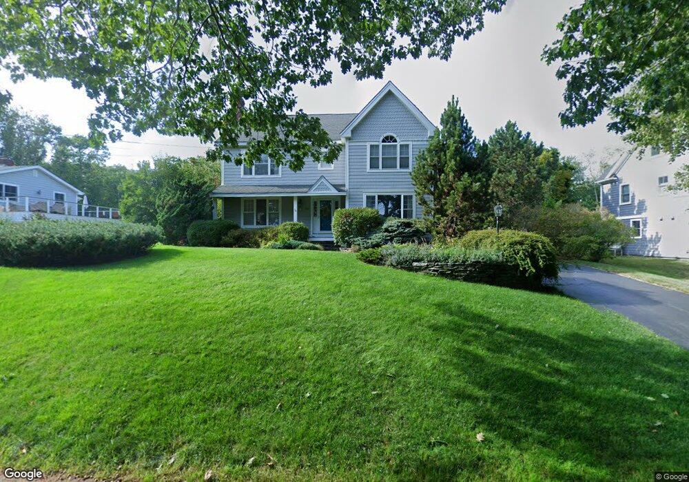
20 Pilot Point Rd Cape Elizabeth, ME 04107
Estimated Value: $1,179,000 - $1,710,000
3
Beds
3
Baths
3,420
Sq Ft
$433/Sq Ft
Est. Value
About This Home
This home is located at 20 Pilot Point Rd, Cape Elizabeth, ME 04107 and is currently estimated at $1,480,828, approximately $432 per square foot. 20 Pilot Point Rd is a home located in Cumberland County with nearby schools including Pond Cove Elementary School, Cape Elizabeth Middle School, and Cape Elizabeth High School.
Ownership History
Date
Name
Owned For
Owner Type
Purchase Details
Closed on
May 22, 2013
Sold by
Gilman Richard W and Gilman Shirley R
Bought by
Frutiger Elizabeth A and Frey Paul F
Current Estimated Value
Home Financials for this Owner
Home Financials are based on the most recent Mortgage that was taken out on this home.
Original Mortgage
$703,000
Outstanding Balance
$497,479
Interest Rate
3.45%
Mortgage Type
Purchase Money Mortgage
Estimated Equity
$983,349
Purchase Details
Closed on
Dec 2, 2008
Sold by
Budkiewicz John and Budkiewicz Denise
Bought by
Gilman Richard W and Gilman Shirley R
Create a Home Valuation Report for This Property
The Home Valuation Report is an in-depth analysis detailing your home's value as well as a comparison with similar homes in the area
Home Values in the Area
Average Home Value in this Area
Purchase History
| Date | Buyer | Sale Price | Title Company |
|---|---|---|---|
| Frutiger Elizabeth A | -- | -- | |
| Gilman Richard W | -- | -- |
Source: Public Records
Mortgage History
| Date | Status | Borrower | Loan Amount |
|---|---|---|---|
| Open | Frutiger Elizabeth A | $703,000 |
Source: Public Records
Tax History Compared to Growth
Tax History
| Year | Tax Paid | Tax Assessment Tax Assessment Total Assessment is a certain percentage of the fair market value that is determined by local assessors to be the total taxable value of land and additions on the property. | Land | Improvement |
|---|---|---|---|---|
| 2024 | $12,731 | $1,157,400 | $430,400 | $727,000 |
| 2023 | $25,856 | $1,157,400 | $430,400 | $727,000 |
| 2022 | $13,394 | $633,300 | $271,500 | $361,800 |
| 2021 | $12,831 | $633,300 | $271,500 | $361,800 |
| 2020 | $12,615 | $633,300 | $271,500 | $361,800 |
| 2019 | $12,463 | $633,300 | $271,500 | $361,800 |
| 2018 | $12,045 | $633,300 | $271,500 | $361,800 |
| 2017 | $11,399 | $633,300 | $271,500 | $361,800 |
| 2016 | $11,108 | $633,300 | $271,500 | $361,800 |
| 2015 | $10,690 | $633,300 | $271,500 | $361,800 |
| 2013 | $10,310 | $633,300 | $271,500 | $361,800 |
Source: Public Records
Map
Nearby Homes
- 12 Salt Spray Ln
- 9 Eastfield Rd
- 7 Eastfield Rd
- 495 Ocean House Rd
- 10 Crescent View Ave
- 202 Two Lights Rd
- 7 Dyer Ln
- 144 Two Lights Rd
- 25 Blue Meadow Ln Unit 25
- 7 Farm Hill Rd
- 9 Blue Meadow Ln Unit 9
- 3 Canter Ln
- 293 Fowler Rd
- 7 Olde Colony Ln
- 530 Spurwink Ave
- 505 Mitchell Rd
- 10 Wildwood Dr
- 00000 Shore Rd
- 10 Pheasant Hill Rd
- 17 Cross Hill Rd
- 18 Pilot Point Rd
- 22 Pilot Point Rd
- 9 Algonquin Rd
- 11 Algonquin Rd
- 16 Pilot Point Rd
- 24 Pilot Point Rd
- 7 Algonquin Rd
- 25 Pilot Point Rd
- 13 Algonquin Rd
- 27 Pilot Point Rd
- 14 Pilot Point Rd
- 32 Pilot Point Rd
- 29 Pilot Point Rd
- 5 Algonquin Rd
- 12 Algonquin Rd
- 12 Pilot Point Rd
- 11 Waumbek Rd
- 9 Waumbek Rd
- 10 Algonquin Rd
- 16 Algonquin Rd