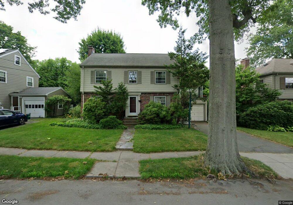
20 Plowgate Rd Chestnut Hill, MA 02467
South Brookline NeighborhoodEstimated Value: $1,281,197 - $1,526,000
3
Beds
3
Baths
1,906
Sq Ft
$740/Sq Ft
Est. Value
About This Home
This home is located at 20 Plowgate Rd, Chestnut Hill, MA 02467 and is currently estimated at $1,411,049, approximately $740 per square foot. 20 Plowgate Rd is a home located in Norfolk County with nearby schools including Baker School, Brookline High School, and Holy Name Parish School.
Ownership History
Date
Name
Owned For
Owner Type
Purchase Details
Closed on
Jan 5, 1998
Sold by
Bethoney John J
Bought by
Katz Jeffrey N
Current Estimated Value
Purchase Details
Closed on
Oct 29, 1997
Sold by
Silber Philip and Silber Frances M
Bought by
Bethoney John J
Create a Home Valuation Report for This Property
The Home Valuation Report is an in-depth analysis detailing your home's value as well as a comparison with similar homes in the area
Home Values in the Area
Average Home Value in this Area
Purchase History
| Date | Buyer | Sale Price | Title Company |
|---|---|---|---|
| Katz Jeffrey N | $357,000 | -- | |
| Bethoney John J | $285,000 | -- |
Source: Public Records
Mortgage History
| Date | Status | Borrower | Loan Amount |
|---|---|---|---|
| Open | Bethoney John J | $242,500 | |
| Closed | Bethoney John J | $241,700 | |
| Closed | Bethoney John J | $264,000 |
Source: Public Records
Tax History
| Year | Tax Paid | Tax Assessment Tax Assessment Total Assessment is a certain percentage of the fair market value that is determined by local assessors to be the total taxable value of land and additions on the property. | Land | Improvement |
|---|---|---|---|---|
| 2025 | $11,415 | $1,156,500 | $653,300 | $503,200 |
| 2024 | $10,877 | $1,113,300 | $628,200 | $485,100 |
| 2023 | $10,163 | $1,019,400 | $509,400 | $510,000 |
| 2022 | $9,893 | $970,900 | $485,200 | $485,700 |
| 2021 | $9,148 | $933,500 | $466,500 | $467,000 |
| 2020 | $8,359 | $884,500 | $424,100 | $460,400 |
| 2019 | $7,893 | $842,400 | $403,900 | $438,500 |
| 2018 | $7,899 | $835,000 | $403,900 | $431,100 |
| 2017 | $7,898 | $799,400 | $381,000 | $418,400 |
| 2016 | $7,785 | $747,100 | $356,100 | $391,000 |
| 2015 | $7,457 | $698,200 | $332,800 | $365,400 |
| 2014 | $7,422 | $651,600 | $302,600 | $349,000 |
Source: Public Records
Map
Nearby Homes
- 227 Bonad Rd
- 55 Bellingham Rd
- 303 Russett Rd
- 170 Bonad Rd
- 72 Wallis Rd
- 91 Grove St
- 16 Alberta Rd
- 25 Clearwater Rd
- 10 Hallwood Rd
- 67 Risley Rd
- 60 Alberta Rd
- 1125 W Roxbury Pkwy
- 17 Fairgreen Place
- 55 Fairgreen Place
- 206 Allandale Rd Unit 3C
- 95 Beverly Rd
- 214 Allandale Rd Unit B
- 37 Morey Rd
- 50-56 Broadlawn Park Unit 221
- 104 Greaton Rd
- 14 Plowgate Rd
- 26 Plowgate Rd
- 19 Puddingstone Rd
- 25 Puddingstone Rd
- 15 Puddingstone Rd
- 32 Plowgate Rd
- 10 Plowgate Rd
- 17 Plowgate Rd
- 9 Puddingstone Rd
- 25 Plowgate Rd
- 9 Plowgate Rd
- 186 South St
- 31 Plowgate Rd
- 962 W Roxbury Pkwy
- 954 W Roxbury Pkwy
- 35 Plowgate Rd
- 180 South St
- 200 South St
- 20 Ogden Rd
- 24 Ogden Rd
Your Personal Tour Guide
Ask me questions while you tour the home.