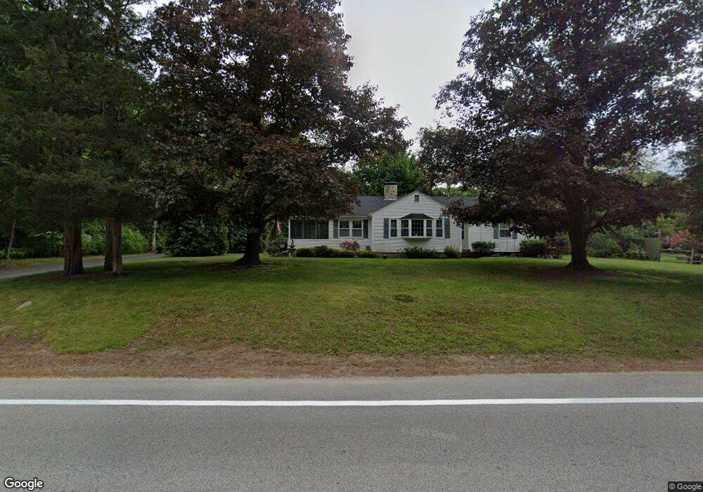
20 Pole Bridge Rd North Scituate, RI 02857
Estimated Value: $468,091 - $552,000
3
Beds
2
Baths
1,336
Sq Ft
$374/Sq Ft
Est. Value
About This Home
This home is located at 20 Pole Bridge Rd, North Scituate, RI 02857 and is currently estimated at $500,023, approximately $374 per square foot. 20 Pole Bridge Rd is a home located in Providence County with nearby schools including North Scituate School, Scituate Middle School, and Scituate High School.
Ownership History
Date
Name
Owned For
Owner Type
Purchase Details
Closed on
Jan 9, 2015
Sold by
Weidele Holly J and Hammer John K
Bought by
Weidele Holly J
Current Estimated Value
Home Financials for this Owner
Home Financials are based on the most recent Mortgage that was taken out on this home.
Original Mortgage
$171,000
Outstanding Balance
$130,876
Interest Rate
3.74%
Estimated Equity
$369,147
Purchase Details
Closed on
Mar 21, 2011
Sold by
Cotugno Ronald F
Bought by
Hammer John K and Weidele Holly J
Home Financials for this Owner
Home Financials are based on the most recent Mortgage that was taken out on this home.
Original Mortgage
$180,000
Interest Rate
4.84%
Mortgage Type
Purchase Money Mortgage
Purchase Details
Closed on
Dec 10, 2004
Sold by
Bailey Steven M and Bailey Lisa R
Bought by
Cotugno Ronald F
Create a Home Valuation Report for This Property
The Home Valuation Report is an in-depth analysis detailing your home's value as well as a comparison with similar homes in the area
Home Values in the Area
Average Home Value in this Area
Purchase History
| Date | Buyer | Sale Price | Title Company |
|---|---|---|---|
| Weidele Holly J | -- | -- | |
| Hammer John K | $230,000 | -- | |
| Cotugno Ronald F | $332,500 | -- |
Source: Public Records
Mortgage History
| Date | Status | Borrower | Loan Amount |
|---|---|---|---|
| Open | Cotugno Ronald F | $171,000 | |
| Previous Owner | Cotugno Ronald F | $180,000 |
Source: Public Records
Tax History Compared to Growth
Tax History
| Year | Tax Paid | Tax Assessment Tax Assessment Total Assessment is a certain percentage of the fair market value that is determined by local assessors to be the total taxable value of land and additions on the property. | Land | Improvement |
|---|---|---|---|---|
| 2025 | $5,232 | $301,900 | $111,400 | $190,500 |
| 2024 | $5,232 | $301,900 | $111,400 | $190,500 |
| 2023 | $5,060 | $301,900 | $111,400 | $190,500 |
| 2022 | $4,945 | $301,900 | $111,400 | $190,500 |
| 2021 | $4,695 | $251,200 | $92,400 | $158,800 |
| 2020 | $4,589 | $251,200 | $92,400 | $158,800 |
| 2019 | $4,494 | $251,200 | $92,400 | $158,800 |
| 2018 | $4,260 | $219,700 | $79,400 | $140,300 |
| 2017 | $4,135 | $219,700 | $79,400 | $140,300 |
| 2016 | $3,963 | $219,700 | $79,400 | $140,300 |
| 2015 | $3,803 | $198,500 | $72,600 | $125,900 |
| 2014 | $3,768 | $198,500 | $72,600 | $125,900 |
Source: Public Records
Map
Nearby Homes
- 17 Country Side Ln
- 22 Oakridge Rd
- 111 Peeptoad Rd
- 12 Tamarac Dr Unit B
- 110 Hopkins Ave
- 6 Tamarac Dr Unit C
- 15 Chiswick Rd
- 42 Hopkins Ave
- 40 Hartford Ave
- 125 Smith Ave Unit 4C
- 125 Smith Ave Unit 8F
- 125 Smith Ave Unit 1B
- 125 Smith Ave Unit 5C
- 111 Smith Ave Unit 7
- 62 Orchard Ave
- 66 Orchard Ave
- 68 Orchard Ave
- 112 Winsor Ave
- 56 Pine Ledge Rd
- 75 Smith Ave
- 18 Pole Bridge Rd
- 46 Country Side Ln
- 4 Alfalfa Dr
- 29 Pole Bridge Rd
- 19 Pole Bridge Rd
- 8 Alfalfa Dr
- 54 Country Side Ln
- 7 Alfalfa Dr
- 34 Pole Bridge Rd
- 33 Pole Bridge Rd
- 49 Country Side Ln
- 58 Country Side Ln
- 18 Alfalfa Dr
- 9 Pole Bridge Rd
- 53 Country Side Ln
- 37 Pole Bridge Rd
- 11 S Woodland Rd
- 16 Sunnybrook Rd
- 33 Country Side Ln
- 20 Sunnybrook Rd