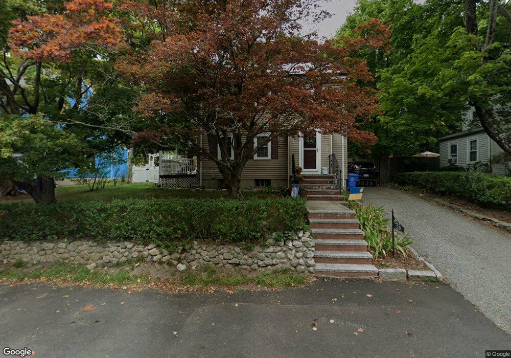
20 Porter Rd Waltham, MA 02452
North Waltham NeighborhoodEstimated Value: $806,000 - $1,017,000
4
Beds
5
Baths
1,774
Sq Ft
$501/Sq Ft
Est. Value
About This Home
This home is located at 20 Porter Rd, Waltham, MA 02452 and is currently estimated at $888,975, approximately $501 per square foot. 20 Porter Rd is a home located in Middlesex County with nearby schools including Northeast Elementary School, John F Kennedy Middle School, and Waltham Sr High School.
Ownership History
Date
Name
Owned For
Owner Type
Purchase Details
Closed on
Mar 25, 2024
Sold by
Mcgann Charlene S
Bought by
Charlene S Mcgann T S and Charlene Mcgann
Current Estimated Value
Purchase Details
Closed on
Feb 23, 2015
Sold by
Mcgann Steven D and Mcgann Charlene F
Bought by
Mcgann Charlene S
Purchase Details
Closed on
Jun 28, 1996
Sold by
Kania Kristen
Bought by
Mcgann Steven D and Mcgann Charlene F
Home Financials for this Owner
Home Financials are based on the most recent Mortgage that was taken out on this home.
Original Mortgage
$167,000
Interest Rate
8.05%
Mortgage Type
Purchase Money Mortgage
Purchase Details
Closed on
Nov 28, 1995
Sold by
Morrison William Est and Donoghue
Bought by
Kania Kristen
Home Financials for this Owner
Home Financials are based on the most recent Mortgage that was taken out on this home.
Original Mortgage
$87,500
Interest Rate
7.47%
Mortgage Type
Purchase Money Mortgage
Create a Home Valuation Report for This Property
The Home Valuation Report is an in-depth analysis detailing your home's value as well as a comparison with similar homes in the area
Home Values in the Area
Average Home Value in this Area
Purchase History
| Date | Buyer | Sale Price | Title Company |
|---|---|---|---|
| Charlene S Mcgann T S | -- | None Available | |
| Mcgann Charlene S | -- | -- | |
| Mcgann Steven D | $176,750 | -- | |
| Kania Kristen | $125,000 | -- |
Source: Public Records
Mortgage History
| Date | Status | Borrower | Loan Amount |
|---|---|---|---|
| Previous Owner | Kania Kristen | $169,000 | |
| Previous Owner | Kania Kristen | $167,000 | |
| Previous Owner | Kania Kristen | $87,500 |
Source: Public Records
Tax History
| Year | Tax Paid | Tax Assessment Tax Assessment Total Assessment is a certain percentage of the fair market value that is determined by local assessors to be the total taxable value of land and additions on the property. | Land | Improvement |
|---|---|---|---|---|
| 2025 | $7,365 | $750,000 | $418,500 | $331,500 |
| 2024 | $7,002 | $726,300 | $398,900 | $327,400 |
| 2023 | $6,903 | $668,900 | $362,600 | $306,300 |
| 2022 | $7,216 | $647,800 | $355,400 | $292,400 |
| 2021 | $6,973 | $616,000 | $340,900 | $275,100 |
| 2020 | $6,876 | $575,400 | $319,100 | $256,300 |
| 2019 | $6,584 | $520,100 | $305,500 | $214,600 |
| 2018 | $6,011 | $476,700 | $282,900 | $193,800 |
| 2017 | $5,668 | $451,300 | $257,500 | $193,800 |
| 2016 | $5,390 | $440,400 | $246,600 | $193,800 |
| 2015 | $5,249 | $399,800 | $221,200 | $178,600 |
Source: Public Records
Map
Nearby Homes
- 100 Shirley Rd
- 43 Agassiz Ave
- 50 Moraine St
- 345 Bishops Forest Dr
- 51 Harrington St Unit 51
- 43-43A Chandler St
- 31 Greensbrook Way
- 289 Bishops Forest Dr
- 135 Marsh St
- 40 Knowles Rd
- 107 Clocktower Dr Unit 3302
- 78 Barbara Rd Unit 1
- 144-146 White St
- 52 Hawthorne St Unit 1
- 918 Belmont St
- 53 Crestview Rd
- 49 Pierce Rd Unit 49
- 9 Henry St Unit 9
- 3 Henry St
- 59 Farnum Rd
Your Personal Tour Guide
Ask me questions while you tour the home.