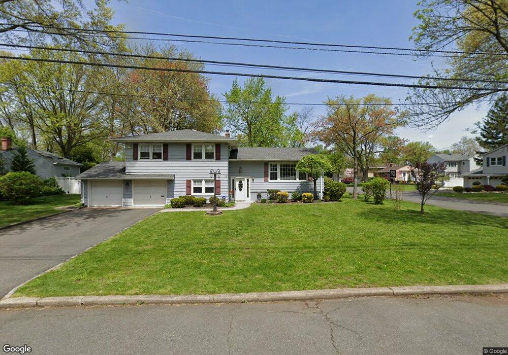
20 Princeton Rd Cranford, NJ 07016
Estimated Value: $835,365 - $980,000
--
Bed
--
Bath
2,186
Sq Ft
$427/Sq Ft
Est. Value
About This Home
This home is located at 20 Princeton Rd, Cranford, NJ 07016 and is currently estimated at $933,591, approximately $427 per square foot. 20 Princeton Rd is a home located in Union County with nearby schools including Cranford Sr High School and St Michael School.
Ownership History
Date
Name
Owned For
Owner Type
Purchase Details
Closed on
Sep 30, 1997
Sold by
Fleming Haydn J and Fleming Helena M
Bought by
Salerno John and Salerno Doreen
Current Estimated Value
Home Financials for this Owner
Home Financials are based on the most recent Mortgage that was taken out on this home.
Original Mortgage
$185,000
Outstanding Balance
$29,905
Interest Rate
7.52%
Estimated Equity
$903,686
Create a Home Valuation Report for This Property
The Home Valuation Report is an in-depth analysis detailing your home's value as well as a comparison with similar homes in the area
Home Values in the Area
Average Home Value in this Area
Purchase History
| Date | Buyer | Sale Price | Title Company |
|---|---|---|---|
| Salerno John | $285,000 | -- |
Source: Public Records
Mortgage History
| Date | Status | Borrower | Loan Amount |
|---|---|---|---|
| Open | Salerno John | $185,000 |
Source: Public Records
Tax History Compared to Growth
Tax History
| Year | Tax Paid | Tax Assessment Tax Assessment Total Assessment is a certain percentage of the fair market value that is determined by local assessors to be the total taxable value of land and additions on the property. | Land | Improvement |
|---|---|---|---|---|
| 2025 | $15,029 | $221,700 | $116,500 | $105,200 |
| 2024 | $14,781 | $221,700 | $116,500 | $105,200 |
| 2023 | $14,781 | $221,700 | $116,500 | $105,200 |
| 2022 | $14,659 | $221,700 | $116,500 | $105,200 |
| 2021 | $14,595 | $221,700 | $116,500 | $105,200 |
| 2020 | $14,548 | $221,700 | $116,500 | $105,200 |
| 2019 | $14,455 | $221,700 | $116,500 | $105,200 |
| 2018 | $14,193 | $221,700 | $116,500 | $105,200 |
| 2017 | $13,705 | $221,700 | $116,500 | $105,200 |
| 2016 | $13,207 | $221,700 | $116,500 | $105,200 |
| 2015 | $12,861 | $221,700 | $116,500 | $105,200 |
| 2014 | $12,597 | $221,700 | $116,500 | $105,200 |
Source: Public Records
Map
Nearby Homes