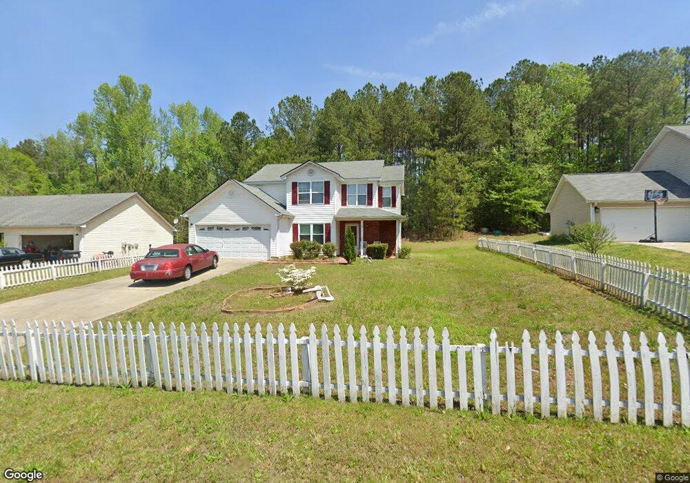
20 Railside Dr Covington, GA 30014
Estimated Value: $257,000 - $321,000
Studio
2
Baths
1,755
Sq Ft
$161/Sq Ft
Est. Value
About This Home
This home is located at 20 Railside Dr, Covington, GA 30014 and is currently estimated at $283,333, approximately $161 per square foot. 20 Railside Dr is a home located in Newton County with nearby schools including Heard-Mixon Elementary School, Cousins Middle School, and Eastside High School.
Ownership History
Date
Name
Owned For
Owner Type
Purchase Details
Closed on
Jul 31, 2006
Sold by
R & B Const Inc
Bought by
Wilson Curtis F and Wilson Christine T
Current Estimated Value
Home Financials for this Owner
Home Financials are based on the most recent Mortgage that was taken out on this home.
Original Mortgage
$109,150
Outstanding Balance
$64,186
Interest Rate
6.67%
Mortgage Type
New Conventional
Estimated Equity
$219,147
Create a Home Valuation Report for This Property
The Home Valuation Report is an in-depth analysis detailing your home's value as well as a comparison with similar homes in the area
Home Values in the Area
Average Home Value in this Area
Purchase History
| Date | Buyer | Sale Price | Title Company |
|---|---|---|---|
| Wilson Curtis F | $136,500 | -- |
Source: Public Records
Mortgage History
| Date | Status | Borrower | Loan Amount |
|---|---|---|---|
| Open | Wilson Curtis F | $109,150 | |
| Closed | Wilson Curtis F | $27,299 |
Source: Public Records
Tax History
| Year | Tax Paid | Tax Assessment Tax Assessment Total Assessment is a certain percentage of the fair market value that is determined by local assessors to be the total taxable value of land and additions on the property. | Land | Improvement |
|---|---|---|---|---|
| 2025 | $3,029 | $125,400 | $15,200 | $110,200 |
| 2024 | $2,943 | $117,200 | $15,200 | $102,000 |
| 2023 | $2,889 | $107,680 | $6,400 | $101,280 |
| 2022 | $2,318 | $86,640 | $6,400 | $80,240 |
| 2021 | $2,166 | $72,920 | $6,400 | $66,520 |
| 2020 | $1,848 | $56,800 | $6,400 | $50,400 |
| 2019 | $1,577 | $48,080 | $6,400 | $41,680 |
| 2018 | $1,222 | $37,440 | $5,000 | $32,440 |
| 2017 | $1,233 | $37,760 | $3,800 | $33,960 |
| 2016 | $1,233 | $37,760 | $3,800 | $33,960 |
| 2015 | $1,200 | $36,840 | $3,200 | $33,640 |
| 2014 | $1,198 | $36,840 | $0 | $0 |
Source: Public Records
Map
Nearby Homes
- 324 Piper Rd
- 25 Scarlett Ct
- 0 Piper Rd Unit 7693971
- 0 Piper Rd Unit 10659921
- 20 Kestrel Cir
- 13268 Tolstoy Ln
- 10717 Highway 36
- 18 River Walk Farm Pkwy
- 370 Granary Walk
- 35 Crossbill Trail
- 60 Laurie Ln
- 0 Briarpatch Dr Unit 10562648
- 7713 Fawn Cir
- 7713 Fawn Cir Unit 51
- 7703 Fawn Cir
- 85 Bellerive Ln SE
- 295 River Walk Farm Pkwy
- 344 Riverwalk Pkwy
- 391 River Walk Farm Pkwy Unit 11
- 323 River Walk Farm
Your Personal Tour Guide
Ask me questions while you tour the home.