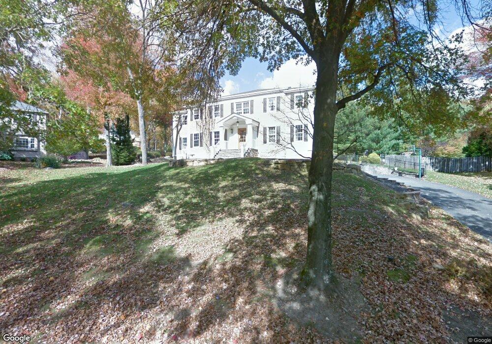
20 Red Barn Ln Randolph, NJ 07869
Estimated Value: $932,000 - $1,122,000
Studio
--
Bath
3,462
Sq Ft
$292/Sq Ft
Est. Value
About This Home
This home is located at 20 Red Barn Ln, Randolph, NJ 07869 and is currently estimated at $1,011,032, approximately $292 per square foot. 20 Red Barn Ln is a home located in Morris County with nearby schools including Randolph High School and Randolph Middle School.
Ownership History
Date
Name
Owned For
Owner Type
Purchase Details
Closed on
Apr 3, 2003
Sold by
Francischiello Michael
Bought by
Relocaction Inc
Current Estimated Value
Home Financials for this Owner
Home Financials are based on the most recent Mortgage that was taken out on this home.
Original Mortgage
$240,000
Interest Rate
5.84%
Purchase Details
Closed on
Mar 15, 2003
Sold by
Relo Action
Bought by
Meyers Raymond and Meyers April
Home Financials for this Owner
Home Financials are based on the most recent Mortgage that was taken out on this home.
Original Mortgage
$240,000
Interest Rate
5.84%
Purchase Details
Closed on
Jul 26, 2000
Sold by
Smith Paul R and Smith Gloria T
Bought by
Francischiello Michael P and Claxton Jennifer L
Home Financials for this Owner
Home Financials are based on the most recent Mortgage that was taken out on this home.
Original Mortgage
$372,000
Interest Rate
8.1%
Create a Home Valuation Report for This Property
The Home Valuation Report is an in-depth analysis detailing your home's value as well as a comparison with similar homes in the area
Home Values in the Area
Average Home Value in this Area
Purchase History
We collect this data history from publicly available records. To have your information removed, we recommend requesting removal directly through your county’s website.
| Date | Buyer | Sale Price | Title Company |
|---|---|---|---|
| Relocaction Inc | $600,000 | -- | |
| Meyers Raymond | $600,000 | -- | |
| Francischiello Michael P | $465,000 | -- |
Source: Public Records
Mortgage History
We collect this data history from publicly available records. To have your information removed, we recommend requesting removal directly through your county’s website.
| Date | Status | Borrower | Loan Amount |
|---|---|---|---|
| Previous Owner | Meyers Raymond | $240,000 | |
| Previous Owner | Francischiello Michael P | $372,000 |
Source: Public Records
Tax History
| Year | Tax Paid | Tax Assessment Tax Assessment Total Assessment is a certain percentage of the fair market value that is determined by local assessors to be the total taxable value of land and additions on the property. | Land | Improvement |
|---|---|---|---|---|
| 2025 | $18,679 | $659,800 | $244,400 | $415,400 |
| 2024 | $18,210 | $659,800 | $244,400 | $415,400 |
| 2023 | $18,210 | $659,800 | $244,400 | $415,400 |
| 2022 | $17,498 | $659,800 | $244,400 | $415,400 |
| 2021 | $17,498 | $659,800 | $244,400 | $415,400 |
| 2020 | $17,320 | $659,800 | $244,400 | $415,400 |
| 2019 | $17,122 | $659,800 | $244,400 | $415,400 |
| 2018 | $16,904 | $659,800 | $244,400 | $415,400 |
| 2017 | $16,693 | $659,800 | $244,400 | $415,400 |
| 2016 | $15,200 | $415,300 | $157,700 | $257,600 |
| 2015 | $15,017 | $415,300 | $157,700 | $257,600 |
| 2014 | $14,785 | $415,300 | $157,700 | $257,600 |
Source: Public Records
Map
Nearby Homes
Your Personal Tour Guide
Ask me questions while you tour the home.