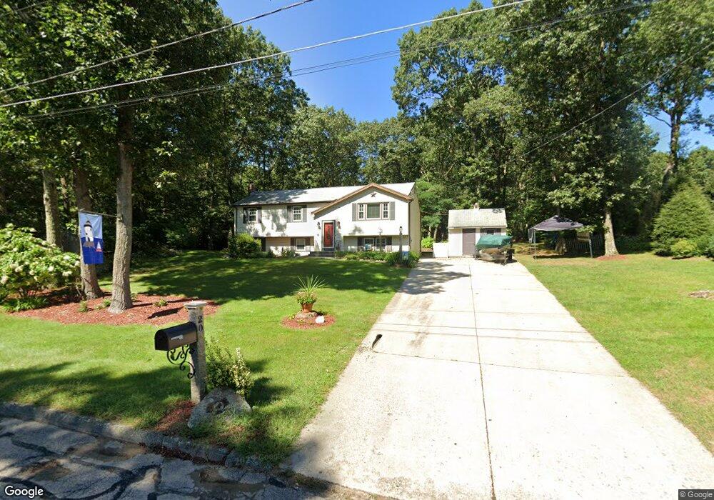
20 Regent Rd Wrentham, MA 02093
Estimated Value: $548,000 - $682,000
3
Beds
2
Baths
1,406
Sq Ft
$436/Sq Ft
Est. Value
About This Home
This home is located at 20 Regent Rd, Wrentham, MA 02093 and is currently estimated at $613,055, approximately $436 per square foot. 20 Regent Rd is a home located in Norfolk County with nearby schools including Delaney Elementary School, Charles E Roderick, and Discovery Daycare Center.
Ownership History
Date
Name
Owned For
Owner Type
Purchase Details
Closed on
May 30, 1991
Sold by
Diantonio Anthony J and Diantonio Elaine F
Bought by
Halpin Michael A and Halpin Patricia L
Current Estimated Value
Home Financials for this Owner
Home Financials are based on the most recent Mortgage that was taken out on this home.
Original Mortgage
$119,500
Interest Rate
9.35%
Mortgage Type
Purchase Money Mortgage
Create a Home Valuation Report for This Property
The Home Valuation Report is an in-depth analysis detailing your home's value as well as a comparison with similar homes in the area
Purchase History
| Date | Buyer | Sale Price | Title Company |
|---|---|---|---|
| Halpin Michael A | $149,500 | -- |
Source: Public Records
Mortgage History
| Date | Status | Borrower | Loan Amount |
|---|---|---|---|
| Closed | Halpin Michael A | $101,500 | |
| Closed | Halpin Michael A | $163,200 | |
| Closed | Halpin Michael A | $119,500 |
Source: Public Records
Tax History
| Year | Tax Paid | Tax Assessment Tax Assessment Total Assessment is a certain percentage of the fair market value that is determined by local assessors to be the total taxable value of land and additions on the property. | Land | Improvement |
|---|---|---|---|---|
| 2025 | $6,423 | $554,200 | $275,200 | $279,000 |
| 2024 | $6,020 | $501,700 | $275,200 | $226,500 |
| 2023 | $5,764 | $456,700 | $250,300 | $206,400 |
| 2022 | $5,497 | $402,100 | $225,400 | $176,700 |
| 2021 | $4,697 | $333,800 | $201,600 | $132,200 |
| 2020 | $5,330 | $374,000 | $184,100 | $189,900 |
| 2019 | $5,113 | $362,100 | $184,100 | $178,000 |
| 2018 | $5,104 | $358,400 | $184,300 | $174,100 |
| 2017 | $4,799 | $336,800 | $180,700 | $156,100 |
| 2016 | $4,718 | $330,400 | $175,500 | $154,900 |
| 2015 | $4,569 | $305,000 | $168,700 | $136,300 |
| 2014 | $4,497 | $293,700 | $162,300 | $131,400 |
Source: Public Records
Map
Nearby Homes
- 282 Thurston St
- 483 Thurston St
- 10 Nature View Dr
- 15 Nature View Dr
- 3 Earle Stewart Ln
- 10 Earle Stewart Ln Unit Lot 5
- 2 Earle Stewart Ln
- 12 Earle Stewart Ln
- 135 Creek St Unit 2
- 576 Dedham St
- 46 Mirimichi St
- 500 Franklin St
- 160 Washington St Unit 22
- 25 Foxboro Rd
- 1 Weber Farm Rd Unit 1
- 158 Washington St
- 126 Washington St
- 130 Washington St
- 124 Washington St
- 131 Washington St Unit 42
Your Personal Tour Guide
Ask me questions while you tour the home.